Understanding Map Projections: Comparing Mercator, Robinson, Peters, and Winkle Tripel
100 likes | 224 Vues
This text explores various map projections, including Mercator, Robinson, Peters, and Winkle Tripel. Mercator's projection distorts the size of regions, making Greenland appear larger than Africa. The Robinson projection offers a more accurate representation of high-latitude regions. Peters is controversial for altering continent sizes, while the Goode projection presents the entire world in proper size but sacrifices distance accuracy. Lastly, Winkle Tripel combines features of the Robinson projection but with slightly curved latitude lines, aiming to minimize distortions in area, direction, and distance.

Understanding Map Projections: Comparing Mercator, Robinson, Peters, and Winkle Tripel
E N D
Presentation Transcript
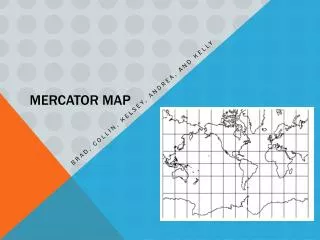
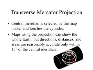
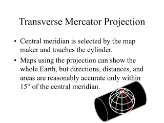
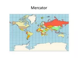
Shows longitude and latitude as straight, parallel lines • Increasingly enlarges the sizes of regions according to their distance from the equator. Ex: Greenland is larger than Africa, whereas in reality Africa is 14 times bigger.
More accurately portrays high latitude lands and water to land ratio
Area accurate map • Controversial b/c it drastically alters the continents
Designed to present the entire world in one view. • Continents are viewed in their proper size with respect to one another. • Distance is not accurate
Looks like the Robinson Projection • BUT- lines of latitude in a Robinson projection are parallel straight lines, while in a Winkle Triple they are slightly curved, nonparallel lines • Goal is to minimize distortions in area, direction, and distance.