EARLY WARNING SYSTEM IN DOM
EARLY WARNING SYSTEM IN DOM. A .R. WARNASOORIYA. DEPUTY DIRECTOR DEPARTMENT OF METEOROLOGY. Communication facilities. WMO. GTS. ICAO. A MHS. INTERNET SADIS ADS EMAIL FAX. RECEIVING OF TSUNAMI ADVISORIES. RECEIVING OF TSUNAMI ADVISORIES. CISN. CISN. BIA. GTS.

EARLY WARNING SYSTEM IN DOM
E N D
Presentation Transcript
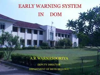
EARLY WARNING SYSTEM IN DOM A.R.WARNASOORIYA DEPUTY DIRECTOR DEPARTMENT OF METEOROLOGY
Communication facilities WMO GTS ICAO AMHS INTERNET SADIS ADS EMAIL FAX
RECEIVING OF TSUNAMI ADVISORIES CISN CISN BIA GTS
Interim Service providers-PTWC,JMA • Regional Tsunami Service Providers (RTSP)-From 12th October 2011 • India-ITEWC • Australia-JATWC • Indonesia- IndoTEWS • Thailand-RIMES
user agencies of DOM forecast products and services from the national level Coast Conservation Department, Building Department, National Housing Development Authority, Police Communication Division, Tourism Development Authority, National Water Supply and Drainage Board, Irrigation Department, University of Colombo, National Science Foundation,
American Red Cross, Agrarian Development Department, Central Environmental Authority, Electricity Board, Disaster Management Center, National Building Research Organization, Department of Health, Sarvodhaya and Sri Lankan Red Cross Society
SHIPPING REPORT The cyclonic storm in the SW Bay of Bengal located near 7.9N 84.5E RPT 7.9N 84.5E at 06/0830UTC. Intermittent showers or thundershowers, strong winds and rough seas are expected within 2 to 3 degrees of the above center. Winds: Strong cyclonic winds over SW Bay of Bengal and fairly strong North-Easterly to North-Westerly winds over elsewhere. WX: OCNL showers or thundershowers over SW Bay of Bengal and SCT showers or thundershowers over elsewhere srilanka area and neighbourhood.
FROM MET COLOMBO TO COLOMBO RADIO AND SL NAVY FLEET FORECAST Fleet forecast for area E 06/0600 Z- 1400Z The cyclonic storm in the central Bay of Bengal has weaken in to a deep depression and located near 8.5N 86.2 E RPT 8.5N 86.2 E at 05/2030 UTC in the SW Bay of Bengal. Intermittent showers or thundershowers, strong winds and rough seas are expected within 2 to 3 degrees of the above center. ITCZ North limit approximately along; 02N 60E, 03N 75E & 05N 95E ITCZ South limit approximately along; 08S 60E, 05S 75E & 03S 95E Winds: North of ITCZ North limit; West of 80E: NE to NW/ 10-20 KNOTS East of 80E: Cyclonic / 20-25 knots, gusting up to 30-35 knots In between limits of ITCZ; W/10-20 knots, gusting up to 25 knots South of ITCZ South limit; SE/10-20 knots, gusting up to 25 knots WX: OCNL showers or thundershowers in sections; 10, 15,30,35,60 &75 SCT showers or thundershowers in sections; 00, 05, 25, 40, 45, 50, 65 & 70 ISOL showers or thundershowers in sections; 20, 80 & 85 SEAS:Rough in sections 10, 15 30, 35, 50,55,80,85 and moderate elsewhere.
SP 09-01 SPECIAL WEATHER ADVISORY (No: 1) ISSUED AT 1400 HOURS, 10th APPRIL 2009. ISSUED BY EARLY WARNING CENTRE OF THE DEPARTMENT OF METEOROLOGY Due to the presence of active Inter Tropical Convergence Zone (ITCZ) in the vicinity of Sri Lanka, disturbed weather is expected to continue for a few days. Thundershowers will be fairly wide spread during the afternoon or night (after 12.00 noon.). Heavy falls sometimes associated with fairly strong winds and lightning activities will be experienced particularly over Southern half of the island. General public is kindly requested to take adequate precautions to minimize the damages caused by lightening activities.
WW 08-21 Signal level:-3 Colour: Orange BAD WEATHER WARNING (Fifth Advisory) ISSUED AT 1700 HOURS, 06th DECEMBER 2008. (Issued by Early Warning Centre of the Department of Meteorology) The deep depression in the Bay of Bengal was located 350 km East of Trincomalee at 1500 hours today (06th). It is expected to move in a Northwesterly direction. Prevailing showery and windy weather conditions will continue in the Ampara ,Batticaloa. Trincomalee, Mulativu , Kilinochchi, Jaffna Polonnaruwa and Anuradhapura districts with more frequent showers by tomorrow (7th), with the approaching of to disturbance Sri –Lanka Northeast coast. Showers or thunder showers will extend to other areas too, with fairly heavy falls in places. Sea around the island and especially off Eastern, Northeastern and Northern coasts, will continue to be rough and windy during next two days.
WW 10-04 BAD WEATHER ADVISORY VALID FOR NEXT 12 HOURS FROM 1500 HOURS OF 18th MAY 2010. ISSUED BY EARLY WARNING CENTRE OF THE DEPARTMENT OF METEOROLOGY The depression which was over the Bay of Bengal yesterday, has intensified in to a cyclonic storm and it has been named as “LAILA”. It is located about 600km northeast of Jaffna at 02.00 pm and moving North-westward towards India. The North and North- Eastern seas will experience frequent showers, strong winds and rough conditions. Sea areas around the island will experience strong winds and rough conditions. Due to the Cyclone “LAILA” the Western, Central, Sabaragamuwa provinces, Galle and Matara districts will experience rain or thundershowers with heavy falls at some places. Strong winds will also occur at times over the island especially in the South-western region.
(ISSUED AT 1600 HOURS ON 10th NOVEMBER 2010) WEATHER FORECAST FOR NEXT 36 HOURS Thundershowers will develop at several places inland during the afternoon and will spread to the South-western coastal areas latter. Inter Tropical Convergence Zone (ITCZ-Active zone where the winds coming from Northern Hemisphere and Southern Hemisphere meet), lies just south of Sri Lanka causing thunder showers along and off the Southern coast. There may be temporary localized fairly strong winds during thundershowers. General public is kindly requested to take adequate precautions to minimize the damages caused by lightning activities.
FEEDBACK FROM STAKE HOLDERS • DURING AWARENESS POGRAMES • MONSOON FORUM • RAWING SEMINARS FOR FARMERS
Indigenous knowledge Indigenous knowledge widely exists in the form of monitoring astrological calendar, stars, flowering, movement of animals and birds, winds and clouds, changes in comfort (body temperature,sweating) etc.. Indigenous knowledge is strong among the elders especially with farmers and fishermen. However they feel it is difficult to predict due to erratic weather and climate pattern Limited knowledge among business community In some communities the knowledge is passed on to younger generation while in others the younger generation rely only on DOM forecast

