Download

1 / 10
100 likes | 301 Vues
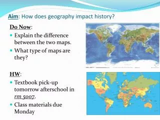
Maps and photos - Chapter 6 & 7 All maps have common elements Scale Legend Coordinate system Orientation info- directional system. Directional information. Quadrant system. Azimuth system. N. 0. 0. 90. W. 90. E. 270. 90. 180. S. 0.

E N D
Maps and photos - Chapter 6 & 7 • All maps have common elements • Scale • Legend • Coordinate system • Orientation info- directional system
Directional information Quadrant system Azimuth system N 0 0 90 W 90 E 270 90 180 S 0 Unless otherwise stated, North is always toward the top of the page on all printed maps
Map Scales • Verbal- words used to convey map distance / real world distance equivalencies • e.g., one inch equals four thousand feet • Graphic- usually a bar or line with calibration marks that indicate map distance real / world distance equivalencies • Fractional - the unitless numeric ratio of map distance to real world distance equivalencies 1:40,000
Legend- a window that shows all the symbols used on the map, commonly includes scale, title, and orientation information
Coordinate systems Latitude/ Longitude (LAT/LONG)- based on 360 degree circle coordinate system with Equator and Prime meridian as the index lines Commonly given as decimal degrees (38.6466° N, 98.3456° W), degrees with decimal minutes (38° 36.32’ N, 98° 18.2’ W) or degrees minutes and seconds (38° 36’ 18” N, 98° 18’ 12” W) North South
Coordinate systems UTM- a coordinate system based on a 1000 meter grid with the center of of each Zone as the alignment point of the grid cells UTM coordinates might read 13 T 0559760 E 4282176 N
Coordinate systems Township Range a coordinate system based on a numeric grid
Isoline maps The most common of these in the geologic community are Topographic contour lines that show lines of equal elevation above mean sea level (msl) Other types of contours show... Isothermal - lines of equal temperature Isoseismal- lines of equal seismic shaking intensity Isobaric- lines of equal pressure Isopach- lines of equal thickness
Topographic maps Contour lines represent vertical elevation with reference to sea level (zero elevation) Contour intervals are 5, 10, 20, 50 or 100 foot intervals Index contours are labeled and are thicker Contour lines NEVER cross or touch- WHY? They “V” or kink when they cross a stream channel, with the point of the “V” in the UPSTREAM direction They can create closed shapes on the map can represent either a hill or a depression Frequently used to make topographic profiles
Topographic profile & Vertical Exaggeration VE= fractional Vertical Scale fractional Horizontal scale 1/24000 63360 = = 2.64X 24000 1/63360