Download
1 / 10
100 likes | 257 Vues
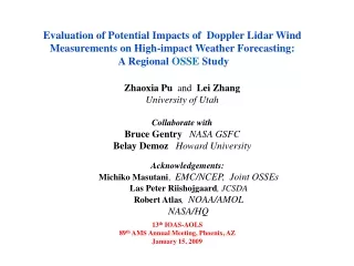
The Impact of Airborne Doppler Wind Lidar Profiles on Numerical Simulations of Typhoon Nuri’s Formation. Zhaoxia Pu and Lei Zhang Department of Atmospheric Sciences, University of Utah David Emmitt Simpson Weather Associates, Inc.

E N D
The Impact of Airborne Doppler Wind Lidar Profiles on Numerical Simulations of Typhoon Nuri’s Formation Zhaoxia Pu and Lei Zhang Department of Atmospheric Sciences, University of Utah David Emmitt Simpson Weather Associates, Inc. Meeting of the working group on Space-based Lidar Winds Destin, Florida February 2010
Backgorund “Tropospheric winds are the number one unmet measurement for improving weather forecasts.” -- National Research Council In this talk • Demonstrate the impact of Doppler Wind Lidar (DWL) profiles in • numerical simulations of tropical cyclones • Airborne DWL profiles during TPARC/TCS08
Airborne DWL profiles, collected during TPARC/TCS-08 from ONR P-3 Case Typhoon Nuri over the Western Pacific Life cycle: 17Aug – 22 Aug 2008 • Wind profiles with 50 m vertical and 1 km horizontal resolution P3DWL winds at1500m P3DWL winds at 500m Time period of data 2330UTC 16 August to 0200UTC 17 August 2008 (about 3-h)
DWL vs. Dropsonde Quality of the data Correlation of wind speed is nearly 98%
Impact study: Data Assimilation Experiments WRF-ARW model: Two-level nested grids (27 km and 9km ) Experiments: “No Data” -- guess field (6 h WRF forecast) CTRL -- 3DVAR assimilation of conventional and dropsonde data 3DVAR – 3DVAR assimilation of DWL profiles 4DVAR – 4DVAR assimilation of DWL profiles Data assimilation Cycled 3DVAR 00Z 01Z 02Z 34-h forecast 1-h intervals 4DVAR 00Z 01Z 02Z 4DVAR assimilation window
Divergence + Wind “No Data” Divergence + analysis increment of wind -- “CTRL” Divergence + analysis increment of wind --“3DVAR” Use of DWL data enhanced the low level convergence of Nuri in the simulation
Averaged divergence profiles over the area with radius of 250 km around Nuri’s circulation center at 0600 UTC 17 August 2008.
Maximum surface wind of Nuri DWL data has positive impact on numerical simulation of Typhoon Nuri Compared with 3DVAR, 4DVAR is deemed to be more promising for assimilating airborne DWL data.
Concluding remarks • Airborne DWL profiles are potentially very helpful for numerical forecasting of tropical cyclones • Since the conventional and dropsonde data are very sparse in this study, more realistic comparisons of forecasting impacts from the DWL and dropsonde measurements still await future field experiments when more data become available.