Download
1 / 13
130 likes | 251 Vues
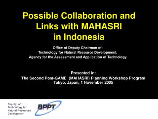
Deputy of: Technology for Natural Resources Development. Possible Collaboration and Links with MAHASRI in Indonesia. Office of Deputy Chairman of: Technology for Natural Resource Development, Agency for the Assessment and Application of Technology. Presented in:

E N D
Deputy of: Technology for Natural Resources Development Possible Collaboration and Links with MAHASRIin Indonesia Office of Deputy Chairman of: Technology for Natural Resource Development, Agency for the Assessment and Application of Technology Presented in: The Second Post-GAME (MAHASRI) Planning Workshop Program Tokyo, Japan, 1 November 2005
HONGKONG Instansi Lokal JAMSTEC ADPC NOAA TSI Res Res & Dev & Dev RESEARCH INSTITUTES: MPI ( Max MPI ( Max MPI ( Max Planc Planc Planc Institute ) Institute ) Institute ) - - - GKSS GKSS GKSS - - - LIPI, LAPAN, LIPI, LAPAN, - - WRCP WRCP WRCP BAKORSURTANAL, BAKORSURTANAL, - - - - - KYOTO UNIVERSITY KYOTO UNIVERSITY KYOTO UNIVERSITY DEL, UNIBRAW DEL, UNIBRAW - - - PI: Prof. Ding - - TOKYO UNIVERSITY TOKYO UNIVERSITY TOKYO UNIVERSITY IPB IPB - - - - - ITB ITB - - FORSGC PHILLIPINE PHILLIPINE PHILLIPINE MMS MMS MMS Users ASIA ASIA ASIA BMG BPPT Regional BMG Stations PASIFIC PASIFIC PASIFIC NETWORK NETWORK NETWORK VIETNAM VIETNAM VIETNAM HONGKONG HONGKONG Agam Districts JMA JMA JMA JAMSTEC JAMSTEC WMO ADPC ADPC NOAA NOAA Regional Institution KERANGKA KERJASAMA OPERASIONALISASI HASIL PENELITIAN BPPT-BMG
Technology Policy • Agroindustry & Biotech • IT, Energy, Material, Envi • Industrial & Engineering Deputy Chairman of Technology for Natural Resource Development • Energy Resources • Mineral Resources • Land & Region Resources • Weather Modification • Research Vessels Center of Technology for Natural Resource Inventory TISDA ACCOUNTING MODELING CHARACTERIZATION NATURAL RESOURCE VALUATION MARINE & COASTAL RESOURCES CLIMATE SYSTEM TECHNOLOGY TERRESTRIAL SURVEY SYSTEMS GEOGRAPHIC INFORMATION SYSTEMS REMOTE SENSING
Climate Research Facilities at Geostech Laboratory • RESEARCH DATA • SATELITE (NOAA, GMS, T/P, TRMM) • SHIP (SURFACE, SUB SURFACE) • BUOY (TRITON, ATLAS, SEAWATCH) • RADAR (ATMOSFER, CUACA) • FORSGC Instruments • Intensive Observation Data • Analyses: • Climatology, • Climatology • Dynamics, • Dynamics • Modelling : • Statistical • Dynamical NON CONVENSIONAL CLIMATE RETRIEVING AND ANALYSIS SYSTEM CLIMATE INFORMATION SYSTEM FOR NATURAL RESOURCE DEVELOPMENT DATA ACQUISITION SYSTEM DATABASE MANAGEMENT SYSTEM DATA ANALYSIS SYSTEM CONVENSIONAL • DATA EXCHANGE FORMAT • 3-D TIME-SPACE DOMAIN • DATA • CLIMATE GEO REFERANCE • BASED DATA • ASIMILATION/ REANALYSIS • DATA SOFTWARE DEVELOPMENT AND COMMUNICATION SYSTEM • National Met. Service Data • Raingauge • Synop Data • FKLIM Data • Rawindsonde Data (Dimodifikasi dari Sribimawati, T. 1998)
Siberia (Tundra) Siberia (Taiga) Mongolia Tongue(Inner Mongolia) Tibet Korean Haenam Korean Peninsula Himalaya NSCSSJ(TMEX) North East Thailand Western Pacific Ocean Chao-Phraya River Equatorial Island ARM Site GEOSTECH Laboratory Manage CAMP Reference Site Gambar 3. Wilayah Sumatera Barat yang dikelola oleh Lab. GEOSTECH sebagai salah satu Reference Site program CEOP
Deputy of: Technology for Natural Resources Development Research Instrument Distribution AWS GPS SODAR GPS MRR Automatic Weather Station (AWS) GPS for Water Vapour ARG Data transfer to GEOSTECH Disdrometer, SODAR, MRR, dll Manual Rain Gauge Over Agam District
Suppression of diurnal cycle due to Intra-Seasonal Variations (Murata et al, 2002) Strong westerly periods ⇒ Low humidity & weak rain 1 month
Rainfall Marching within Indonesian Maritime Continent Region
Pasaman 50 Koto Agam Tanah Datar Padang Pariaman Sawahlunto Sijunjung Solok Implementation Area: Agam and Tanah Datar District
Lokasi AWS Existing Gauges Observation Stations for Agriculture in Agam District, West Sumatera Additional Gauges
Pd. Panjang Timur Keterangan : Existing Gauges Additional gauges contributed by LAPAN Additional gauges contributed by Local Auth. Observation Stations For Agriculture in Tanah Datar District AWS (Planned)
Cloud cluster organizations/modifications • Diurnal-intraseasonal scale interaction • Interannual scale monitoring • “Radar-AMeDAS”-like system planning Planned radar-profiler network over the Maritime Continent Padang Pontianak Manado Biak Kototabang Jakarta Palau Existing buoy network over PacificOcean Planned buoy network over Indian Ocean
Summary Coperation in Observation Activities: • at National Level Starting from District Levels (AWS and Radar System of NMC) Cooperation in National-International Interoperability National vs. International Interests Data Management: • Cooperation in maintaining data and develop data communication system (Geostech Laboratory) Modelling • Modelling Indonesian rainfall with a coupled regional model: MPI Regional Climate Model (Aldrian, et.al, 2005, Climate Dynamics 25:1-17).