Download

1 / 21
210 likes | 345 Vues
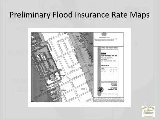
FEMA Region II Morris County Digital Flood Insurance Rate Map (DFIRM). FEMA Region 2 Mitigation Division April 28th, 2010 10:00-11:00 or 14:00-15:00.

E N D
FEMA Region IIMorris County Digital Flood Insurance Rate Map (DFIRM) FEMA Region 2 Mitigation Division April 28th, 2010 10:00-11:00 or 14:00-15:00
Purpose of this Coordination Call: To establish the awareness and understanding in the ongoing collaborative efforts to update Community’s flood risk analysis and mapping (ie. FIS and DFIRM). • Whois Involved: TEAM comprised of Federal/State/Local/Contract Partners - • Federal – FEMA, Region II Project Manager; Paul K. Weberg, PE Communications/Outreach Support; Adie Koby Technical Assistance; Alan Springett • Engineering Contacts: Regional Support Center (RSC2); Andrew Martin, Tolga Yilmaz Regional Program Management Lead (RPML); Bo Juza Map Mod Mapping Partner; NTHMC – Roger Kowieski, PE Risk MAP Mapping Partner; RAMPP, JV – Robyn Boyd • State – NJDEP, Joseph Ruggeri, P.E., CFM Supervising Engineer NJ State NFIP Coordinator's Office Bureau of Dam Safety & Flood Control Office of Engineering & Construction • Local – Morris County & Communities Purpose
WHY: maintain an up-to-date and accurate flood risk analysis and delineation for local decision makers in flood risk management. • This SUCCESS of this effort and outcome relies on the active participation of EACH COMMUNITY Purpose
Overview of current DFIRM mapping status of Morris County • Future projects and next steps • QA/QC & Feedback from the communities Objective
Mapping partner to deliver countywide preliminary maps to Morris communities Friday, April 30th 2010 • Preliminary DFIRM Project Team • NTHMC, Inc. • AECOM • Preliminary DFIRM Tasks -Base Map Acquisition -Redelineation -New Detailed Hydrology & Hydraulics (H&H) -FIS Report Production -Terrain data processing -DFIRM panel and database production -Preliminary DFIRM Production and Distribution Current Status of Morris County DFIRM Mapping
Preliminary DFIRM Scope of Work: The selection of study streams were primarily driven by a severe flooding of August 11-14, 2000, which impacted several areas in Morris, Sussex, and Hunterdon Counties. This flooding was well documented in the USGS WRI Report 02-4099, which was reviewed by NTHMC and discussed with FEMA, USGS and NJDEP Morris County – 4/30/2010 Preliminary DFIRMs
Re-delineation • 69 streams, 370 miles of detailed study reaches • 73 streams, 111 miles of approximate 1% annual-chance floodplains • Using updated digital topography (LIDAR collected in 2005) provided by the Morris County, The Department of Planning, Development, and Technology, GIS Department Morris County – 4/30/2010 PreliminaryRe-delineation
Converts the existing manual format flood maps to a GIS-based digital format • Includes a Digital FIRM Database • Updates the base map to 2005 orthophotography • Converts flood hazard data from the National Geodetic Vertical Datum of 1929 (NGVD 29) to the North American Vertical Datum of 1988 (NAVD 88) • NAVD 88 = NGVD 29 (–0.78) Morris County – 4/30/2010 PreliminaryMap Modernization
Discrepancies in the 100-year water surface elevations between adjacent communities (15 out of 39 Municipalities) • Missing delineations between adjacent communities (gaps in the delineations) Morris County – 4/30/2010 PreliminaryProblems Encountered
The 100-year floodplain elevation at the corporate limit between Morris Plains and Parsippany-Troy Hills has an elevation drop of approx. 2 feet Borough of Morris Plains BFE: 450 Township of Parsippany-Troy Hills BFE: 448 Morris County – 4/30/2010 PreliminaryProblem Area Examples
Pequannock River, Riverdale Borough - The bridge going over Interstate 287 is not located on the flood profile Morris County – 4/30/2010 PreliminaryProblem Area Examples
New mapping partner (RAMPP) to start revising and deliver revised preliminary maps on June, 2011 Revised Preliminary DFIRM Scope of Work: • Approximately 31 miles of detailed analysis for various streams due to mismatches found during the first-time countywide mapping effort • 14 miles of detailed analysis for the Passaic River Revised Preliminary DFIRM Current Status: • Field survey for the approximately 31 miles of detailed analysis for various streams has been completed • Awaiting the completed survey of the 14 miles of the Passaic River project and also to obtain the preliminary countywide mapping data Morris County - Future WorkRevised Preliminary
6 month: FEMA 6-month LFD Letter • 5 month: NJDEP Assistance Letter • 3 ½ month: Draft Ordinance • 3 month: NJDEP review of draft ordinance • 3 month: FEMA 90-day Reminder Letter • 1 month: FEMA 30-day Reminder Letter • 0: Ordinance Adopted The Road to Ordinance Re-Adoption
Contact Information • FEMA Region II Paul Weberg, DHS/FEMA Region II 290 Broadway, 29th Floor New York, NY (212) 680-3638 Paul.weberg@dhs.gov • NJDEP office: John Scordato / Joseph Ruggeri / Chris Gould / NJDEP, Bureau of Dam Safety & Flood Control (609) 292-2296 phone, (609) 984-1908 fax Visit NJDEP website: www.nj.gov/dep/floodcontrol Download Model Ordinances: http://www.nj.gov/dep/floodcontrol/modelord.htm Questions & Feedback


![Risk MAP and Discovery FEMA Region [#], [WATERSHED NAME] Watershed](https://cdn1.slideserve.com/2868558/risk-map-and-discovery-fema-region-watershed-name-watershed-dt.jpg)