Download
1 / 31
460 likes | 1.88k Vues
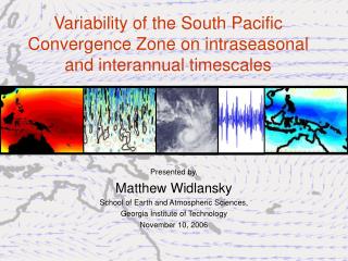
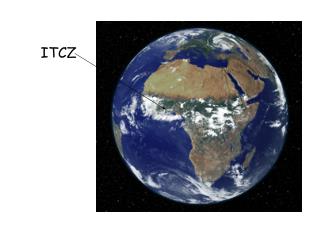
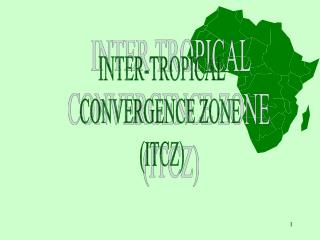
INTER-TROPICAL CONVERGENCE ZONE (ITCZ). INTER-TROPICAL CONVERGENCE ZONE (ITCZ). SUMMARY NOTE: ITCZ A zone of convergence is where winds meet Converging winds include the trade winds which meet at the equator – called the ITCZ Associated low pressure: calm, warm conditions

E N D
INTER-TROPICAL CONVERGENCE ZONE (ITCZ)
INTER-TROPICAL CONVERGENCE ZONE (ITCZ) SUMMARY NOTE: ITCZ • A zone of convergence is where winds meet • Converging winds include the trade winds which meet at the equator – called the ITCZ • Associated low pressure: calm, warm conditions EFFECT OF THE EARTH’S ORBIT ON THE ITCZ • Latitude receiving the most intense heating from the sun • This areas moves between the tropics due to the Earth’s orbit • The area of maximum heating is known as the thermal equator • Sun overhead at the Tropics at the solstices (once in N. Hemisphere and once in the S.) • Sun directly over the equator twice a year – equinoxes • This migration of the thermal equator shifts the belts of winds and pressure systems north and south over the year
INTER-TROPICAL CONVERGENCE ZONE (ITCZ) SUMMARY NOTE (Cont.): EFFECT OF LAND AND SEA MASSES ON ITCZ • Rates of heating vary greatly over land and sea • Temperature extremes are greater over land – it heats and cools at a faster rate • This means that the ITCZ (zone of low pressure) moves at a different rate around the world • As a result the ITCZ moves further N and S over land than sea
INTER-TROPICAL CONVERGENCE ZONE (ITCZ) CASE-STUDY – EQUITORIAL & SAVANNA REGIONS OF AFRICA Main climatic regions: • Equatorial Climate • Tropical Climate • Hot Deserts These zones merge into one another Key difference is the rainfall rather than temperature Therefore seasons tend to be wet season and dry season rather than winter and summer
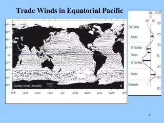
23º The most intense heating of the sun, occurring at the so-called thermal equator, annually moves between the tropics. On or around June 20th each year the sun is overhead at 23½ºN, the Tropic of Cancer. On or around December 20th the the sun is at overhead at 23½ºS, the Tropic of Capricorn. These two dates are the solstices. Twice a year, at the equinoxes, on or around March 20th and September 20th the overhead sun crosses the equator. This annual north to south and back again "shift" of the thermal equator shifts the belts of planetary winds and pressure systems to the north and to the south as the year turns.
June Summer Solstice 23½ºN TROPIC of CANCER September Autumn Equinox March Spring Equinox 0º EQUATOR December Winter Solstice 23½ºS TROPIC of CAPRICORN
ITCZ JULY ITCZ JANUARY
The location of the ITCZ varies throughout the year The ITCZ over land moves farther north or south than the ITCZ over the oceans due to the variation in land temperatures. ITCZ JANUARY ITCZ JULY
http://www.cla.sc.edu/geog/faculty/carbone/modules/newmods/africa-itcz/http://www.cla.sc.edu/geog/faculty/carbone/modules/newmods/africa-itcz/ The blue shading on the map shows the areas of highest cloud reflectivity, which correspond to the average monthly position of the ITCZ.
The migration of the inter-tropical convergence zone (ITCZ) in Africa affects seasonal precipitation patterns across that continent. http://www.bbc.co.uk/scotland/learning/learningzone/clips/538/
DESERT dry all year SAVANNA dry ‘winter’ wet ‘summer’ RAINFOREST wet all year ITCZ moves north in summer
Tropical rainforest savanna
The further North • of the Equator in tropical Africa:- • the lower the annual rainfall • the more the rainfall is concentrated in the summer months • the more variable the rainfall.
0º 10ºN 20ºN GUINEA SAVANNA SAHEL SAVANNA DESERT RAINFOREST rainfalldecreases seasonalityincreases variability increases
LAGOS SOKOTO TIMBUKTU
savanna climate tropical summer rain
savanna vegetation
INTER-TROPICAL CONVERGENCE ZONE (ITCZ) CASE-STUDY – EQUITORIAL & SAVANNA REGIONS OF AFRICA Using pages 19 26 Answer questions 4 6 on page 39 under the heading ‘Tropical Africa: Climate’
3 Marks Name the air masses Describe where they come from Give their characteristics
Air Mass A: Tropical Continental or cT Origin: Over the Sahara Desert (ie large land mass in tropical latitudes) Nature: Warm, dry, stable air Air Mass B: Tropical Maritime OR mT Origin: Over Atlantic Ocean (Gulf of Guinea) in tropical latitudes Nature: Warm, moist, unstable air Allow one mark for each correctly named air mass,origin and nature. Candidates who incorrectly name (or omit the name) of the air mass can still gain credit for the correct origin and/or nature of the air mass.
12 Marks Describe the climate graphs: i. Highest rainfall ii. Least rainfall iii. Rain all year iv. One peak or two Give figures Explain why this happens. Match movement of ITCZ to rainfall i. Dry = cT ii. Wet = mT iii. Peak Rainfall = ITCZ overhead Why does the ITCZ move?
Description should be able to focus on the marked contrasts in rainfall amounts between a very dry north (with only 250 mm per annum) and a much wetter south (where some coastal areas receive over 2000 mm per annum) as shown on the map provided. Candidates could also refer to the graphs and note the variations between the three stations with Tombouctou in the north and Jos “in the middle” experiencing obvious wet and dry seasons whilst coastal Lagos in the south has a vastly greater annual rainfall total, no dry months and a “twin peak” regime. Explanation ought to concentrate on the role of the I.T.C.Z and its associated Tropical Maritime air mass (warm, moist and unstable) and Tropical Continental air mass (warm, dry and stable). For example, Lagos – On the coast of the Gulf of Guinea – is influenced by warm moist Tm air for Most of the year. This accounts for its much higher annual rainfall total. The twin rainfall peaks can be attributed to the I.T.C.Z migrating northwards and then southwards again later in the year, following the overhead sun or thermal equator. Tombouctou, in contrast, lies well to the north of the I.T.C.Z in January and is under the influence of the hot, dry Tc air from the Sahara Desert. In May/June the I.T.C.Z. moves north bringing moist Tm air and rainfall to Jos and, to a much lesser extent, Tombouctou which lies closer to its point of maximum extent.