Download
1 / 18
180 likes | 372 Vues
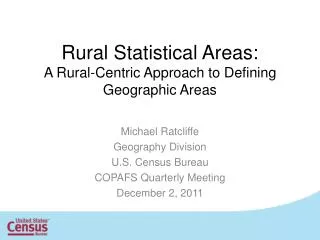
Rural Statistical Areas: A Rural-Centric Approach to Defining Geographic Areas. Michael Ratcliffe Geography Division U.S. Census Bureau COPAFS Quarterly Meeting December 2, 2011. What Are Rural Statistical Areas?.

E N D
Rural Statistical Areas:A Rural-Centric Approach to Defining Geographic Areas Michael Ratcliffe Geography Division U.S. Census Bureau COPAFS Quarterly Meeting December 2, 2011
What Are Rural Statistical Areas? • A set of geographic areas defined using counties, county subdivisions, and/or census tracts as building blocks. • Defined as part of a 3-year joint research project between the Census Bureau and the State Data Centers to tabulate and analyze ACS 1-year estimates for areas of 65,000 or more people. • Goal was to create rural, or predominantly rural, sub-state areas of 65,000 or more people. • Initial delineation focused on county-based areas. • As the joint research project progressed, county subdivisions and census tracts also were used to define areas.
RSA Delineation Process • State Data Center Steering Committee provided the initial concept– county groupings of 65,000 or more; focus on rural counties; counties of 65,000 or more people would be “standalone” RSAs. • Geography Division used the USDA’s Urban Influence Codes to classify counties. • Created an “aggregation net” to create initial grouping of counties, then modified interactively. • SDCs reviewed and made additional changes. • SDCs made additional changes to boundaries and building blocks as the 3-year joint project progressed.
Urban Influence Codes for Counties With Population Less Than 65,000
Problems Arising With Initial Aggregation • County with UIC 8-12 completely surrounded by counties with different UICs • Solution: aggregate county with other non-stand-alone counties
Problems Arising With Initial Aggregation • Completely surrounded by stand-alone counties • Solution: aggregate with contiguous stand-alone county
Problems Arising with Initial Aggregation • Total population of aggregated counties within net is below 65,000 • Solution: combine areas across aggregation polygons 89,712 8,549 3,600 1 – 2 (Metropolitan) 3 – 4 (Adjacent to Large Metro) 5 – 7 (Adjacent to Small Metro) 8 – 12 (Not Adjacent to Metro) Stand Alone County Aggregation Net 31,953
Rural Statistical Areas All Counties Included
Questions and thoughts that arose during the joint research project: • Should RSAs be contiguous? • It might be valuable to define multiple, noncontiguous micropolitan statistical areas as a single RSA, separate from surrounding Outside CBSA counties • “Rural” counties with similar demographic characteristics may not be contiguous, but for analytical purposes should be in the same RSA • Can a variety of building blocks be used to form RSAs? • Group counties, county subdivisions, and census tracts, as appropriate, to form meaningful areas • Should counties of 130,000+ population be split into multiple areas?
Next Steps • The State Data Center Steering Committee has requested that the Census Bureau adopt RSAs as a standard tabulation geography • Review concept more widely within Census Bureau • Prepare Federal Register notice with proposal for comment • Think of a better term for these areas since some are obviously urban or predominantly urban
Thanks! Comments, questions: Michael Ratcliffe Geography Division Census Bureau 301-763-8977 michael.r.ratcliffe@census.gov