Environmental Interactions: Rural Land Resources
900 likes | 1.12k Vues
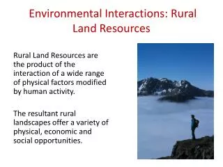
Environmental Interactions: Rural Land Resources. Rural Land Resources are the product of the interaction of a wide range of physical factors modified by human activity. The resultant rural landscapes offer a variety of physical, economic and social opportunities . .

Environmental Interactions: Rural Land Resources
E N D
Presentation Transcript
Environmental Interactions: Rural Land Resources Rural Land Resources are the product of the interaction of a wide range of physical factors modified by human activity. The resultant rural landscapes offer a variety of physical, economic and social opportunities.
Environmental Interactions: Rural Land Resources • Characteristics of glaciated upland, upland limestone and coastal landscapes. • The evolution of these landscapes. • Economic and social opportunities in these areas. • Environmental problems and conflicts in these areas. • UK and European Union policies.
Assessment in Rural Land Resources The content covered in this unit will be assessed in paper 2.
Limestone: Yorkshire Dales Environmental Interactions: Rural Land Resources
Topic Outline • Limestone landforms in the Yorkshire Dales. • Background to the Yorkshire Dales. • Land Use in the Yorkshire Dales: • Farming • Tourism • Quarrying • Land use conflict in the Yorkshire Dales. • Management of land use conflicts.
Aims of the lesson • To introduce the Rural Land Resources Unit. • To practice answering 20 mark questions on upland limestone landforms.
Limestone Landforms in the Yorkshire Dales Lets create a list of limestone landforms you have learnt about in the Yorkshire Dales. Can you remember the named examples?
2012 PPQ Paper 2 Q1a The Yorkshire Dales National Park is an area of Upland Limestone.With the aid of annotated diagrams, describe and explain how the main physicalfeatures of upland limestone landscapes are formed.Both surface and underground features should be included in your answer. (20 Marks) Tips: • Arrange your answer into a series of subheadings: • Surface Features • Limestone Pavement • Underground Features • Caverns • Stalactites, Stalagmites & Pillars • 4 Marks awarded for named examples. • Detailed explanation of processes required. • 16 marks only if no diagrams included.
Homework Complete your 20 mark question at home for next lesson.
Summary So far we have… • Introduced the Rural Land Resources Unit. • Practiced answering 20 mark questions on upland limestone landforms.
Aim of the lesson • To practice answering 20 mark questions on upland limestone landforms.
Peer Marking Pass your finished 20 mark answer to another member of the class. Using a highlighter you will mark on the areas where you would give marks. Use the marking scheme provided and textbooks to help you. As bullet points, add in any information you feel they have missed out.
Homework Using the peer feedback you have been provided with, rewrite your answer to include all of the missed information.
Summary So far we have… • Introduced the Rural Land Resources Unit. • Practiced answering 20 mark questions on upland limestone landforms.
Aim of the lesson • To practice answering 20 mark questions. • To develop our ability to write extended answers under exam timed conditions.
Sample Answer Take a look at this sample answer for the question you have been tackling in class. Using a post-it, mark this sample answer and also write down any information you feel it may have missed. Now take a look at this handwritten version.
Time Test The Yorkshire Dales National Park is an area of Upland Limestone.With the aid of annotated diagrams, describe and explain how the main physicalfeatures of upland limestone landscapes are formed.Both surface and underground features should be included in your answer. (20 Marks)
Summary So far we have… • practiced answering 20 mark questions. • developed our ability to write extended answers under exam timed conditions.
Aims of the lesson • To learn about the location and background of the Yorkshire Dales • To learn the definition of social, economic and environmental factors.
Location of the Yorkshire Dales Using the “Modern School Atlas” you are going to writer a brief description of the location of the Yorkshire Dales. It should include: • When it opened: 1954 • The name of a settlement within it: M______. • The names of three cities nearby. • The names of the main roads connecting those cities to the Dales.
Location of the Yorkshire Dales The Yorkshire Dales National park was founded in 1954. It is located in the north east of England. One of the main settlements in the Dales is Malham. Three major cities nearby to the park are Birmingham, Newcastle (both connected by the A1) and Manchester (connected by the M65).
Social, Economic & Environmental Factors A social factor is one which will affects the people in the area. An economic factor is one which affects industry in the area. An environmental factor is one which affects the natural landscape.
Factors Affecting the Yorkshire Dales Each pair has been given a set of cards containing information on factors affecting the Yorkshire Dales. You must divide these factors into 3 groups: • Social Factors • Economic Factors • Environmental Factors There may be some cross over. Once complete, take a copy of these into your notes.
Review Questions • Give 2 social factors affecting the Yorkshire Dales you have learnt. • Give 2 economic factors affecting the Yorkshire Dales you have learnt. • Give 2 environmental factors affecting the Yorkshire Dales you have learnt.
Summary • To learn about the location and background of the Yorkshire Dales • To learn the definition of social, economic and environmental factors.
Aims of the lesson • To understand how quarrying is a suitable land use for the Yorkshire Dales. • To learn the social, economic and environmental impacts of quarrying in YD with reference to named examples. • To identify conflicts and solutions between quarrying and other land uses in the YD with reference to named examples.
Jobs You should be in groups with a maximum of 4 people per group • Timekeeper – keeping track of the time and making sure all tasks are completed within the time limit. • Resource Manager – responsible for collecting and returning all resources required e.g. maps, paper etc. • Chairperson – ensures that everyone has a chance to have their say and help keep the discussion on track. • Recorder – Makes notes on what has been discussed by the group.
What you will need Once each person in the group has a role the Resource Manager should collect the following • A copy of the Ingleton map • A set of characters (4) and statements (6) for your group • Lined paper to record the discussions
Roles For this activity each of you is going to take on a role: • Quarry Manager • Local Resident • National Park Authority Representative • Potholer
Task 1: Discussion • As a group identify the quarry at grid reference 706740 (this quarry spills over into parts of two squares). • The owners of this quarry have applied to extend the quarry to the North-west of its current location. • As a group you will have to discuss the merits and disadvantages of the extension and come to a decision on whether or not the extension can go ahead. • You will have 15 minutes for your initial discussions – the recorder should keep accurate notes of what is being discussed, timekeepers and chairperson make sure the group is on track!
Task 2: Conflict Spider Diagram For the Yorkshire Dales we are going to create am A3 spider diagram that outlines the key conflicts that exist between land uses. We will also add in possible solutions to these conflicts.
Tourism Conflicts YORKSHIRE DALES Quarrying Farming Solutions Suitable
Summary Today we have… • understood how quarrying is a suitable land use for the Yorkshire Dales. • learnt the social, economic and environmental impacts of quarrying in YD with reference to named examples. • identified conflicts and solutions between quarrying and other land uses in the YD with reference to named examples.
Aims of the lesson • To understand how farming is a suitable land use for the Yorkshire Dales. • To learn the challenges and changes to farming in the Yorkshire Dales with reference to named examples. • To identify conflicts and solutions between farming and other land uses in the YD with reference to named examples.
Farming in the Yorkshire Dales The Yorkshire Dales landscape is one of small fields enclosed with limestone dry stone walls. This traditional way of life is now increasingly under threat due to pressure on farming practices.