Download
1 / 9
90 likes | 218 Vues
Viewing the world in 3-D: using Google Earth TM to complement traditional geological mapping. Simon Brocklehurst School of Earth, Atmospheric and Environmental Sciences, University of Manchester shb@manchester.ac.uk. The problem. Geology is an inherently 3-D subject

E N D
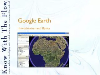
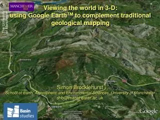
Viewing the world in 3-D:using Google EarthTM to complement traditional geological mapping Simon Brocklehurst School of Earth, Atmospheric and Environmental Sciences, University of Manchester shb@manchester.ac.uk
The problem • Geology is an inherently 3-D subject • Many students struggle to grasp 3-D structural geometries when these are taught using 2-D maps and cross-sections • Can virtual-globe technology (i.e., Google EarthTM) be used to help students grasp 3-D geometries more readily? Twin aims: • Use Google EarthTM to improve students’ grasp of geologic structures in 3-D • Find effective means to communicate how to do this
Semester One Tutorial exercise • Import field maps and cross sections drawn during the Second Year Barreme field trip (September, 2010) into Google EarthTM and use the 3-D, virtual globe perspective to test understanding of the structures within the area mapped • Delivered through Blackboard, with written directions and 4 Camtasia films: • Introduction to Google EarthTM (23 views) • How to import maps (294 views) • How to import cross sections (39 views) • What to do once maps and cross sections have been imported (14 views) • 6 tutors, 42 students
Gauging the success of the exercise • Did the students manage to do the task? • Did the students benefit from the task? • Anecdotal evidence (discussions in tutorials) plus online questionnaire • Questions: • How useful did you find the notes for guidance? • How helpful did you find the instructional videos? • How helpful did you find the ability to view your map draped over the topography in Google EarthTM? • How helpful did you find the ability to view your cross section in Google EarthTM? • How much did it add to your understanding of the geologic structure to be able to view your map and section in 3-D? • Do you foresee Google EarthTM being helpful in the future, e.g., before, during or after Independent Mapping?
Feedback and reflection • Only 11 of 42 students completed the questionnaire... • Abridged comments: • Such a cool tool, and very encouraging when you can see that you've done everything right; a thoroughly enjoyable assignment • The videos were concise and very informative/helpful • Map in 3-D was helpful; cross section wasn’t • It was helpful to understanding the structure • Students don’t prioritise completing questionnaires • Camtasia is helpful in disseminating instructions • Students don’t necessarily embrace new technologies; though Google EarthTM clearly has potential to aid understanding
Future development – bigger picture • Add Google EarthTM exercises to Second Year, second semester tutorials • e.g., remote sensing of potential Independent Mapping areas • Encourage use of Google EarthTM in Independent Mapping projects • Explore relevant web resources • Discuss effectiveness of current and future tools with fellow tutees and field trip staff • Bigger question: use of GIS and associated new technologies in geological fieldwork