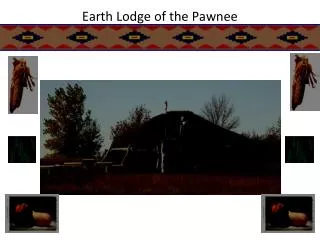
Download
1 / 1
20 likes | 162 Vues
Community Classification of the Pawnee National Grasslands, Shortgrass Steppe, USA. Scott B. Franklin 1 , Michael Schiebout 2 , & Amber Brandt 1 1 School of Biological Sciences, University of Northern Colorado, Greeley, CO USA; 2 Department of Biology, Union University, Jackson, TN USA.

E N D
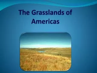
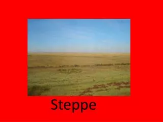
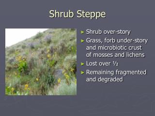
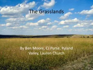
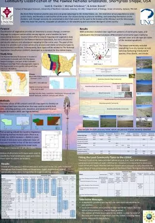
Community Classification of the Pawnee National Grasslands, Shortgrass Steppe, USA Scott B. Franklin 1, Michael Schiebout 2, & Amber Brandt 1 1 School of Biological Sciences, University of Northern Colorado, Greeley, CO USA; 2 Department of Biology, Union University, Jackson, TN USA But from these immense prairies may arise one great advantage to the United States, viz., the restriction of our population to some certain limits, and thereby a continuation of the union. Our citizens being so prone to rambling, and extending themselves on the frontiers, will, through necessity, be constrained to limit their extent on the west to the borders of the Missouri and the Mississippi, while they leave the prairies, incapable of cultivation, to the wandering and uncivilized Aborigines of the country. Zebulon Pike Purpose Classification of vegetation provides an inventory to assess change, a common language to compare communities among regions, and a baseline for land stewardship decisions. Several initial efforts toward mapping and vegetation data collection are available for the Pawnee National Grasslands, but not a structured community analysis and subsequent mapping for the entire area. The goal of this study is to provide such a local community analysis and relate community types to environmental conditions. Subsequently, local types will be related to The National Vegetation Classification (USNVC) developed as a standard for the United States. Results NMS ordination revealed clear significant patterns of community types, and subsequent discriminant analyses differentiated community types mainly by percent cover and site type (an index of the moisture gradient). The mixed community included everything from dry riparian to rock outcrops harboring mixed prairie species, Pinusflexilis, and shrubs. Study Area The Pawnee National Grasslands is located in northeastern Colorado with the ShortgrassSteppe Ecoregion, and part of the Colorado Piedmont and High Plains physiographic regions. The fragmented area is gently rolling with few outcrops; 78,128 ha. Site 1 Euclidean Distance Clustering using Ward’s Method Site 5 Sedimentary cycles Physiography Climate Mean Max Daily Temp in Summer = 31°C Mean PPT = 305-380 mm Slightly increasing moisture from west to east Geology includes shale, sandstone, sand dunes, and gravel; soils include badlands, mollisols, entisols, and alfisols. Bouteloua-Yucca Small Rock Outcrop Community Bouteloua-Opuntia Slope Community Site 7 PascopyrumsmithiiCommunity Remnant Buffalo Wallow Bouteloua Open [low cover] Community Cottonwood riparian Mixed Community Site 2 Carex-Eleocharis Wet Community Sprobolisairoides-GlycyrrhizalepidotaCommunity Methods The initial phase of this project used GIS map layers to develop an ecological land type classification that was used to stratify field plots, including geology, soils, elevation, and landscape location (Kupfer & Franklin 2000; see Figures below). Boutelouagracilis Community Site 97 BoutelouadactyloidesCommunity Site 4 Site 11 Site 44 Site 33 Discriminant Analysis accuracy table; values are percent of plots correctly classified Plot sampling utilized the Carolina Vegetation Sampling method modular plots (Peet et al. 1998); ten 10X10 modules = 20X50 m plots. A total of 102 plots were collected. Cover of taxa was recorded in four of the ten modules using a modified Daubenmire cover scale. Trees were measured in all ten modules. Various multivariate techniques were used to classify the local community types and relate those types to abiotic parameters. Fitting the Local Community Types to the USNVC The local Community types provided above are just that, local, and represent variations on concepts of wider distribution. However, it is important to place our local community types into the national classification concepts to fully describe the types. Most of the communities are part of the Great Plains Shortgrass Prairie Group. Results A total of 299 species (~430 known) were witnessed in the 102 plots scattered throughout the Pawnee National Grasslands. Eights distinct (one mixed) community types were distinguished through clustering analysis. http://usnvc.org/explore-classification/ • Take-home Messages • A vegetation gradient was found from open rock communities to wet prairies. • Local communities were related to environmental factors, but also typical disturbances (i.e., prairie dogs, grazing). • The relation of these local types to the USNVC is clear for most of the area and common vegetation, but the USNVC is lacking mesic prairie association descriptions.