Download
1 / 33
330 likes | 372 Vues
Discover the geological and cultural significance of rivers and streams as vital pathways of water flow on Earth's surface. Learn why streams are essential for water transportation, erosion, and the formation of sediment as tributaries of larger rivers. Explore the behaviors and features of streams, including downcutting, gradient, and types of flow. Gain insight into river speeds and common misconceptions through a literary analogy. Compare river characteristics in headwaters versus lower courses and understand the role of valleys shaped by stream erosion and sediment transport. Embark on an educational journey to appreciate the crucial role of rivers and streams in Earth's natural systems.

E N D
Rivers: The geological and cultural significance of rivers
Streams as part of the Earth system Streams are important pathways of water flow on Earth’s surface, connecting land areas that receive water as precipitation with the sea. Most “excess surface water” that does not soak into the ground or is evaporated is directed down stream channels.
What is a Stream and Why are Streams Important ? • In a geological sense, a stream can be considered a body of water that carries rock particles and dissolved ions and flows down slope along a clearly defined path, called a channel • Streams are important because: • They deliver much of the water from land to the sea • They erode lots of sediment particles and transport then to lower elevations (thus being important in the formation of sediment, and ultimately sedimentary rocks) • They carry dissolved ions (weathered from rocks on land) to the sea (this is why the sea is salty) • They are major sources of water and serve as transportation routes for humans. Most population centers are located along streams (both along their courses and at their mouths.
Origin of Streams • Water that falls to the ground as precipitation can: • Evaporate back into the atmosphere • Soak into the ground (ultimately becoming groundwater) • Remain at the surface as runoff.
Runoff initially moves over the surface in a thin, continuous sheet (sheetflow), but eventually becomes confined to tiny channels called rills.
Rills merge into larger, more permanent, stream channels… which are tributaries of even larger rivers (a river is a stream with several tributaries)
Stream Characteristics: Ability to Downcut Streams tend to erode downward in an effort to reach base level (sea level). The greater the elevation above sea level, the greater the rate of downcutting. Thus, erosion tends to dominate at the headwaters (highest elevation above base level).
Stream Characteristics: Gradient The gradient (slope) tends to be higher at the upper reaches of a stream (headwaters) than its lower reaches (close to its mouth).
Stream Characteristics: Load • Streams carry clastic sedimentary particles in two ways: • As bedload; large and/or dense particles that remain on the bed of a stream most of the time, but can move by tumbling and saltation (in turbulent layer). • As suspended load ; small and/or light particles that are suspended in water most of the time (in turbulent and laminar layers) • In general, the volume and sediment grain size of both bedload and suspended load decrease downstream (with increasing distance from the primary sediment source).
Stream Characteristics: Types of Flow • Two main types of flow occur in streams: • Turbulent (non-linear) flow dominates near the bottom and sides of a stream channel where swirling eddies are generated around elements of surface roughness. • Laminar flow (linear) flow dominates water that is out of reach of turbulent eddies. Laminar flow Turbulent flow Stream bed
A Common Misconception: River Speed The House at Pooh Corner (A.A. Milne, 1928) Chapter 6: In which Pooh invents a new game and Eeyore joins in. “ BY the time it came to the edge of the Forest the stream had grown up, so that it was almost a river, and, being grown-up, it did not run and jump and sparkle along as it used to do when it was younger, but moved more slowly. For it knew now where it was going, and it said to itself, "There is no hurry. We shall get there some day." But all the little streams higher up in the Forest went this way and that, quickly, eagerly, having so much to find out before it was too late.” This statement expresses a common misconception – that streams are faster close to their source than far from their source.
Comparing river characteristics: Channels Headwaters Lower Course Small, shallow, channels Coarse bedload Turbulent flow dominant Overall velocity often low because drag affects most of water column Large, deep, wide channels Fine bedload Laminar flow dominant Overall velocity high because drag is confined near the stream bed (well below the surface)
Comparing river characteristics: Valleys River channels are bounded on either side by valleys. Valleys reflect the erosive action of streams, which undercut and destabilize their banks. Destabilized material tumbles down into the stream channel, providing sediment particles for the stream to transport as bedload or suspended load.
Valleys at headwaters (high above base level) tend to be deep and v-shaped due to rapid downcutting. Meandering pattern not pronounced.
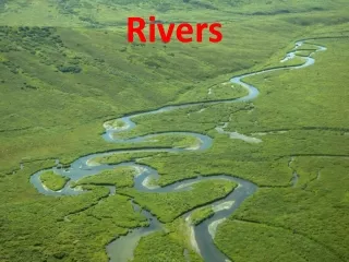
Valleys in the lower parts of a stream’s course (only slightly above base level) tend to be broad due to little downcutting and greater lateral movement. Meandering pattern more pronounced. The “flatness” of the valley floor is accentuated by the deposition of sediment during floods. Areas adjacent to the channel that are built up by sediments during floods are called floodplains.
Back to Pooh: Studying River Flow The House at Pooh Corner (A.A. Milne, 1928) - Chapter 6: In which Pooh invents a new game and Eeyore joins in. This story is best known for the invention of the game “Pooh Sticks” • How to play: • On one side of a bridge, players drop a stick into the river. • Players run to the other side of the bridge • The first stick to appear from under the bridge is the winner
Yes, there is a real Poohsticks Bridge The real bridge is near Hartfield, West Sussex (southern U.K.) Pooh Sticks Bridge crosses Steel Forge Stream, which is a tributary of the River Medway
Meandering river flow: the middle of the river is not necessarily the fastest part as you might assume. Outside bank Inside bank The path of highest flow velocity (called the thalweg) veers toward the outer bank of a meander. Inside bank Outside bank Outside bank Cross section shown in next slide
How to win at Pooh Sticks bridge bridge bridge Drop stick here Always drop your stick in the thalweg (zone of fastest flow) Here are three possible bridge locations, and suggested places to drop your stick Drop stick here Drop stick here
How a meandering stream moves laterally The path of highest flow velocity (called the thalweg) veers toward the outer bend of a meander. This creates an area of high water pressure at the outer bend. The inner bend is the zone of slowest flow, representing an area of low water pressure Inside bank Outside bank Cross section shown in next slide
To relieve the differences in pressure, water flows rapidly downward at outside bank, across the bottom of the channel, and up the inside bank. Inner bank Outer bank High pressure Low pressure strong flow weak flow This produces helical flow (circulating in a corkscrew fashion) and produces a channel which is obviously assymetrical about the stream’s midline.
Outer bend (Cut Bank) Inner Bend (Point Bar) High pressure Low pressure strong flow weak flow Deposition Erosion Strong flow erodes the outer bend, producing a steeply sloping cut bank. Weaker flow on the inner bend allows deposition of sediment there. Build up of sediment on inner bend displaces the water laterally (in opposite direction) necessitating generation of equivalent new space on outer bank side through erosion. The net result is that the meander moves laterally in the direction of the cut bank (to the left, in this case).
St. Mary River, Alberta Point Bar Cut Bank Cut Bank Point Bar
Oxbow Lakes Meander loops become more pronounced through time, resulting in cutoffs as the base portions of the loops merge to locally form a new channel and flowcourse. The development of a new bank corresponding to the new channel will result in the isolation of the loop remnant. This commonly leads to the formation of a U or C shaped depression (Yoke shaped) which will become an oxbow lake. New bank
The lowest parts of a river’s course In the lowest parts of a stream’s course, it is deprived of coarse sediment but still carries lots of fine-grained sediment as bedload and suspended load. It has also reached its highest discharge (the volume of water passing a given point in a given period of time). This is because it is receiving water from a great many tributaries. The high discharge of a river its lowest course can be appreciated when one considers the total amount of water received by the Mississippi River.
Mississippi River Drainage Basin Note that the majority of rivers in the US ultimately drain into the Mississippi River. The lower Mississippi transports a huge amount of water and a huge amount of fine-grained sediment (fine sand and silt as bedload and mud as suspended load).
The Muddy Mississippi The muddiness of the Mississippi is legendary ! Mississippi River in New Orleans, Louisiana
The Muddy Mississippi …so much so that it has even influenced the regional culture For example: The famous Mississippi Mud Pie Also: Blues artist Muddy “Mississippi” Waters, 1920’s song “Mississippi Mud” (original lyrics would be considered racist today), Mississippi Mud Black and Tan Beer
Floodplain Deposition Floods are important events that deposit sediments beyond a river’s channel. This is particularly important in lower river courses where the gradient is very low. During a flood, water spills over the river’s banks. The sudden reduction in the speed of the water allows sediment to be deposited on the floodplain. Water level during flood Current weakens Current weakens Sediment deposited Sediment deposited muddy sediment sandy sediment sandy sediment muddy sediment
Levees The coarsest sediment (sand and silt) is deposited closest to the channel,forming ridges called levees (derived from French verb Lever “to raise”). These raised banks are exposed when the river returns to its normal water level.
So, putting it all together, the floodplain of the Mississippi Looks Like This
Cultural Value of Floodplains Floodplains are commonly of great cultural significance, being as they are among the most fertile lands (for agriculture) within any given area. This is due to the replenishment of nutrients, ions and other materials, necessary for the maintenance of arable soils, during flooding. Otherwise, the soils would quickly become depleted of vital nutrients. The lush Nile floodplain (green). Beyond this, infertile desert sand.