Download
1 / 36
360 likes | 536 Vues
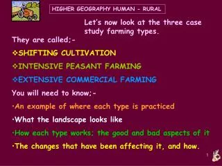
HIGHER GEOGRAPHY HUMAN - RURAL. Let’s now look at the three case study farming types. They are called;- SHIFTING CULTIVATION INTENSIVE PEASANT FARMING EXTENSIVE COMMERCIAL FARMING You will need to know;- An example of where each type is practiced What the landscape looks like

E N D
HIGHER GEOGRAPHY HUMAN - RURAL Let’s now look at the three case study farming types. • They are called;- • SHIFTING CULTIVATION • INTENSIVE PEASANT FARMING • EXTENSIVE COMMERCIAL FARMING You will need to know;- • An example of where each type is practiced • What the landscape looks like • How each type works; the good and bad aspects of it • The changes that have been affecting it, and how.
HIGHER GEOGRAPHY HUMAN - RURAL Amazon Basin Central Africa Indonesia and PNG. Tropic of Cancer Equator Tropic of Capricorn Global Distribution of Shifting Cultivation
HIGHER GEOGRAPHY HUMAN - RURAL Shifting cultivation is practiced in the Equatorial Rainforest areas of the world. An example is the Boro Indian tribe in Amazonia- Brazil, South America.
HIGHER GEOGRAPHY HUMAN - RURAL • This type of farming is subsistence, extensive, low technology, peasant, low productivity, labour intensive, mainly arable. • It is practiced by between 3 and 6 extended families -perhaps twenty to fifty people- who live and farm together. • They use a huge area of rainforest for their farming, but only small amounts at any one time. • It relies on leaving the land empty- fallow- for many years to recover after use. • The area of rainforest is traditionally handed down to the next generation; no-one actually ‘owns’ the land.
HIGHER GEOGRAPHY HUMAN - RURAL The land is lush with dense vegetation cover, but it is very fragile! Stop the cycle of nutrients and the soil is easily ruined! The native indians know how to work the land without spoiling it in the long term. This is called SUSTAINABLE, and it is good!
HIGHER GEOGRAPHY HUMAN - RURAL What are the processes involved in Shifting farming? • The group decide to settle in an area- it could be several hectares in size. • They build a large, communal hut called a MALOCA. • The men chop the smaller trees down with axes and machetes. • Useful trees like bananas and pineapples are left. • The larger trees are left to help bind the soil and to provide shade; they are too hard to remove, anyway!
HIGHER GEOGRAPHY HUMAN - RURAL A clearing with its crops surrounding the communal hut. A maloca- home to several inter-related families.
HIGHER GEOGRAPHY HUMAN - RURAL A Boro tribe Maloca A Guarani tribe version The design varies between different tribal groups…
HIGHER GEOGRAPHY HUMAN - RURAL SLASH AND BURN is used to clear the land. Some trees such as the banana tree might be left standing. Why? Why is this better than chopping the trees down and removing them?
HIGHER GEOGRAPHY HUMAN - RURAL In Papua New Guinea a house is built in a few hours… The final roof covering goes on…
HIGHER GEOGRAPHY HUMAN - RURAL Inside, the houses are extremely basic.
HIGHER GEOGRAPHY HUMAN - RURAL A family in their Maloca.
HIGHER GEOGRAPHY HUMAN - RURAL 6. The women and children burn the chopped wood- it adds ash as a weak fertiliser, though this is quickly washed out of the soil by the rain. 7. The women then plant their ‘gardens’ called CHAGRAS between the stumps in a random, irregular way. 8. They weed and tend the plants over the next few months, and can harvest up to three crops a year. Remember there are no seasons in the rainforest, and there is continuous growth! 9. All the work is done with digging sticks, hoes and machetes- very low technology!
HIGHER GEOGRAPHY HUMAN - RURAL ..the cut down trees are allowed to dry for three months or so, then burned, in small, controlled fires.
HIGHER GEOGRAPHY HUMAN - RURAL Who needs matches? … making fire with two sticks
HIGHER GEOGRAPHY HUMAN - RURAL Ground clearance is very hard work, so many stumps, branches and roots are left.
HIGHER GEOGRAPHY HUMAN - RURAL The burned wood adds ash (a natural fertiliser) to the soil.
HIGHER GEOGRAPHY HUMAN - RURAL In this Chagra, -a garden rather than a field-, maize seeds are being planted amongst SweetPotato.
HIGHER GEOGRAPHY HUMAN - RURAL Manioc – probably the singlemost important crop… …its roots providing carbohydrate-rich Cassava flour (Tapioca).
HIGHER GEOGRAPHY HUMAN - RURAL Simple fences to keep out wild and domestic animals…
HIGHER GEOGRAPHY HUMAN - RURAL Maize (corn) may be grown where the soils are richer. Papaya and other fruits form an important part of the diet.
HIGHER GEOGRAPHY HUMAN - RURAL Other crops may include… • Yams • Tobacco • Coca • Mangoes • Beans Domesticated animals such as pigs and chickens may also be kept.
HIGHER GEOGRAPHY HUMAN - RURAL However, the torrential rains cause rapid leaching of the already poor soils, washing vital minerals out of the soil and reducing its fertility. This is why the clearings are only used for a few years. Unless the land is left fallow (rested) to recover these nutrients, it will be permanently degraded. LEACHING by rain.
HIGHER GEOGRAPHY HUMAN - RURAL After a few years, the crops start to fail and the clearing is abandoned – to be reclaimed by the forest.
HIGHER GEOGRAPHY HUMAN - RURAL See Booklet p7 Forest cleared by ‘slash and burn’ method. The ash acts as a fertiliser Copy labels This farming does not lead to serious destruction as it allows the forest to naturally regenerate. Food crops such as manioc, sweet potatoes and maize are grown. The diet is supplemented by hunting, fishing and gathering food from the forest. River sites are good for fishing and transport
HIGHER GEOGRAPHY HUMAN - RURAL …Shifting village and cultivation
HIGHER GEOGRAPHY HUMAN - RURAL The settlement pattern is dispersed or scattered. Because of the large area of forest required with all of these moves, the overall population density is very low – often less than 1 person per sq.km.
HIGHER GEOGRAPHY HUMAN - RURAL There is a variation on this type of farming; BUSH FALLOWING iswhere the group settle in one area, living in a permanent maloca for very much longer than usual. They grow their crops in ‘fields’ around the settlement. To stop the soil getting ruined too soon, they practice CROP ROTATION. This is where they use a different field each time for a different crop. They usually leave some of the fields FALLOW to let them recover a bit. See the booklet, pages 12/13.
HIGHER GEOGRAPHY HUMAN - RURAL Changes 1 • Shifting cultivation is in danger of disappearing; • This is due to destruction of large areas of the rainforest on which this system depends – the area available is rapidly shrinking; • This is caused by logging companies, cattle ranchers, gold and diamond miners and other mineral hunters, and new settlers moving in to the forest; • Population growth is also putting additional strain on this way of life – particularly in west Africa. See Booklet P10/11
HIGHER GEOGRAPHY HUMAN - RURAL Changes 2 Some Indian groups have been forced into reservations or retreated into more remote areas deep in the forest; many tribes have suffered from Culture Shock; There has been violence and intimidation against these tribes, with many thousands killed by new settlers; Thousands have also died due to lack of immunity to “western” diseases such as measles; There has been serious water pollution by gold mining, which uses toxic substances such as mercury. This has caused poisoning of rivers and people.
HIGHER GEOGRAPHY HUMAN - RURAL In Brazil, for example, the building of the Trans Amazonian Highway has opened up the virgin rainforest to settlement and exploitation, often with disastrous consequences for the shifting cultivators.
Massive deforestation is removing the habitat on which shifting cultivation depends, as here in Brazil. HIGHER GEOGRAPHY HUMAN - RURAL
HIGHER GEOGRAPHY HUMAN - RURAL Huge fires now destroy enormous areas in a few hours. Shifting cultivation is abandoned and replaced by large, often foreign owned schemes.
HIGHER GEOGRAPHY HUMAN - RURAL …such as the Jari Project in the 70s and 80s, with its forestry plantations, cattle ranches, towns and railway lines.
HIGHER GEOGRAPHY HUMAN - RURAL Thousands of garimpeiros, or gold miners, devastate an area of rainforest in a desperate search for gold.
HIGHER GEOGRAPHY HUMAN - RURAL Review of Main points • Shifting Cultivation is also known as slash and burn; • It is found mostly in the equatorial rainforest areas of the world e.g. Amazon, Congo, PNG. • It has several versions, including bush fallowing; • It is low technology; • It supports a very low population density; • Its settlement pattern is dispersed; • It is subsistence farming, with little surplus; • It is under threat due to a combination of outside influences. Detailed knowledge of these forces of change is essential.