BUILDING STRONG
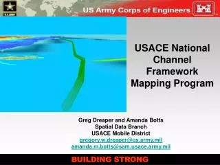
USACE National Channel Framework Mapping Program. Greg Dreaper and Amanda Botts Spatial Data Branch USACE Mobile District gregory.w.dreaper@us.army.mil amanda.m.botts@sam.usace.army.mil. BUILDING STRONG. Overview. Goals of the Channel Framework Inventory (CFI)

BUILDING STRONG
E N D
Presentation Transcript
USACE National Channel FrameworkMapping Program Greg Dreaper and Amanda Botts Spatial Data BranchUSACE Mobile Districtgregory.w.dreaper@us.army.mil amanda.m.botts@sam.usace.army.mil BUILDING STRONG
Overview • Goals of the Channel Framework Inventory (CFI) • Benefits for developing a national channel mapping project. • Understanding the components of the Channel Framework Inventory (CFI) • Who provided it, and who is its primary customer? • What Districts are involved • How many are complete? • What are the major hurdles?
Goals • Standardization and centralization of the USACE authorized and maintained Federal Navigation Projects • Accurately portray the channels and maintain them in a central eCoastal / eGIS system • Improve communication by serving as a single point of contact between NOAA and USACE district offices
Benefits • Single Feature Class that can by accessed by • Multiple users • Multiple formats • Multiple projections • The first contiguous channel dataset produced by the Corps of Engineers. • Responsible for updating the National Waterway network. • This network is used to track all domestic and foreign commerce.
Navigation Project vs. Sub-Project • A Federal Navigation Channel Project • A single or multiple channels by which Congress has authorized for the USACE to build and/or maintain. • Will have a defined CWIS number • A Federal Sub-Project • Within the Congressional language of a Navigation project, a set section of the entire Channel. • Will use its parent project’s CIWS number for funding needs.
What are Authorized, Constructed, and Maintained Channel Dimensions • Authorized Channel • Definition. The authorized channel is defined by original, federal authorization legislation. (engineering dimensions) This textual description, when manually tied to real world coordinates, and represented by two channel toes in either an electronic or hard copy format, is known as the authorized channel. • Constructed Channel • Definition. The constructed channel may differ in dimension from the authorized channel due to funding shortfalls, or local geomorphic conditions that preclude or hinder the construction of the channel to authorized dimensions. Where constructed and authorized channel dimensions differ, both dimensions must be captured in the coastal channel framework. Where constructed channel and authorized channel are the same, a note stating such must be included with the data. • Maintained Channel • Definition. Ideally, the channel is maintained to its authorized dimensions. However, where this is not the case, a maintained channel dimension results. This maintained channel dimension should not, however, result in a new set of channel toes, centerlines, or stations. In fact, maintained channel dimensions need be reported in relation to the authorized and constructed dimensions of the channel via the channel condition report and survey.
Construction Centerline Top of Slope TOE Line Station Lines Components • Channel Toe • Definition. Channel toes represent external channel limits measured horizontally from and perpendicularly to the channel centerline. Channel toes form the boundaries which encompass entire federal projects and sub-projects. • Representation. Toes are represented by single, continuous vectors extending from the beginning to the end of each federal project or sub project. The depth of the channel toe should be provided as an attribute attached to each channel vertex. • Top of Slope Line • Definition. The slope line is derived from the channel toe line depth and angle of slope values as provided with each station line. Where a line, starting from the channel toe, intersects project datum elevation 0, that is where the top of slope line is drawn. The channel slope angle, as well as depth of channel toe, is provided as an attribute of each channel station. • Representation. TOS lines are represented by single, continuous vectors extending from the beginning to the end of each federal project or sub project. The depth of the channel toe should be provided as an attribute attached to each channel vertex. • Channel Stationing • Definition. A channel station is a reference line, primarily used during channel surveying and dredging operations, and meant to convey locations along a channel’s length. A station is placed within a channel at consistent intervals, perpendicular to the centerline, and extends horizontally to each channel toe. Traditionally, channel stations are placed every 100 feet along a channel’s length. In addition to positioning stations at regular intervals, stations also must be placed where channel toes change direction (horizontal inflection). • Representation. Channel stations are represented by individual vectors. Station names are conveyed through associated text fields. The depth of the channel toe should be provided as an attribute attached to each channel vertex.
Channel Reach Definition. The area within a project or sub-project traditionally used in reporting channel condition information via a channel condition report (ENG Form XX.XX). A reach may, or may not, possess a one-to-one spatial relationship to a project or sub-project. Reaches, if used for reporting purposes, must describe the entire project length. Representation. Channel reaches are represented by individual vectors placed parallel to the channel centerline at the beginning/end of each reach. Channel Quarter Definition. For channels 100 to 400 feet wide (ENG Form 4021-R) see paragraph 7 Appendix D - ENG FORM 4021-R, Nov 90 and for channels 400 feet wide and greater (ENG Form 4020-R) see paragraph 8 Appendix E - ENG FORM 4020-R, Nov 90 Channel Condition Report Definition USACE continues to utilize a tabular system for reporting channel condition reports. This standardized form calls for the structuring of such reporting into either three, or four channel sections depending on the width of the channel in question. Right Outside Quarter Right Inside Quarter Left Outside Quarter Left Inside Quarter Components
Why build the Framework? • Updates to NOAA charts • Provide NOAA an accurate inventory and location for all Corps Navigation Projects. • Better reporting of current conditions to USCG, NOAA, and the public. • Quick response during disaster events. • Better understanding of the costs verses benefits for maintaining the safe and consistent navigation for our customers.
Hurdles • Accurately define extents of complete Projects and Sub-Projects • Understanding Project history • Maintained verses authorized dimensions • District communication • Data • Consistency • Dirty graphics • Layer separation
Future Provide automatically generated CCR to NOAA and the Public Provide automatically generated CCI data to HQ
Project Manager: Duane Morrison Topographic Engineering Center / 703-428-6758duane.morrison@usace.army.mil GIS Analyst: Greg DreaperBowhead / Mobile District USACE / 251-694-3728gregory.w.dreaper@usace.army.mil GIS Analyst: Amanda Botts Bowhead / Mobile District USACE / 251-694-3750amanda.botts@usace.army.mil BUILDING STRONG