NWS Forecast Office Preliminary Results
280 likes | 436 Vues
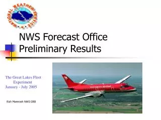
NWS Forecast Office Preliminary Results. The Great Lakes Fleet Experiment January - July 2005. Rich Mamrosh NWS GRB. Training. A thirty minute narrated training CD was prepared and sent to 42 NWS WFOs and CWSUs in the GLFE area.

NWS Forecast Office Preliminary Results
E N D
Presentation Transcript
NWS Forecast OfficePreliminary Results The Great Lakes Fleet Experiment January - July 2005 Rich Mamrosh NWS GRB
Training • A thirty minute narrated training CD was prepared and sent to 42 NWS WFOs and CWSUs in the GLFE area. • Presentations were delivered at the U.S. Canada Great Lakes Workshop in Buffalo last summer and at the AMS meeting this January. • Articles have appeared twice in the NWS FOCUS magazine.
Program Application Awareness • Regular messages have been sent to SOOs in the GLFE area asking them to arrange AWIPS displays of TAMDAR in their WFOs, and to assure training of their staff meteorologists. • Aviation, marine and fire weather focal points have been contacted with suggested applications of TAMDAR in their program areas.
NWS Participation • How can you gauge the use of TAMDAR by NWS WFOs and CWSUs? • Decided to use access to FSL web page as primary means. Also conducting surveys and collecting case studies. • Web Page Access is probably the most objective.
FSL Aircraft Data Page Used by many NWS offices to access MDCRS And TAMDAR.
Monthly statistics show user and number of web accesses Starting at 0Z 1-Jun-105 (Wed), and processing 30 days, we had a total of approximately 5828 visits by humans and 4104 visits by robots (ETL, MIT, and Mass), as follows: User Visits Barbs Eddy World Sharp Soundings | Vapor | g | Sat | Avg-time 28OWS 1 0 0 0 0 0 0 1 0 1.0 Airline: Northwest 65 4 25 1 3 2 0 59 0 1.5 Barbs at (Kft): 22+/-23 (5) 25+/-10 (4) 27+/-3 (2) 34+/-3 (5) 35+/-3 (7) Barbs at (Kft): 36+/-3 (2) Soundings at: CYYZ DTW (2) MHT Airline: United 89 31 0 0 0 0 0 51 0 1.9 Soundings at: DTW MKG (2) ORD (24) PIA SBN (3) DWD 2 0 2 0 0 0 0 2 0 0.9 Barbs at (Kft): 22+/-23 (2) FSL 12 0 0 0 0 0 0 11 0 1.4 HNL 11 1 0 0 0 0 0 9 0 1.9 Soundings at: ORD MIT 3357 0 0 0 0 0 0 0 0 3.0 Mass 747 0 0 0 0 0 0 27 0 5.3 McGill 17 10 0 0 0 0 0 6 0 2.0 Soundings at: CYMX CYQB CYUL (8) NTSB 21 1 0 0 0 0 0 6 0 1.6 Soundings at: JFK PerthAQ 5554 0 0 0 0 0 6 1 0 0.6 Stm. Pred. Ctr. (Nor 6 2 0 0 0 0 0 4 0 2.5 Soundings at: CYVR (2)
NWS Central Region The Central Region of the NWS has the greatest number of TAMDAR soundings
TAMDAR Data Access GLFE Begins Web access in the NWS Central Region increased 340% after the GLFE began!
Forecast Applications • TAMDAR has been found to be useful in many different forecast applications. • Public – cloud, wind, temperature, precipitation and convective forecasts • Aviation – ceiling heights, winds, fog
But not always useful! AREA FORECAST DISCUSSIONNWS GAYLORD MIAFDAPX 1025 PM EDT SAT JUN 25 2005 HAVE BEEN SEEING SOME SCATTERED CONVECTION DEVELOP OVER SOUTHEAST WI/CENTRAL LAKE MICHIGAN OVER PAST FEW HOURS. TOUGH TO SAY EXACTLY HOW FAR SOUTH DRIER AIR EXTENDS...AIRCRAFT SOUNDINGS NOT MUCH HELP TONIGHT. BUT JUDGING FROM RADAR TRENDS AND SURFACE DEW POINTS LOOKS LIKE AT LEAST SOME INSTABILITY UP TO ABOUT U.S. 10 OR SO.
Gaylord NWS would have liked to have TAMDAR that evening To determine southward extent of dry air.
Cloud Cover Forecast AREA FORECAST DISCUSSIONNWS DETROIT/PONTIAC MIAFDDTX 1100 PM EST MON FEB 21 2005 .AVIATION... MVFR CONDITIONS TO DOMINATE THE FORECAST THROUGH TUESDAY EVENING AS COLD CYCLONIC FLOW PERSISTS. SOLID OVERCAST OVER SOUTHERN LOWER MICHIGAN AS 19Z TAMDAR FLIGHT OUT OF METRO (ASCENDING) REVEALED A STEEP INVERSION JUST UNDER 4000 FEET. LOW LEVEL MOISTURE LOOKS TO BE TRAPPED THROUGH THE NIGHT.
Wind Advisory AREA FORECAST DISCUSSION NWS EASTERN ND/GRAND FORKS NDAFDFGF 400 PM CDT SUN MAY 22 2005 FSL AIRCRAFT DATA INTO GFK AND GLACIAL RIDGE SHOW WE ARE FULLY MIXED TO 825 MB AND THE 40 KNOTS CONTAINED WITHIN THAT BOUNDARY LAYER. SO EXTENDED THE WIND ADVISORY TO 7 PM BUT FIGURE WINDS SHOULD SIGNIFICANTLY WEAKEN IN NEXT SEVERAL HOURS DUE IN PART TO DECOUPLING.
Precipitation type “On December 5, 2004, there was some question on the precipitation type during the night. The models were indicating that the warm air would advance northward into the region...but the TAMDAR flights that evening showed that the cold air was holding. As a result, the snow changing to all rain forecast was changed to all snow and accumulations were added to the forecast. The area ended up seeing all snow during this event; thus, the TAMDAR data proved to be a very valuable data during this event.” Comment submitted to TAMDAR Forum from NWS La Crosse
NWS Marquette “During the morning hours of December 30th we constantly looked at the latest TAMDAR soundings to get a measure of the amount of both dry air over the Western Great Lakes Region and how warm the air was aloft. The concern was a period of freezing rain across Upper Michigan, and whether some of the precipitation would start off as snow or sleet due to evaporative cooling. Surface observations told us when the freezing rain would transition over to rain, however the frequent soundings gave us more of an idea how long the freezing rain would last. Because the soundings showed potential for a couple of hours of freezing rain with little in the way of snow or sleet, we upgraded the winter weather advisories to ice storm warnings. These warnings would eventually verify during the afternoon, with reports of anywhere from 0.25 to 0.5 inch of ice along with plenty of accidents on the roads.” Comment submitted to TAMDAR Forum
Convective Forecasts • TAMDAR has been useful to many NWS offices in convective weather situations. It is frequently used to monitor the strength of mid level capping inversions, calculate CAPE and CIN, and to calculate helicity. • A few short examples follow from NWS Grand Rapids and Sioux Falls
NWS Grand Rapids AREA FORECAST DISCUSSION NWS GRAND RAPIDS MI 340 PM EDT SAT JUN 25 2005 TONIGHT...CAP HAS ERODED ACROSS NORTHERN ILLINOIS AND NRN IN AND SCATTERED THUNDERSTORMS ARE DEVELOPING IN AIRMASS SUPPORTING 1500-2000 J/KG OF MLCAPE. TONIGHT DO NOT ANTICIPATE MUCH MORE SOUTHERLY PUSH TO THE FRONT AS THE FRONT STALLS OUT TO OUR S. CURRENTLY THE CENTRAL AND SRN PORTIONS OF THE CWA HAVE MLCAPE VALUES OF 500-1500 J/KG WITH VIRTUALLY NO CIN AS INDICATED BY TAMDAR PROFILE FROM MKG THIS AFTERNOON AND LAPS OBJECTIVE ANALYSIS.
NWS Sioux Falls AREA FORECAST DISCUSSION FOR SOUTHEAST SD/SOUTHWEST MN/NORTHWEST IA NWS SIOUX FALLS SD 315 PM CDT THU JUN 23 2005 .DISCUSSION... CONCERNS FOR THIS PACKAGE ARE MULTIPLE CHANCES FOR THUNDERSTORMS AND WITH EACH ONE WHETHER OR NOT THE CAP WILL SUPPRESS ACTIVITY. FOR THIS AFTERNOON AND EVENING...STOUT MID LEVEL TEMPERATURES SEEN ON MORNING RAOBS AS WELL AS A VERY DRY ATMOSPHERE. 1925Z TAMDAR SOUNDING FROM ABR SHOWS CAP AROUND 800MB...WITH PLENTY MORE WARMING NEEDED TO BREAK THROUGH.
Tornado Potential AREA FORECAST DISCUSSIONNWS GREEN BAY WIAFDGRB 300 PM CDT THU AUG 18 2005 .SHORT TERM...TONIGHT AND FRIDAY. FORECAST FOCUS ON SEVERE WEATHER POTENTIAL THIS EVENING AND FRIDAY AFTERNOON. TAMDAR SOUNDINGS SHOW FAIRLY GOOD TURNING IN THE LOWER LEVELS WHICH COULD SPIN UP SOME QUICK TORNADOES. FREEZING LEVEL HEIGHTS OF 13K FT SEEM A BIT HIGH FOR LARGE HAIL POTENTIAL. THE SEVERE WEATHER THREAT WILL DIMINISH BY MIDNIGHT AS THE BEST FORCING MOVES EAST OF THE CWA
Aviation Forecasts • NWS forecast offices in Northern Indiana and Detroit have used TAMDAR to forecast ceiling heights and the likelihood of fog. • Fog formation is highly dependant on the presence of moisture and light winds in the lowest 50mb, as well as suitable ground temperatures.
NWS Northern Indiana AREA FORECAST DISCUSSIONNWS NORTHERN INDIANAAFDIWX 722 AM EST FRI FEB 4 2005 .AVIATION...TAMDAR DATA SHOWING A RELATIVELY SHARP RADIATIONAL INVERSION AT NEARBY LOCATIONS....SO EXPECT DENSE FOG WILL MIX OUT LATER THIS MORNING...SOMETIME BETWEEN 14Z AND 16Z.
Actual Observations Ksbn 1154z 20004kt 1/4sm fzfg vv001 Ksbn 1419z 00000kt 1/4sm fzfg vv002 Ksbn 1554z 08003kt 1 1/2sm br clr
NWS Detroit AREA FORECAST DISCUSSIONNWS DETROIT/PONTIAC MIAFDDTX 1021 PM EST FRI FEB 4 2005 TAMDAR SOUNDING ANALYSIS OUT OF DTW OVER THE LAST COUPLE OF HOURS SHOW A NEARLY UNIFORM MOISTURE PROFILE OVER THE LOWEST 50MB... WITH VERY DRY AIR ATOP THIS MOIST LAYER. THIS COUPLED WITH CLEAR SKIES... TODAYS SNOWMELT AND SOME REMAINING SNOW COVER WILL SPELL IDEAL CONDITIONS FOR FOG FORMATION TONIGHT.
Actual Observations Kdtw 0532z 00000kt 2sm br clr Kdtw 0739z 17003kt 1 3/4sm br r04/1000v3500 Kdtw 0936z 17004kt 1/4sm fg r04/0500v0600 Kdtw 1154z 16004kt 1/4sm fg r04/2800v0600
Future Plans • Remind WFOs and CWSUs about fall and winter weather applications. • Conduct another survey by end of year. • Recruit regional or local representatives to collect examples and case studies for final GLFE report.
