Download
1 / 11
120 likes | 468 Vues
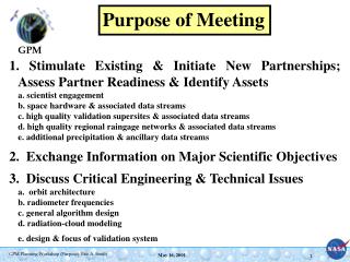
Purpose of Meeting. 1. Stimulate Existing & Initiate New Partnerships; Assess Partner Readiness & Identify Assets a. scientist engagement b. space hardware & associated data streams c. high quality validation supersites & associated data streams

E N D
Purpose of Meeting 1. Stimulate Existing & Initiate New Partnerships; Assess Partner Readiness & Identify Assets a. scientist engagement b. space hardware & associated data streams c. high quality validation supersites & associated data streams d. high quality regional raingage networks & associated data streams e. additional precipitation & ancillary data streams 2. Exchange Information on Major Scientific Objectives 3. Discuss Critical Engineering & Technical Issues a. orbit architecture b. radiometer frequencies c. general algorithm design d. radiation-cloud modeling e. design & focus of validation system
GPM’s Key Science Theme Global Water & Energy Cycle • GOAL: Observe, understand, & model Earth system to learn how it is changing, & consequences for life on Earth. • SOLUTION: Establish existence (or absence) of trend in rate of global water cycle -- acceleration would lead to faster evaporation, increased global average precipitation, & general increase in extremes, particularly droughts & floods. GPM will extend TRMM’s observations of rainfall rates to higher latitudes thus yielding more complete and accurate representation of global water cycle. Advanced rainfall measurement core satellite will make detailed & accurate estimates of precipitation structure & microphysical properties -- while constellation of drone satellites flying passive microwave radiometers will provide required temporal sampling of highly variable precipitation systems. Uncertainty in global tropical rainfall estimates has been reduced from 50% to 25% using TRMM data
NASA ESE Strategy for Earth System Science Forces Acting on Earth System Earth System Response Impacts How is Earth changing & what are consequences for life on Earth ? 1. How is global Earth system changing ? 2. What are primary causes of change of Earth system ? 3. How does Earth system respond to natural & human-induced changes ? 4. What are consequences of change in Earth system for human civilization ? 5. How well can future changes in Earth system be predicted ? Climate Feedback
(1) Climate Diagnostics: refining & extending precipitation climatologies including snow climatologies; detecting statistically significant global & regional precipitation trends (2) Global Water & Energy Cycle / Hydrological Predictability: global water & energy cycle (GWEC) analysis & modeling; water transports; water budget closure; hydrometeorological modeling; fresh water resources prediction (3)Climate Change/ Climate Predictability: climate-water-radiation states; climate-change analysis & prediction; GWEC response to climate change & feedback; (4) Data Assimilation / Weather & Storms Predictability: rainfall data assimilation; global-regional scale NWP techniques (5) MBL Processes: air-sea interface processes & surface flux modeling; ocean mixed layer salinity changes (6) Land Processes: land-atmosphere interface processes & surface flux modeling; integrated surface radiation-energy-water-carbon budget process modeling (7) Coupled Cloud-Radiation Models: diagnosis of cloud dynamics, macrophysical/microphysical processes, & response of 3D radiation field; parameterizing microphysics & radiative transfer in nonhydrostatic mesoscale cloud resolving models (8) Retrieval/Validation/Synthesis: physical retrieval of precipitation & latent heating; algorithm calibration & products normalization; algorithm validation & quantification of uncertainty; synthesis of validation for algorithm improvement (9) Applications/Outreach: weather forecasting; flash flood forecasting; news media products; educational tools GPM’s Nine (9) Science Discipline Areas Atmosphere Weather, Climate, & Hydrology Water Land
OBJECTIVE: Understand Horizontal & Vertical Structure of Rainfall & Its Microphysical Nature. Train & Calibrate Algorithms for Constellation Radiometers. OBJECTIVE: Provide Sufficient Sampling to Reduce Uncertainty in Short-term Rainfall Accumulations. Extend Scientific and Societal Applications. GPM Reference Concept • Constellation Satellites • Dedicated Small or Pre-existing Experimental & Operational Satellites with PMW Radiometers • Revisit Time • 3-Hour goal • Sun-Synchronous Polar Orbits • ~600 km Altitude • Core Satellite • TRMM-Like S/C, NASA • H2A Launch, NASDA • Non-Sun Synchronous Orbit • ~ 65° Inclination • ~450 km Altitude • Dual Frequency Radar, NASDA • Ku & Ka Bands • ~ 4 km Horizontal Resolution • ~250 m Vertical Resolution • Multifrequency Radiometer, NASA • 10.7, 19, 22, 37, 85 GHz V&H Pol • Global Precipitation Processing Center • Produces Global Precipitation Data Product Streams Defined by GPM Partners • Precipitation Validation Sites • Selected & Globally Distributed Ground- Based Supersites (polarimetric radar, radiometer, raingages, & disdrometers) & Dense Regional Raingage Networks
TRMM Era Constellation Coverage 3-hour sensor ground trace TRMM + DMSP(F14) + DMSP(F15)
EOS Era Constellation Coverage 3-hour sensor ground trace TRMM + DMSP(F15) + DMSP(F16) + AQUA + ADEOS II
GPM Systematic Measurement Coverage(Core + 6 constellation members) 3-hour sensor ground trace GPM Core + MEGHA-TROP + DMSP(F18) + DMSP(F19) + GCOM-B1 + NASA-GPM I + Euro-GPM I & II + Partner-GPM I & II