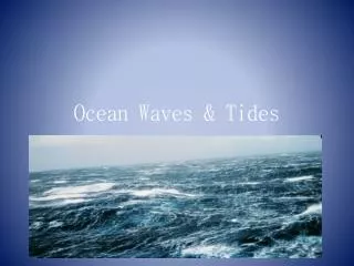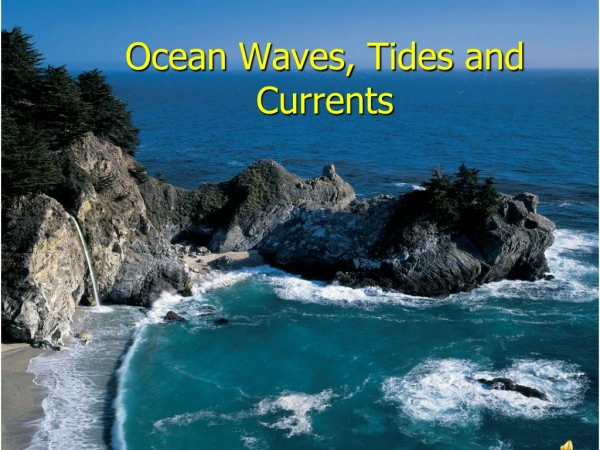
OCEAN WAVES
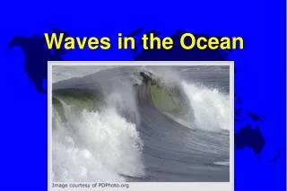
Ocean waves are categorized by their scale and formation methods, ranging from tiny capillary waves to massive tsunamis. Capillary waves, less than 3/4 inch in length, form due to wind and exhibit a unique relationship with disturbing and restoring forces like gravity. Wind waves, commonly experienced, range from 3/4 inch to up to 112 feet, influenced by wind speed and fetch distance. As they travel away from their formation source, they transform into uniform swells. Tsunamis, the seismic waves, reach devastating speeds and heights but primarily affect coastal areas.

OCEAN WAVES
E N D
Presentation Transcript
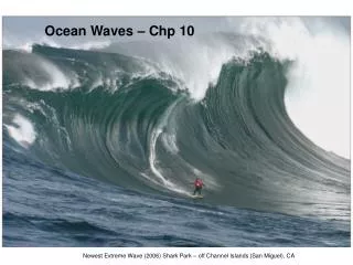
There are several different categories of waves in the ocean, and they are classified by scale, which is dependent on their method of formation. Starting from the smallest scale we have capillary waves, which are those you see forming as a puff of wind passes over a puddle. Capillary waves are less than 3/4 of an inch in length. Waves are built up by a disturbing force, and settle back down due to a restoring force. In this case the wind is the disturbing force and gravity and surface tension are the restoring forces. Other disturbing forces are seismic activity and tidal activity. Next in size come wind waves, the ones we are probably most familiar with and which range in size from 3/4" to as high as 112 feet--the highest dependably recorded sustained waves. These were measured by the US Navy tanker Ramapo in 1933. Wind waves are formed by the wind that is blowing over the surface at the time of the wave's occurrence.
Wind, blowing over the surface of the sea, interacts with the water by friction. As the frictional drag on the water begins to pull the water along, ripples begin to form. As soon as these begin, the wave building process is begun. As the wind blows across the tops of the ripples, a high pressure area is built up on the windward surface of the ripple, and a low is developed on the leeward surface. This causes the wave to move in the direction of the wind, and also to build in height. Both of these will continue to build (speed and height) as long as the wind is moving faster than the wave, and as long as nothing else interferes. What will usually interfere is land, so the greater the distance over which the wind can act on the water, without the wave colliding with a land mass, the larger the waves will be. The distance over which the wind is blowing over unobstructed water is known as the fetch. In the Roaring Forties south of South America, the fetch goes right around the world, and with plenty of wind blowing quite steadily out of the west, there is a steady progression of very large waves formed.
Waves are measured by four dimensions: speed (C) in knots length (L) in feet or meters, horizontally from crest to crest, or trough to trough period (T) in seconds, from crest to crest, or trough to trough height (H) in feet or meters, from crest to trough Small waves have a profile essentially that of a sine wave, though larger waves do not. The speed of a sine wave in deep water can be related to its length by its speed/length ratio:C = 1.2 L
It is important to understand that height has no such relationship. That is, waves of a specified period, length, or speed can be associated with a wide range of heights. This is largely becausethe steepness of a wave can vary greatly, and the steepness affects the speed (steeper waves travel faster) but not the height. How high a sustained wave can get (as opposed to a momentary collision of two or more waves) is limited by the ratio of height to length. If that ratio (H/L) is greater than 1/13, the wave will break. (Kotsch says 1/7 - 1/10) This is because it gets unstable, and the wind will literally blow it over and it will topple, or break.
The next scale of waves are called swells. Swell waves are formed by a wind that was blowing somewhere else. After wind waves are generated, the waves travel. When they have traveled out of the area where they were formed, they become swells. The area in which the wind is blowing will probably contain many conflicting wave sets, since there is bound to be a good deal of turbulence and interaction between different waves. But as the waves travel away from their source they settle out in long, regular rows of well ordered and smooth waves which we call swells. Therefore swell waves are much more uniform than wind waves. Waves lose very little energy as they travel, and therefore swells can travel great distances. We also know that the speed of a wave is dependent on its length, so the longer waves will travel faster and therefore be the first to reach you. Furthermore, short waves dissipate sooner than long waves, so the longer the wave the farther it will travel. Particularly large wind waves, like those formed by a hurricane, can cover over a thousand miles and still be recognizable.
The next larger scale of wave is the seismic sea wave, called a Tsunami in the Pacific. These are generated by a seismic event (earthquake) under the sea bed, and have a typical wavelength of 125 miles. They can attain speeds of over 470 mph. They may be of great height, but with that kind of wavelength, you will probably not notice one passing under you in the deep ocean. They become noticeable, and devastating, when they reach shallow water, where they build up and break. The largest-scale wave on earth has a length of 1/2 the circumference of the earth and travels completely around the earth every day, at a speed of over 1000 mph (900 kts.). This is the tidal wave that brings us high and low tides twice a day.
OBSERVATION AND REPORTING OF WAVES Wind waves, as we mentioned, are not generally well ordered and regular. They do blow generally to leeward, but in a given set of wind conditions there will be multiple wave sets, or trains, developed. When two or more crests coincide, you will get a larger than normal wave, and when a crest and a trough coincide, you will get a flat spot. So wave observation and reporting is difficult. Looking at the graph of a typical wave set, as recorded by a wave recorder, we can see what we are up against. The Weather Observer's Handbook tells us to estimate the average maximum height of 15 -- 20 of the well formed waves in a group. This tells us to discard the exceptionally high ones, as well as the lulls. This is reported as the significant wave height. You cannot do this in a glance at the sea.
Many people have the idea that every seventh wave in a set will be a big one. This is unlikely to pan out for you. But some statistical analysis has been done with the following results. If we start with a wave group that has a significant wave height (Hs) of 15 feet, we can expect that in a ten minute interval we will see a wave of between 1.4 to 1.8 times the Hs (21 -- 27 feet). This is known as the 10 minute maximum. A wave of twice the Hs can be expected once in every 3 hours (30 feet). In 12 hours, a wave of 1.4 times the 10-min. max. is likely, which in this case would be a wave of up to 38 feet. It is also important to distinguish between the wind waves and the swell waves. The swells will be telling you what's out ahead, while the wind waves are telling you what's right there. In many cases it is not difficult, as the swells will be long and even, and the waves can be seen distinctly riding on top of them. They can be in any relative direction, even 180 apart. Only experience and practice will improve your ability to distinguish between them when they are indistinct.
With either wind waves or swell waves, if the period of the wave is greater than the roll period of the ship, the ship will have time to respond to each wave, and though she may roll quite a lot, she will not likely ship much water, since she will align herself with the surface of each wave. If her roll period is longer than the period of the wave, she will not have time to recover from one wave before the next arrives, and she will ship a good deal of water, though she probably won’t roll as much. A very dangerous event called synchronization occurs when the period of the waves is about equal to the ship's roll period, and each successive roll gets deeper until there is a very real possibility of capsize. To avoid this you must do anything possible to change your rate of encounter with the seas. This may involve a course change or speed change, but avoid getting broadside to them. If you have no steerage, a sea anchor may do the trick. In the case of a dead ship, if the sea anchor doesn't work, take whatever measures are possible to change your roll period by shifting weights on board up or down, or by taking on or discharging ballast or cargo (throw deck cargo overboard).
An equally dangerous situation called parametric rolling occurs when the period of the wave is about equal to one-half the roll period of the ship. This causes an amplification of your roll, adding momentum to each roll until capsize is possible. But what about the actual motion of, and within, a wave? Waves certainly appear to move, and we talk about their speed, and how they travel hundreds of miles. But does the actual water in the wave move like that? The answer is no. The water particles do not move with the wave, except to move in a circular fashion as the wave passes by. Here's how that works. A wave is energy moving through the water. The water itself, which can be represented by a cork, or seagull, floating on the surface, will not progress as this energy passes by, but will instead describe a circle whose diameter is equal to the wave height. Although the cross section of a small wave approximates a sine wave, when larger waves begin to form, their crests get sharper and their troughs get longer. Their profile is a curve known as a trochoid.
Particles under the surface will describe progressively smaller circles as their depth increases until at a depth equal to the wave's length the disturbance is so slight it can be considered negligible. When an ocean wave (or deep-water wave) comes into shallow water, the lower-most portion of the wave begins to "feel" the bottom and the reaction is passed on up through the wave. This reaction first becomes noticeable when the water depth is equal to or less than one-half the wavelength. When this occurs, the wave's speed and length decrease, while its height remains constant. Therefore it becomes progressively steeper until, when the water depth is about 1.5 times the wave's height, the wave breaks. Note that this means that there are plenty of large sea areas where the water depth is such that large waves can never reach deep-water status. The North Sea is one prime example. This does not mean you can't get dangerous waves there, only that you can't get long waves. In fact these areas are notorious for tall, steep, short (length) waves of considerable violence. Also the huge scale waves (tsunamis and tidal waves) never exist in deep-water circumstances, since nowhere is the ocean deep enough for that.
Currents play an important role in wave formation as well. When the current runs against the wind the waves are built up steeper and shorter in length. This can produce very hazardous conditions for small craft. When the current runs in the same direction as the wind, the effect is to lengthen and lower the waves. Both of these conditions can occur at sea as well as in coastal waters, as the current can be one of oceanic magnitude, or of tidal formation. When the tide must run through a narrow slot somewhere along the coast, it will inevitably run counter to the wind on a regular basis. These areas get a reputation for being rough and sometimes dangerous, and are usually indicated on charts. They are generally called a race.
There is a famous one in between the eastern end of Long Island and Fisher's Island, and it is called The Race. This area can develop what are called square seas, meaning they are virtually as high as they are long, and are very dangerous for small craft. At sea, a fast-moving current like the Gulf Stream can build up very steep vicious seas when the wind gets strong out of the north. These can be a hazard to larger craft, since these are ocean seas.
EXCEPTIONAL STORM WAVES, ROGUE WAVES, OR FREAK WAVES We have all probably heard stories of freak waves, or rogue waves. These are not just sea stories, but very real events that are not all that rare. Recall our discussion of multiple wave trains traveling in the same area. We described how when two wave crests coincide, they compliment each other, and when a crest and a trough coincide, they cancel each other out. When two or more very large wave sets, or swell sets, coincide you get freak waves. In National Weather Service parlance these are called Exceptional Storm Waves or ESW's. It is important to note that the combination of two troughs can be in some ways more dangerous than two crests. When two troughs get together you get what looks like "a hole in the ocean". The dangerous part of this is that the vessel drops down into the exceptional trough, but doesn't have time to recover before the crest is on top of her, burying the ship under hundreds of tons of water.
There are a couple of particularly well known areas where conditions for this sort of thing come together fairly regularly. One, and perhaps the most famous, is the stretch of coast off the West Coast of South Africa, in the Agulhas Current. Here you have a south-flowing current that flows to, and past, the Cape of Good Hope. You also have the famous "Cape Rollers", which are the very long, deep swells formed by the westerlies blowing over the entire South Atlantic Ocean. When a high pressure system forms to the southwest of the Cape, and a low forms to the southeast of the Cape, each generates its own set of waves, both of which are traveling northeast, head-on into the Agulhas Current. The Cape Rollers also bend around the Cape and head northeast, so you have three potentially very large wave trains headed directly into the current. When they get in synch, you get the monsters that have been reported as over 100 feet high. They tend to form just off the 100-fathom curve, where the current is strongest.
These conditions are fairly predictable, and the thing to do when such forecasts are made is to get out of the center of the current, by heading inshore, inside the 100-fathom curve, or well offshore, at least 20 miles east of the 100 fathom curve. A similar set of conditions can develop right off the US East Coast, in the Gulf Stream. Here the Gulf Stream is a north flowing current, and when one of the east coast lows moves out to sea off Long Island, it sends a big swell down into the teeth of the stream. If a second or third wave train is around, the combination can create the right set of conditions for freak wave formation. These conditions can occur anywhere when the right set of wave trains meet. What is important is that they produce momentary waves of tremendous height, not sustained waves. If you see something that looks like one around you, you can try to get up onto the shelf, or if you are in a strong current, try to get out of it. What you need to look for is anything that will significantly change the period or length of any of the wave sets, thus breaking the synchronization.
Table indicates the relationship between wind speed, fetch, length of time the wind blows, wave height, and wave period in deep water.