Download
1 / 20
240 likes | 494 Vues
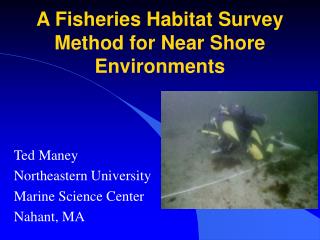
A Fisheries Habitat Survey Method for Near Shore Environments. Ted Maney Northeastern University Marine Science Center Nahant, MA. What is an Essential Fish Habitat?. A specific habitat that is key to life history of a fish for survival. Eel grass & kelp beds juvenile fish

E N D
A Fisheries Habitat Survey Method for Near Shore Environments Ted Maney Northeastern University Marine Science Center Nahant, MA
What is an Essential Fish Habitat? • A specific habitat that is key to life history of a fish for survival. • Eel grass & kelp beds juvenile fish • Scallops juvenile hake • Areas should be protected in order to help increase the stocks of commercially important fish species.
The Problem: • Biologists do not know much about the life histories of the fish they are trying to regulate. • Larval stages, feeding grounds, recruitment areas. • The shallow sub-tidal areas of concern are not well surveyed due to the inability of large research vessels to map sites.
Sources and levels of EFH information. Levels 1 = presence/absence 2 = relative abundance 3 = Growth, Reproduction Survival 4 = production by habitat
Atlantic Cod Essential Fish Habitat Eggs Larvae Juveniles Adults
Current Surveys • Estimates of adult and juvenile population sizes are measured by fisherman and observers. • Volunteers and national survey teams take qualitative measurements of fish populations. • Ex. Single, Few, or Many or Abundant numbers of each species observed. • Quantitative Survey Methods used by Scientists • Fixed area or Timed Surveys
A New Method • Linear Point Intercept • Under water research method (SCUBA) • 15 meter transect tape • standardized list of benthic substrates and organisms • Used on reef assessment projects • (Aronson, 1995) • Every 25 cm is a data point.
Why is LPI a Better Technique? • Provides the researcher with real data that can be used for quantitative analysis • Fixed Area is surveyed at multi-levels • Areas can be mapped and referenced with global positioning system (GPS) for future projects or habitat assessments/monitoring
Can these surveys be conducted by the recreational dive community? Volunteers are useful for this kind of project. • Sport diving community can collect valuable data needed by researchers and fisheries managers • In preliminary studies, a dive team can accurately and efficiently complete a transect in a single dive.
Level I: Substrate Survey • Identify substrate at every 25 cm point along transect • Fill out data sheet with standardized substrate codes
Results of LPI method trial for Substrate Using both scientific divers and scientific divers-in-training.
Level II: Benthic Organisms • Identify organisms attached to the substrate at intercept point • Requires ID of benthic marine organisms • Can supplement with photo or video quadrats in transect area.
Level III: Mobile Fauna Surveys • Swim along transect and record number of species. • Fish, Decapods, Echnoderms, etc.. • Video can be used • Requires ID of Mobile Fauna
Photo or Video Quadrats can be taken at random in transect area
Survey Uses Results from EFH Surveys • A better understanding of our sub-tidal environment. • Basic data that can lead to other more complex and specific questions on essential fish habitats • Gain a basic knowledge of where commercially important fish are surviving through all life stages • use that to make better educated policies on fisheries management issues. • Site assessment and monitoring of artificial reefs
Conclusions • Properly trained divers can conduct EFH surveys using this multi-level LPI method • Going to next level of survey requires more training • Data collected can be used by the science community
Acknowledgements Northeastern’s Marine Science Center • Craig McMannus • Sal Genovese Bay State Council of Divers New England Aquarium Dive Club South Shore Neptune's. Vin Malkowski, MA Division of Marine Fisheries