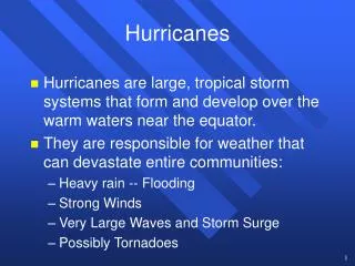
HURRICANES
Learn about hurricanes from Dr. Richard M. Yablonsky in this informative lecture. Discover the features, impacts, and life cycle of hurricanes, as well as the distinction between tropical and extratropical cyclones.

HURRICANES
E N D
Presentation Transcript
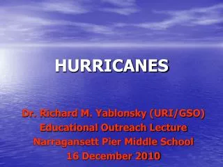
HURRICANES Dr. Richard M. Yablonsky (URI/GSO) Educational Outreach Lecture Narragansett Pier Middle School 16 December 2010
A little bit about me… • Born in Brooklyn, NY in 1980 • Grew up in Durham, NC (1985-1998) • Received B.S. in Meteorology & B.A. in Chemistry from North Carolina State University in 2002 • Received M.S. in Atmospheric Science from North Carolina State University in 2004 • Received Ph.D. in Oceanography from URI/GSO in 2009: Dissertation on hurricane-ocean interaction • Go tornado chasing in the Midwestern U.S. for one week in May every year (for fun)
WHAT IS THIS??? < 1 mile Image courtesy of http://www.andovernet.com/ • The Andover, KS TORNADO of April 26, 1991 (Wind ≈ 250 mph) • This is NOT a hurricane!!! This is NOT a hurricane!!!
WHAT IS THIS??? • A thunderstorm near • Ardmore, OK • This is NOT a hurricane! • This is NOT a hurricane! • This is NOT a hurricane! ~ 10 miles < 1 mile ~ 10 miles Image courtesy of http://www.chaseday.com/
OK Rich… so you have lectured us on what a hurricane IS NOT.Please stop teasing and tell us what a hurricane IS!
Definitions from United States National Hurricane Center • Hurricane: “A tropical cyclone in which the maximum sustained surface wind is 74 mph or more” (NHC). OK, but what is a tropical cyclone? • Tropical cyclone: “A warm-core, non-frontal, synoptic-scale cyclone, originating over tropical or subtropical waters, with organized deep convection and a closed surface wind circulation about a well-defined center” (NHC).WHAT???
Hurricane Ivan on September 9, 2004 A thunderstorm in one of Ivan’s spiral bands Eye (No Wind) Eyewall: Region of strongest winds ~ 250 miles Image courtesy of NOAA
SIZE ≠ INTENSITY! 150 mph (Category 4) 140 mph (Category 4) 100 mi 09/13/04 1200Z 09L IVAN 09/13/04 1315Z GOES - 12 VIS 200 mi 250 mi 160 mph (Category 5) What about SIZE? Courtesy of Brian Kabat US Air Force Academy
Hurricanes Floyd (1999) & Andrew (1992) 125 mph (Category 3) 120 mph (Category 3)
Hurricane Life Cycle Tropical Depression: Maximum wind < 39 mph Tropical Storm: Maximum wind 39-73 mph Hurricane: Maximum wind > 73 mph
The seed of a hurricane: Pre-existing disturbance • In Atlantic basin, common pre-existing disturbance is easterly wave • In Northwest Pacific basin, common disturbance is monsoon trough
Ingredients to cook up a hurricane Sufficient Distance from Equator
COLD Image courtesy of http://www.photohome.com/ WARM HOT Free Convection in the Atmosphere COLD The hot air parcel rises… just like in a hot air balloon! COOL Image courtesy of http://home.comcast.net/~j2jensen/ WARM
Things that can kill a hurricane • Landfall: Reduced evaporation + friction • Encountering area of vertical wind shear • Encountering area of dry and/or dusty air • Being absorbed by an extratropical cyclone • Extratropical transition • Moving over ocean waters below ~80°F • Churning up ocean waters below ~80°F
Definitions from United States National Hurricane Center • Hurricane: “A tropical cyclone in which the maximum sustained surface wind is 74 mph or more” (NHC). Rich, you said that already! • Tropical cyclone: “A warm-core, non-frontal, synoptic-scale cyclone, originating over tropical or subtropical waters, with organized deep convection and a closed surface wind circulation about a well-defined center” (NHC).I think I get it now!
The Hurricane Problem in the U.S. … although hurricanes can still be very deadly, as Katrina showed
Economic Costs • When a hurricane warning is issued…. • It costs $1 million per mile of coastline warned for evacuations and preparations • This amounts to $5 billion per year on average! • This is in addition to storm damage costs!!! Information courtesy of Isaac Ginis
Trivia Question What are “hurricanes” called when they are located in the Pacific Ocean west of the International Date Line (e.g. near Japan)? Answer: TYPHOONS!
Saffir-Simpson Hurricane Wind Scale Does not account for storm size or storm surge and rainfall potential!
Cat. 2: Hurricane Bob (1991) Image courtesy of Isaac Ginis Newport, Rhode Island
Cat. 3: 1938 New England Hurricane Images courtesy of http://www.geocities.com/hurricanene/
1938 New England Hurricane Images courtesy of http://www.geocities.com/hurricanene/
Cat. 4: Hurricane Charley (2004) Florida Image courtesy of Isaac Ginis
Hurricane Charley (2004) Florida
Cat. 5: Hurricane Camille (1969) Before After Images courtesy of http://www.angelfire.com/ms3/n5ycn/
Where have major hurricanes (cat. 3-5) made landfall in the United States? Image courtesy of http://www.geocities.com/hurricanene/
Trivia Question What category was Hurricane Katrina when it made landfall near the Louisiana/Mississippi border on August, 29 2005? Answer: Category 3
National Hurricane Center(Miami, FL) http://www.nhc.noaa.gov
Questions you ask duringa hurricane event… • Where will the hurricane go? • How strong will the winds become? • What is the size of the hurricane wind field? • How high will the storm surge be? • Is there a threat of inland flooding from rain?
Hurricane Forecasting Numerical Modeling Dissemination Data Acquisition And Processing Warnings Operations Response Information courtesy of Isaac Ginis
Before we can predict what a storm will do in the future, we need to know what the storm, the atmosphere, and the ocean look like right now! Radiosondes: Instruments attached to weather balloons that transmit temperature, humidity, & wind data back to the ground. These balloons are launched globally twice a day. Aircraft:Commercial aircraft regularly report weather data. NOAA “Hurricane Hunter” aircraft penetrate hurricanes to gather valuable data on the storm. Satellites:Gather data on clouds, water vapor, and land & sea surface temperatures. Observational Tools Surface:Thousands of weather stations across the globe report weather conditions every hour. View from a Hurricane Hunter aircraft inside the eye of category 5 Hurricane Isabel Two NOAA P3 “Hurricane Hunter” aircraft Weather satellite
The Role of Numerical Models Numerical (computer) models allow us to predict the future state of the atmosphere and ocean using mathematical equations! Who likes to play video games or has friends that do? Image courtesy of Isaac Ginis
Track errors cut in half in 16 years! 400 350 300 250 200 150 100 50 0 Image courtesy of James Franklin, NHC
The Intensity Problem: How strong will the winds become?
No progress with intensity in 16 years! Image courtesy of James Franklin, NHC
We are improving this model at URI… Note the reduced GFDL intensity error in 2006!!! Intensity Errors in Recent Seasons
Ocean’s Role in Hurricane Intensity Satellite Infrared Image of Sea Surface Temperature Hurricane Gert (1999)