Simplified Global Circulation Model: Exploring Winds and Currents
230 likes | 484 Vues
Understand the simplified models of Earth's atmospheric and oceanic interactions, from single-cell to three-cell systems. Delve into global wind patterns and pressure systems, seasonal effects, and the impacts on local climates. Explore how surface and aloft winds shape atmospheric and oceanic dynamics and influence temperature patterns. Learn about major ocean currents, Ekman spirals, upwelling processes, and their effects on coastal water temperatures. Discover the intricate relationship between winds, currents, and climate systems.

Simplified Global Circulation Model: Exploring Winds and Currents
E N D
Presentation Transcript
The Single Cell Model • This is a very simplified model based on the following three assumptions: • The Earth’s surface is uniformly covered with water (no differential heating of the land and the oceans) • The sun is always directly over the equator (no seasonal variations of the winds). • The Earth does not rotate. • No Coriolis effect. • The only active force is the pressure gradient force.
The Three Cell Model • Keep two of the assumptions, relax the third: • The Earth is covered with a continuous ocean • The sun is always directly over the equator • The Earth rotates -> Coriolis force!
Intertropical convergence zone Observing global winds from space
Winds and pressure in the real world • Semi-permanent highs and lows: persist throughout the year, correspond to converging/diverging upper air masses. • Bermuda, Pacific highs; Icelandic, Aleutian lows • Seasonal highs and lows (continents heat/cool faster) • Winter: Siberian high, Canadian high • Summer (thermal lows): Southwest US, Iran January July Subtropical highs Subtropical highs
Does it work? • Yes: semi-permanent highs and lows: persist throughout the year • No: seasonal highs and lows (continents heat/cool faster) • No: seasonal shifts N-S (today) • No: winds aloft in mid latitudes January July Subtropical highs Subtropical highs
Effect on the local climate • During summer, the Pacific high moves north near the CA coast, and the Bermuda high moves closer to the SE coast. • CA: dry summers • GA: wet summers
Seasonal Effects on the Global Circulation. January • The three cell model neglects the Earth’s tilt • The tilt would cause seasonal N-S shifts • Bright white colors correspond to stronger winds. • The winds are stronger in the winter. • The wind system shifts slightly north-south during the year (think of bird migration) July
The General Circulation and Precipitation Paterns Timbo • Converging surface flows: • Low surface pressure • Uprising air • Heavy precipitation • Diverging surface flows: • High surface pressure • Sinking air • Dry climate • Seasonal variations of the climate. Example: Timbo, Guinea (Chapter 17).
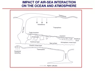
Winds and Pressure Systems Aloft • The wind system aloft differs from the surface wind system. It is close to a geostrophic flow. • There is no significant friction with the ground. • The three cell model does not work that well in the middle latitudes. • The winds aloft are stronger than on the ground. • In the winter the gradients are bigger -> the winds are stronger. July January
Winds Aloft • Warm air above the equator and cold air above the polar regions • Higher pressure at the equator, lower pressure both to the north and to the south of the equator • The pressure gradient force is towards the poles, sets the air in motion • The Coriolis force • NH: to the right • SH: to the left • The wind turns right in the NH and left in the SH, becomes parallel to the isobars • Westerly winds aloft in both the NH and SH. • Easterly winds at the surface in both the NH and SH.
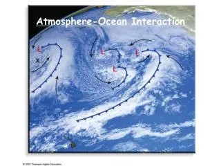
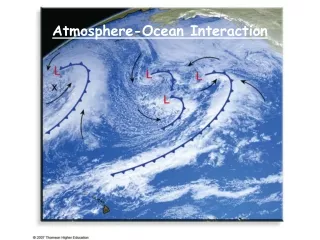
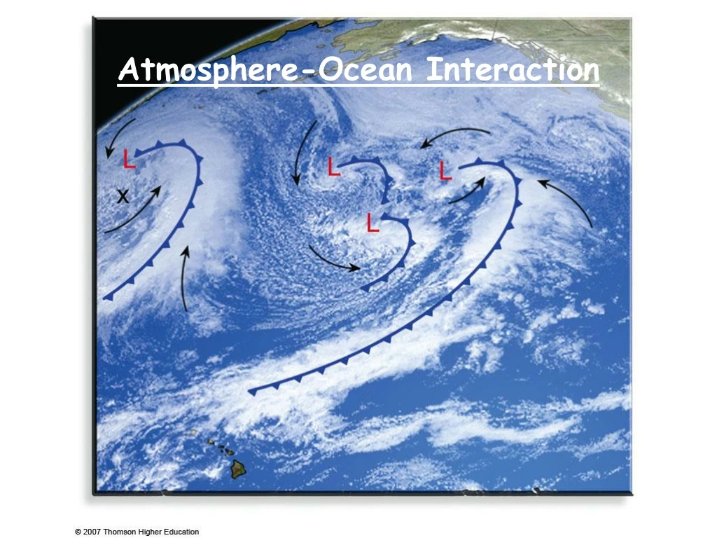
Atmosphere-Ocean Interaction • The surface of the Earth impacts the air motion through the friction force. • Newton’s III law: for every action there is a reaction. The atmosphere exerts a friction (drag) force on the surface of the Earth. • The prevailing surface winds drive the surface currents in the oceans. • Variations in the surface temperature of the ocean impacts the atmospheric T as well as amount of the water vapor in the atmosphere.
Major ocean currents • Gyres: circular whirls of ocean currents • 25-40 deg angle b/n wind and current • Clockwise in the North Pacific and Atlantic • Counterclockwise in the South Pacific and Atlantic
Ekman Spiral • The surface winds drive the surface currents. • The friction force acting on the ocean surface is in the direction of the wind. • The Coriolis force deflects the current to the right (NH). • Each layer of water drags the water layer below, and the Coriolis force pushes the moving water below to the right. • The direction of the ocean current changes with depth. • The net mass transport within the first 100 m is perpendicular to the wind direction.
Upwelling of the Ocean Water • Winds plowing along the coastal line result in a net surface current perpendicular to the wind and away from the coast. • The warm surface water is replaced by an upwelling deep cold water. • Water upwelling explains the low water temperatures along the California coast.
Surface Water Temperature Along California’s Coast • The low water temperatures result in low saturation vapor pressure over the ocean. • Recall the advection fog example from Chapter 5 • As the air moves over the land the air warms up and results in low relative humidity. • The summer is very dry.