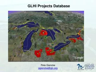
GLHI Projects Database
GLHI Projects Database. Pete Giencke pgiencke@glc.org. Web Entry Form -> Database. Web Entry Form -> Database. Required Fields. Optional Fields. Status Toward Restoration Goals Present Land Use Habitat Connectivity Estimated Timeline Significance to Other Programs

GLHI Projects Database
E N D
Presentation Transcript
GLHI Projects Database Pete Giencke pgiencke@glc.org
Web Entry Form -> Database Required Fields Optional Fields • Status Toward Restoration Goals • Present Land Use • Habitat Connectivity • Estimated Timeline • Significance to Other Programs • Sensitive Species / Habitat • Mitigation Techniques/Measures • Monitoring Requirements • Federal Sponsors • Non-Federal Sponsors • Other Project Partners • Cost Estimates • Land Ownership / Easement • Real Estate Availability • Legal Authorities in Place • Project Title • Project Abstract • Project Type • Project Status • Locality Description • Geographic Extent • Estimated Project Size • Habitat Type(s) • Ecological Stressors • Anticipated Ecological Outcomes • Project Contact • Access Constraints
Leverages Existing Resources • Use of pre-vetted regional classifications/picklists • (e.g. MIRIS, GLRC)
Leverages Existing Resources • Use of pre-vetted regional classifications/picklists • (e.g. MIRIS, GLRC) • 1:1 Mapping of field names with complimentary databases • (i.e. NERI)
Leverages Existing Resources • Use of pre-vetted regional classifications/picklists • (e.g. MIRIS, GLRC) • 1:1 Mapping of field names with complimentary databases • (i.e. NERI) • Use of Great Lakes Information Network for hosting, marketing, and data dissemination
Support for Geographic Objects/Operations SELECT s.id, g.huc_code, huc_name, reg, sub FROM submit_data s, gl_hucs g WHERE s.id = 245 and INTERSECTS(s.the_geom, g.the_geom)"; #Find all hydrologic units (HUCS) within project area 245
Built on Free and Open Source Software Perl PHP GeoServer MapServer PostgreSQL PostGIS GDAL Tomcat
Schema/Structure • Data warehouse star schema model, normalized to the Third Normal Form (3NF).
Schema/Structure • Data warehouse star schema model, normalized to the Third Normal Form (3NF). • “Fact table” tblProject linked to tblGeography, tblRestoration, tblHabitat, tblContacts, and tblFunding
Schema/Structure • Data warehouse star schema model, normalized to the Third Normal Form (3NF). • “Fact table” tblProject linked to tblGeography, tblRestoration, tblHabitat, tblContacts, and tblFunding • Placeholders (“buckets”) included for further iterations of database (“version 1.0”)
Schema/Structure • Schema/Structure Documents • Entity Relationship Diagram (ERD) • http://gis.glin.net/dropbox/glhi_erd.pdf
Schema/Structure • Schema/Structure Documents • Entity Relationship Diagram (ERD) • http://gis.glin.net/dropbox/glhi_erd.pdf • Data Dictionary • http://gis.glin.net/dropbox/glhi_data_dictionary.pdf
Web-Based Tools for GLHI Projects Database Access Dissemination Analysis Visualization
Analysis Tools Web-based query functionality http://gis.glin.net/dropbox/query.php http://gis.glin.net/dropbox/query.php
GLHI Data Dissemination http://gis.glin.net/dropboxglhi_access.php
Conclusions and Next Steps • Bang for the buck
Conclusions and Next Steps • Bang for the buck • Usability
Conclusions and Next Steps • Bang for the buck • Usability • Extensibility
Conclusions and Next Steps • Bang for the buck • Usability • Extensibility • Integrate GLHI Programs (funding) database
Conclusions and Next Steps • Bang for the buck • Usability • Extensibility • Integrate GLHI Programs (funding) database • Facilitate machine-level project population
Conclusions and Next Steps • Bang for the buck • Usability • Extensibility • Integrate GLHI Programs (funding) database • Facilitate machine-level project population • Improve user ease of use
Conclusions and Next Steps • Bang for the buck • Usability • Extensibility • Integrate GLHI Programs (funding) database • Facilitate machine-level project population • Improve user ease of use • Enhance external compatability
Conclusions and Next Steps • Bang for the buck • Usability • Extensibility • Integrate GLHI Programs (funding) database • Facilitate machine-level project population • Improve user ease of use • Enhance external compatibility • Transition to repository
A Wetlands-Focused Spatial Decision Support System for the Great Lakes Great Lakes Commission 2007 NSDI CAP-Category 4
Great Lakes Wetlands SDSS Overview • Enhance the Bain’s NWI coverage through the integration of mined attribute data from disparate wetlands and wetlands-related datasets • Leverage existing projects and inventories (i.e. GLHI) to facilitate tracking and reporting of wetlands owned by federal agencies in the GL basin • Create a web-based (GLIN) toolkit to support visualization, analysis, and dissemination of wetlands data in the GL basin • Demonstrate, through open source and open standards technologies (i.e. WFS-T), the value of incorporating geospatial approaches into Federal business processes.
Wetlands Data Integration • National Datasets: • National Wetlands Inventory (NWI) • Coastal Change Analysis Program (C-CAP) • Soil Survey Geographic (SSURGO) Database • National Hydrography Dataset (NHD) • State/Province Datasets: • Ontario • Michigan DEQ • New York DNR • Ohio DNR • WISCLAND (WI) • Great Lakes Habitat Initiative (GLHI)
More…. http://gis.glin.net/wetlands