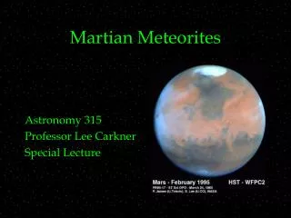
MARTIAN LANDSCAPES
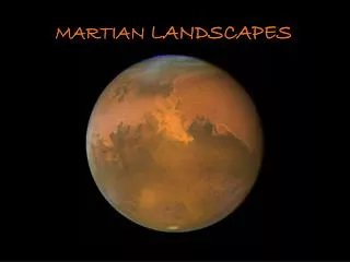
MARTIAN LANDSCAPES. Martian Landscapes. Since 2006, NASA's Mars Reconnaissance Orbiter (MRO) has been orbiting Mars, currently (November 2009)circling approximately 300 km (187 mi) above the Martian surface.

MARTIAN LANDSCAPES
E N D
Presentation Transcript
Martian Landscapes • Since 2006, NASA's Mars Reconnaissance Orbiter (MRO) has been orbiting Mars, currently (November 2009)circling approximately 300 km (187 mi) above the Martian surface. • On board the MRO is HiRISE, the High Resolution Imaging Science Experiment camera, which has been photographing the planet for several years now at resolutions as fine as mere inches per pixel. • Collected here is a group of images from HiRISE over the past few years, in either false colour or grayscale, showing intricate details of landscapes both familiar and alien, from the surface of the planet, Mars.
Intersecting swirling trails left by the earlier passage of dust devils across sand dunes, as they lifted lighter reddish-pink dust and exposed the darker material below. Also visible are darker slope streaks along dune edges, formed by a process which is still under investigation.
An eroded crater in a larger plain with a scalloped appearance near Pavonis Mons.
Part of the Abalos Undae dune field. The sands appear blue because of their basaltic composition, while the lighter areas are probably covered in dust.
A portion of the Martian South Polar Cap, showing stratified layers exposed by a long process of sublimation.
Exposure of Layers and Minerals in Candor Chasma. This image shows a cliff along a light-toned layered deposit in Valles Marineris. Erosion by wind has carved V-shaped patterns along the edges of many of the layers.
Avalanches on Mars' North Polar Scarps. Material, likely including fine-grained ice and dust and possibly including large blocks, has detached from a towering cliff and cascaded to the gentler slopes below. The cloud is about 180 meters (590 feet) across and extends about 190 m (625 ft) from the base of the steep cliff.
Pathfinder spotted on an ancient flood plain of the Ares and Tiu outflow channels. The bright spot visible at lower left is the Mars Pathfinder Lander, its ramps, science deck, and portions of the airbags visible. NASA's Pathfinder landed on Mars on July 4, 1997 and continued operating until September 27 of that year.
Victoria Crater at Meridiani Planum. The crater is approximately 800 meters (about half a mile) in diameter. Layered sedimentary rocks are exposed along the inner wall of the crater, and boulders that have fallen from the crater wall are visible on the crater floor. NASA's Mars rover Opportunity explored this crater and its walls in 2006.
Close-up of tracks made by NASA's Mars rover Opportunity in the soil near Victoria Crater.
Linear dunes in the north polar region of Mars. Polygons formed by networks of cracks cover the substrate between the linear dunes and may indicate that ice-rich permafrost is present or has been present geologically recently in this location.
Scalloped sand dunes in the southern hemisphere of mars, displaying seasonal frost on the south-facing slopes, which highlights some of the regular patterns, as the frost forms only on parts of the ripples.
This image shows lineated valley fill and lobate debris aprons in the Deuteronilus Mensae region. Many of the valley floors in this region exhibit complex alignments of small ridges and pits often called "lineated valley fill". The cause of the small-scale texture is not well understood, but may result from patterns in ice-rich soils or ice loss due to sublimation (ice changing into water vapour).
A large barchan (crescent-shaped) dune, in a region where some dunes have been observed shrinking over several years.
The edge of an approximately 6 km diameter crater in the southern hemisphere, laced with gullies leading down to the crater floor.
Dunes in a crater in Newton Basin that are eroding or covering a more coherent rock structure below.
The south polar region of Mars is covered every year by a layer of carbon dioxide ice. In a region called the "cryptic terrain," the ice is translucent and sunlight can penetrate through the ice to warm the surface below. The ice layer sublimates (evaporates) from the bottom. The dark fans of dust seen in this image come from the surface below the layer of ice, carried to the top by gas venting from below. The translucent ice is "visible" by virtue of the effect it has on the tone of the surface below, which would otherwise have the same colour and reflectivity as the fans. Bright streaks in this image are fresh frost.
An impact crater on the south polar layered deposits. This is a small, approximately 330 meter (360 yard) diameter impact crater. The polar layered deposits on Mars are believed to be very young because there are no large craters on them and very few small craters.
Rocky mesas of Nilosyrtis Mensae region. Phyllosilicate (clay) minerals have been detected in this region by imaging spectrometers on the Mars Express and MRO spacecraft, and these minerals are of great interest in the search for evidence of life on ancient Mars.
Gullies, streaks, ripples and dust devil tracks on Russell Crater Dunes.
A 4 km diameter feature near the edge of the south polar residual cap. The bright areas in this image are covered by carbon dioxide frost, and the ‘swiss cheese’ terrain typical of the south polar residual cap covers much of the imaged area. The dark walls of the circular depression do not have as much frost on them, and are fractured in a polygonal pattern. Apparently the surface of the walls has been extensively modified by thermal expansion and contraction of water ice. It also appears that the ‘swiss cheese’ terrain of the residual cap has buried the floor of the circular depression, as well as the terrain surrounding the feature, making it difficult to infer the origin of this depression.
HiRISE catches a dust devil blowing across the Martian surface east of the Hellas impact basin and south of Reull Vallis. The diameter of this dust devil is about 200 meters, but at the surface it is probably much smaller. Based on the length of the shadow in this image, the dust devil is on the order of 500 meters tall.
Erosion of the south polar residual ice cap, with exposed strata in pits surrounded by cracked polygonal features.
Light-toned layered deposits along the floor of Becquerel Crater, an impact crater in Arabia Terra. The deposits consist of stacked, repeating layers which consistently appear to be only a few meters thick. The surface of the deposits also appears to be cracked into blocks a meter or so in length.
Defrosting dunes in the north. In northern winter a seasonal polar cap composed of carbon dioxide ice (dry ice) forms in the north polar region. This cap covers a vast sea of dunes at high northern latitudes. In the spring the ice sublimates (evaporates directly from ice to gas) and this active process loosens and moves tiny dust particles.
Dunes line a valley floor in Ladon Valles, an outflow channel forming a segment of a larger system that heads in Argyre basin to the south and eventually links up with the larger Ares Valles outflow channel to the north.
A small impact crater, surrounded by ejecta, is filled in with rippled sand on the floor of Ritchey Crater.
Fuzzy-looking landscape near Tharsis Montes. Some parts of this image may appear out-of-focus at first. However, sharper-looking features such as the visible craters show that the fuzzy look is not an artifact of the image, but rather indicative of an extremely smooth surface. That smoothness is due to a thick layer of dust blanketing the landscape.
A sawtooth pattern in carbon dioxide ice in Mars' south polar region.
A small crater partially buried in wind-blown ejecta from a much larger crater (below, out of frame).
A large outcrop of layered rock in Aureum Chaos, an area that has apparently collapsed, leaving a region of irregular knobs and hills. Unlike many of the knobs, the light outcrop shows distinct, nearly horizontal layers. This may indicate that it was deposited after the collapse of the Chaos.
A gully along the inner wall of Western Hale Crater, shadowed by a raised crater rim.
A small impact crater, pitted knobs, and a criss-cross mesh of dust devil trails across the surface.