RADARSAT Constellation: Evolution of the Program
100 likes | 141 Vues
Learn about the RADARSAT Constellation, with focus on global access, NRT marine needs, and communication in high latitudes for security and development. Activities include Arctic science projects and contributing to international science initiatives.

RADARSAT Constellation: Evolution of the Program
E N D
Presentation Transcript
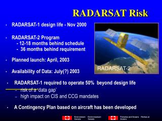
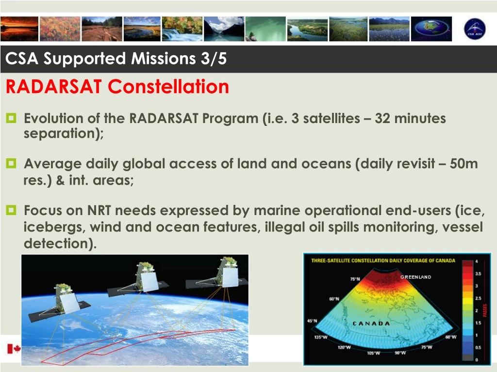
RADARSAT Constellation • Evolution of the RADARSAT Program (i.e. 3 satellites – 32 minutes separation); • Average daily global access of land and oceans (daily revisit – 50m res.) & int. areas; • Focus on NRT needs expressed by marine operational end-users (ice, icebergs, wind and ocean features, illegal oil spills monitoring, vessel detection). CSA Supported Missions 3/5
CSA Supported Missions4/5 Reliable communications in the high latitudes (North of 70º) to ensure: Security Sustainable Development Support to Northern Communities Air and Marine Navigation Provide high temporal/spatial resolution meteorological data above 50º N in support of: Numerical Weather Prediction Environmental monitoring, emergency response Climate monitoring Aurora Borealis PolarSAT (Polar Communication Weather) Mission Definition with User and Science Team
OUR ACTIVITIES: Coordination - Space Task Group Ensure the use of Canadian Space Technologies in IPY Science initiatives Guarantee fluid and continued availability and access to EO data from CSA supported missions Provide access to a federated international science community – all working under Canadian-endorsed science objectives (IPY Federal Program)
OUR ACTIVITIES: Contribution • Arctic Science Archive Project (ASAP) Radarsat Antarctic Mapping Missions – 1997, 2000, 2007 Fine resolution of the Canadian polar region and the Arctic Archipelago (collected during the CIM, 2000-2001) Max and Min ice extent Circum-polar Arctic snapshots from 2003 to … Thematically relevant dataset acquired over specific areas of interest (supersites) identified by the research communities Canadian Ice Service dataset acquired since 1996 Canadian Arctic land mass mosaics – summer and winter 1998-99 Canadian Interferometric Mission dataset
Phase 1 - Baseline Fine Mode. Northern Canadian complete coverage (20 000 scenes)
Phase 2 - - Arctic Basin ScanSAR Sea-Ice Snapshots (364 scenes)
OUR ACTIVITIES: Contribution - New Acquisitions Antarctic pole to coast multi-polarisation imaging campaign; Antarctic pole hole (from 78 to 90° south) InSAR campaign; Greenland RADARSAT InSAR campaign since 2000; Second Canadian Interferometric Mission over Canadian Arctic; Arctic Ocean Snapshots on 3-day basis…
Following on the successful 1997 R1 campaign, the Canadian Space Agency, MDA and GIIPSY executed only the 2nd complete high resolution radar imaging of the Antarctic continent in late 2008. Courtesy: NSF 1997 – Radarsat 1 2008 Data Acquisition Campaign and completed coverage 2008 – Radarsat 2 Crevier, Rigby, Jezek, and Drinkwater