What is a ‘hurricane’?
1.06k likes | 1.39k Vues
What is a ‘hurricane’?. Where do they form? Why? Why do they move east to west rather than west to east? Why do they have names?!? And how do they pick the names? What is the ‘eye”? The ‘eye wall”? How do hurricanes compare to other storms? Typhoons? mid-latitude cyclones?

What is a ‘hurricane’?
E N D
Presentation Transcript
What is a ‘hurricane’? • Where do they form? Why? • Why do they move east to west rather than west to east? • Why do they have names?!? And how do they pick the names? • What is the ‘eye”? • The ‘eye wall”? • How do hurricanes compare to other storms? Typhoons? mid-latitude cyclones? • http://www.aoml.noaa.gov/hrd/tcfaq/tcfaqHED.html
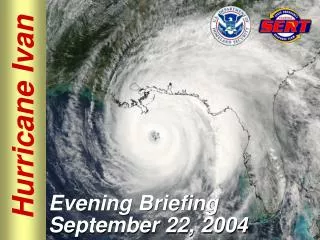
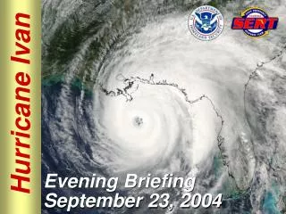
Sept 06 2004 “IVAN IS FORECAST TO SLOWLY DEEPEN OVER THE NEXT 36 HOURS REACHING 130 KT IN 48 HOURS “ DEEPEN? What does this mean? How does it relate to hurricane intensity? “ESTIMATED MINIMUM CENTRAL PRESSURE 951 MB MAX SUSTAINED WINDS 110 KT WITH GUSTS TO 130 KT. “ What is an “MB”? A “KT”? What is the significance of these values?
What does ‘warm water’ have to do with hurricanes? • NWS TPC/NATIONAL HURRICANE CENTER MIAMI FL 5 AM EDT MON SEP 06 2004 “NOW THAT FRANCES HAS MOVED OVER THE WARM WATERS OF THE NORTHEAST GULF OF MEXICO...THUNDERSTORMS ACTIVITY HAS STEADILY INCREASED NEAR THE TIGHT CIRCULATION CENTER DURING THE PAST 6 HOURS. THE LAST RECON REPORT AT AROUND 05Z INDICATED A RAGGED EYE WAS TRYING TO FORM… NOW THAT THE CENTER OF FRANCES IS BACK OVER WARM WATER...SOME RE-STRENGTHENING IS POSSIBLE. WATER TEMPERATURES ARE NEAR 83-84F AND UPPER-LEVEL OUTFLOW IS STILL QUITE IMPRESSIVE.”
What are the ‘levels’ or ‘layers’ of the of the atmosphere? • “UPPER-LEVEL OUTFLOW IS STILL QUITE IMPRESSIVE” • “A STRONG DEEP-LAYER ANTICYCLONE IS FORECAST TO REMAIN TO THE NORTH OF THE HURRICANE STEERING IVAN INTO THE EASTERN CARIBBEAN SEA BY DAY TWO AND TOWARD THE SOUTHWESTERN PORTION OF HISPANIOLA ON DAY FOUR.” • “STRONG UPPER LEVEL SHEAR…”
How are Hurricanes tracks established? • THE NHC MODEL GUIDANCE IN GOOD AGREEMENT ON FRANCES MOVING WEST-NORTHWESTWARD AROUND THE SOUTHWESTERN PORTION OF THE SUBTROPICAL RIDGE AXIS THAT EXTENDS EAST-WEST ALONG 32N LATITUDE. THE PRIMARY DIFFERENCE IN THE MODELS IS HOW SHARP OF A TURN FRANCES WILL MAKE UPON REACHING 32N. THE GFS APPEARS TO MAKE TOO SHARP OF A NORTHEASTWARD TURN GIVEN THE CURRENT LARGE DIAMETER OF FRANCES. THE OFFICIAL FORECAST IS CLOSE TO THE PREVIOUS FORECAST TRACK AND IS CLOSE THE GUNA MODEL CONSENSUS.
Huh? • “THERE IS VERY GOOD AGREEMENT THROUGH DAY FIVE WITH NOGAPS TO THE RIGHT OF THE AIDS ENVELOPE AND THE UKMET TO THE LEFT OF THE AIDS ENVELOPE. THE OFFICIAL FORECAST IS SLIGHTLY RIGHT OF THE PREVIOUS FORECAST TRACK AND IN VERY GOOD AGREEMENT WITH GUNS AND GUNA”.
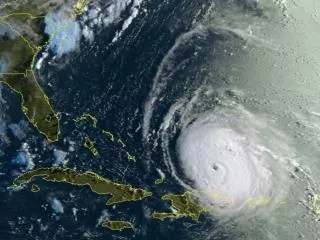
How does RADAR and Satellite imagery assist in evaluating hurricanes?
06 Sept. 04 Visible Satellite Image A SMALL EYE IS EVIDENT ON THE VISIBLE IMAGERY. …. AND SOMEWHAT RAGGED-LOOKING BANDING FEATURES
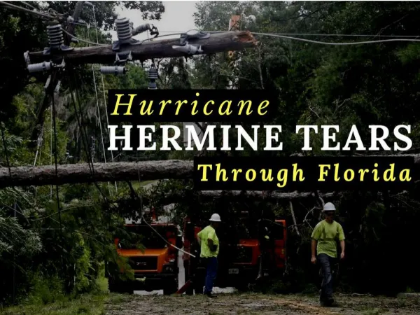
Hermine? Francis IVAN 06 Sept 04 IR Satellite Image
The Dvorak Technique Explained The Dvorak technique is a method using enhanced Infrared and/or visible satellite imagery to quantitatively estimate the intensity of a tropical system. Cloud patterns in satellite imagery normally show an indication of cyclogenesis before the storm reaches tropical storm intensity. Indications of continued development and/or weakening can also be found in the cloud features. Using these features, the pattern formed by the clouds of a tropical cyclone, expected systematic development, and a series of rules, an intensity analysis and forecast can be made. This information is then standardized into an intensity code
How do statistics and probability relate to hurricane forecasts? Note the difference in size between the forecast cones… note the degradation of certainty over time, and the higher certainty of the track for hurricane ‘Ivan’
First question…. • Where do hurricanes form? Why?
Atmospheric heating…. • Imbalances in solar NRG are the driving force behind all weather. • Direct sunlight imparts more NRG to the surface • High angle sunlight has very much lower NRG content • The atmosphere is heated from below…
Another way of looking at June 22… www.time.gov
Daylight pattern on 22 September… near the equinox What would December 22 look like?
What significance do the tropics of Cancer and Capricorn have?
Note the influence of clouds… which interrupts the latitudinal patterns
Figure 3.7 DECEMBER 21
Electromagnetic Radiation (EMR) can be described as waves. Note the generation of a magnetic field at right angles to an electrical field and both are perpendicular to the direction of EMR propagation http://micro.magnet.fsu.edu/primer/java/electromagnetic/index.html
The wavelength () of EMR is directly related to the amount of NRG in the radiation. Short () (e.g. gamma rays) have a higher NRG content Long () (e.g. thermal or microwave (Radio) have a lower NRG content As the velocity of the propagation of EMR (the speed of light) is believed to be a constant (c) The number of waves to pass a single point in a given period (the frequency, v) is much higher for shorter radiation
Blackbody radiance curves… Wein’s Displacement Law
When the sun is at very low angles, virtually all the shorter EMR is scattered, allowing only the longer, lower NRG waves (reds) to pass through.
Atmospheric scattering: (skylight or haze) Rayleigh scatter (molecular scatter) primary factor in upper atmosphere (why the sky is blue) Mie scatter (non-molecular scattering, water/ice/salt/smoke) primarly in lower atmosphere