Download
1 / 18
270 likes | 747 Vues
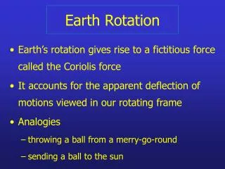
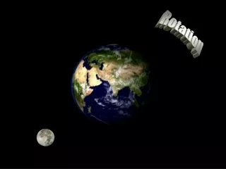
Earth Rotation. The Earth spins slowly, making a full turn with respect to the Sun every day. We use the term rotation to describe this motion.

E N D
Earth Rotation The Earth spins slowly, making a full turn with respect to the Sun every day. We use the term rotation to describe this motion. The Earth's rotation is important for three reasons: The axis of rotation serves as a reference in setting up the geographic grid of latitude and longitude; it provides the day as a convenient measure of time; and it influences physical and life processes on Earth.
Earth Rotation The direction of rotation of the Earth can be thought of as (a) counterclockwise at the north pole, or (b) from left to right (eastward) at the equator. (a) Parallels of latitude divide the globe crosswise into rings. (b) Meridians of longitude divide the globe from pole to pole.
The Earth's Revolution Around the Sun Another important motion of the Earth is its revolution, or its movement in orbit around the Sun. The seasons we experience on Earth are related to the orientation of the Earth's axis of rotation and the position of the Sun.
The Earth's Revolution Around the Sun The tilt of the Earth's axis of rotation with respect to its orbital plane. As the Earth moves in its orbit on the plane of the ecliptic around the Sun, its rotational axis remains pointed toward Polaris, the north star, and makes an angle of 66 1/2° with the ecliptic plane. *See Movie on the Earth’s Revolution Around the Sun in the GeoDiscoveries section of your text's website.
Map Projections Map Projections allow us to present the three-dimensional spherical Earth on a two-dimensional piece of paper or computer screen
Map Projections A Cylindrical Projection can be produced by wrapping a piece of paper around the globe in the form of a cylinder with the paper touching at the equator. *See Animation on Cylindrical Projections in the GeoDiscoveries section of your text's website. An example of a cylindrical projection is the Mercator Projection shown here. Notice how the meridians and parallels are presented as straight vertical and horizontal lines.
Map Projections A Conical Projection can be produced by balancing a cone of paper with the point up, on the globe. *See Animation on Conical Projections in the GeoDiscoveries section of your text's website. An example of conical projection is the modified stereographic conformal projection.
Map Projections A Planar Projection can be produced by laying a flat plane against one point on the Earth. *See Animation on Planar Projections in the GeoDiscoveries section of your text's website. An example of a planar projection is the polar projection produced when the plane intersects with the geographic North Pole. Notice how the meridians radiate outwards from the central point, while the parallels are shown as concentric circles.
Map Projections Today, projections are calculated using equators to create precise maps. The Goode Projection uses mathematical principles to create a map which indicates the true sizes of areas on the Earth’s surface.
Global Positioning Systems (GPS) The Navigation Satellite Timing and Ranging or Navstar System is composed of 24 active satellites (and one or more spares) orbiting the Earth every 12 Hours. There are six orbits inclined at 55 degrees from the equator, and four Satellites on each of the orbits at about 20,200 km altitude. There is also a Russian GPS system, GLONASS. * See Animation on Satellites in the GeoDiscoveries section of your text's website.
Global Positioning Systems Navstar Each satellite contains components that control its position and supply power and maintain contact with the ground: 1.Solar Array (for power generation). The Satellite also has batteries to store power. The satellite is over 5 meters across with its solar panels deployed. 2.Propulsion Systems to move the satellite if necessary. 3.A very precise atomic clock. 4.The satellite also broadcasts signals encoded to indicate the time and the identity of the satellite. 1 4 3 2
Global Positioning Systems Navstar At the ground surface, a GPS receiver receives signals from the satellite. The distance can be precisely estimated because both the speed of the signal and the exact time that it was sent (encoded in the original) are known. There is a wide variety of GPS receivers available ranging in application, accuracy and price: Some are specifically designed for outdoor use and are handheld. Others are designed for aircraft and can access complex navigation charts. The clocks in receivers cannot be as as accurate as those in the satellites, and therefore errors are introduced. However, 1/100 of a second represents 1860 miles, so corrections need to be made. Consequently, signals from three satellites (known as trilateration) allow us to determine our location with greater accuracy.
Global Positioning Systems Navstar The signals from the satellites represent spheres, and so to provide optimal accuracy, a fourth satellite is usually used. However, because of the arrangement of orbits, four to seven satellites will be visible from any location at any time. Accuracy for military users is around 16 meters, while accuracy for civilian users is around 100 m.
Geographic Information Systems Geographic Information Systems (or GIS) are computer-based systems that allow the storage, manipulation, analysis and presentation of spatial data. Spatial data includes not only maps, but also satellite images, aerial photographs, plans and any data that can be spatially referenced. GIS data can be envisaged as layers of data about different topics that can be combined to create new maps.
Observing Earth/Sun Relationships Since the dawn of civilization, humans have been observing and recording the changing path of the Sun in the sky and corresponding rhythm of the seasons. Understanding the causes for seasonal changes will be important for our continued study of the Earth's global energy system, weather systems, and global climate. * See Movie on Earth and Sun in the GeoDiscoveries section of your text's website.
Observing Earth/Sun Relationships The four seasons exist because the Earth's tilted axis keeps a constant orientation in space as the Earth revolves about the Sun. This tips the northern hemisphere toward the Sun for the summer solstice, and away from the Sun for the winter solstice. Both hemispheres are illuminated equally at the spring equinox and the fall equinox.