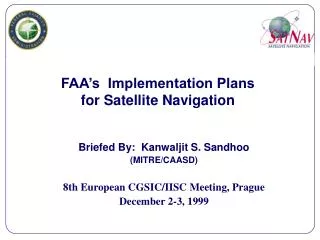
FAA’s Implementation Plans for Satellite Navigation
160 likes | 317 Vues
FAA’s Implementation Plans for Satellite Navigation. Briefed By: Kanwaljit S. Sandhoo (MITRE/CAASD) 8th European CGSIC/IISC Meeting, Prague December 2-3, 1999. Overview. Background SATNAV Program Objectives Wide Area Augmentation System (WAAS) Local Area Augmentation System (LAAS)

FAA’s Implementation Plans for Satellite Navigation
E N D
Presentation Transcript
FAA’s Implementation Plansfor Satellite Navigation Briefed By: Kanwaljit S. Sandhoo (MITRE/CAASD) 8th European CGSIC/IISC Meeting, Prague December 2-3, 1999
Overview • Background • SATNAV Program Objectives • Wide Area Augmentation System (WAAS) • Local Area Augmentation System (LAAS) • Summary
Available to All Nations, Free of Direct User Charges Basic GPS Civil Aviation Benefits • Improves Aviation System Safety • Available for Primary Use in the Oceanic Phase of Flight • Available for Supplemental Use for En Route, Terminal, and Non-Precision Phases of Flight • Cost Effective Resource for Nations with Limited Air Navigation Infrastructures • Primary Means Use of GPS can Reduce or Eliminate Maintenance Costs Associated with Older Expensive Ground-based Navigation Aids
Current Navigation Deficiencies • Large Separation Standard Requirements • Lack of accurate Aircraft Position/Navigation Data • Inability to Provide Optimum Routings to all Users • Absence of Instrument Approaches at Qualified Runways • Restrictive Departure Procedures in Poor Visibility • Limited Automated Aircraft Surface Navigation
Basic GPS System Limitations • Integrity • Notification Time: 15 Minutes or Greater • Availability • 70% for 24 satellites • 98% for 21 satellites • Accuracy • Sufficient for En Route through Non-Precision Approach • Not Sufficient for Precision Approach Does not satisfy Civil Aviation Requirements for Primary-means Navigation in all Phases of Flight
Wide Area Augmentation System (WAAS) • Safer • Increased Capacity • Cost Effective
WAAS Phase I Status • Hardware Installed and Tested • 25 WAAS Reference Stations (WRS) • 2 WAAS Master Stations (WMS) • Communications Installed and Operational • 2 INMARSAT Satellites (AOR-W and POR) • Terrestrial Communications Network • Software • Software Final Qualification Test Completed • 7 of 8 Design Qualification Tests Completed • Successfully Completed 3 Signal in Space Builds • System Integration Completed
WAAS Phase I Capabilities • Introduces Operational Capability • Non-Precision Approach • Precision approach: WAAS Precision Approach procedures and GPS/WAAS Certified Receivers Will Become Available to the Aviation Community • Increases Quantity of Airfields with Precision approach Capability
WAAS Phase ISchedule • 60 Day Stability Test/DQT 1/30/00 • Contractor Acceptance Inspection 4/25/00 • Joint Resource Council In Service Review (ISR) Decision 6/30/00 • Instrument Approaches Published 9/07/00 • Commissioning (IOC) 9/25/00
WAAS FOCInvestment Analysis • Scope: • Congress Wants SatNav Program to be “Most Cost-Beneficial” • Congress Wants FAA to Conduct Lease vs. Buy of WAAS Satellites • FAA Needs to Re-Baseline WAAS and LAAS Programs • Approach: • Involve Users, Industry, and Government Agencies • Re-Calculate Benefits/Costs Using Conservative Approach • Focus on Risk Reduction Strategies in Determining Recommendations
WAAS FOCInvestment Analysis (Cont’d) • Four Alternatives Developed and Analyzed; Includes Different Levels of Investment in WAAS/LAAS/Navaids • Preferred Alternative Based on Performance, Benefit/Cost (2.4), Risks, and Strategic Considerations • Checkpoints Built to Minimize Risk and Allow Alternate Paths • Navaids Reduced 2008-2013 to Basic Backup Network • 4 GEO Satellites to be Acquired Between 2002 and 2008 • Precision Approach Throughout CONUS • Capable of Being the Only Navigation System in an Aircraft • Final Operating Capability (FOC) FY2006 • Capable of Being the Only Navigation Service Provided by the FAA
Local Area Augmentation System (LAAS) L1 - 1575.42 MHz
LAASAcquisition Schedule 99 01 03 05 07 09 11 Assumed by FAA for Maintenance/Liability 18 CAT I Part 171 CAT I Acquisition 20 20 20 7 7 8 8 8 8 (Total of 124 CAT I) CAT III FSD R&D CAT III Conversion from CAT I (Converts78 CAT I to CAT III) 26 26 26 CAT III New Procurement 12 12 12 (Total 0f 114 CAT III) SUMMARY: 160 Total LAAS - 46 CAT I - 114 CAT III (78 CAT I Conversion + 36 New Procurement)
Summary • On September 2, 1999, the FAA JRC Reinforced the FAA’s Commitment to Satellite-Based Navigation • WAAS and LAAS Baseline Approved • Low-End Users Get Safety and Access • High-End Users Get: • Improved Safety • More Airports and Runways • More Efficiencies in Airspace and Terminal Areas • FAA Gets Modernization of NAS • Improved Safety, Improved Efficiency, and Reduced Cost
FAA GPS Product TeamWebsite • For further information on the FAA’s WAAS Program, please visit our website at: http://gps.faa.gov