AVB 7a – Aircraft General Knowledge (Distance, Speed, Time)
250 likes | 547 Vues
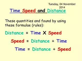
AVB 7a – Aircraft General Knowledge (Distance, Speed, Time). Instructor CSGT Ford. Objectives. Units used for distance in: Navigation (Nautical Miles [NM]) Visibility (Metres [m], Kilometers [Km]) Define a Knot [KT] Define Wind Velocity [MV]. Objectives.

AVB 7a – Aircraft General Knowledge (Distance, Speed, Time)
E N D
Presentation Transcript
AVB 7a – Aircraft General Knowledge (Distance, Speed, Time) InstructorCSGT Ford
Objectives • Units used for distance in: • Navigation (Nautical Miles [NM]) • Visibility (Metres [m], Kilometers [Km]) • Define a Knot [KT] • Define Wind Velocity [MV]
Objectives • Convert between EST, CST or WST and UTC • State the following methods of expressing direction: • As a three figure group • As a two figure group (for runways) • In the clock code
Distances • Runway lengths are usually stated in Metres (e.g. 1500 metres) • Visibility is stated in Km
The Knot & Nautical Mile • One Knot = 1 Nautical Mile per hour • One Nautical Mile = 1.852 Km • Therefore... • This is the standard measurement of speed (incl. windspeed) 1 knot = 1.852 Km/hr
Wind • The term Wind Velocity has two parts: • Its direction • Its speed • E.g: If the Wind Velocity is stated as:015/40 The wind is blowing from 015° at 40 Knots
Bearing Direction(3 Digit) N(0/360°) W(270°) E(90°) S(180°)
Runway Direction(2 Digit) Runways are always built with Bearing intervals of 10°.This allows us to “chop off” the unnecessary 0 at the end. N(0/360°) W(270°) E(90°) 270° becomes 27 27 09 S(180°)
Time • All time in aviation is based on Greenwich Mean Time, which is 24hr UTC (Universal Time Coordinate) i.e 7.35am in Greenwich = 0735 UTC 3.30pm in Greenwich = 1530 UTC • We are UTC+8 i.e While it is 7.35am in Greenwich, at Perth it is 7.35am + 8 hrs = 1535hrs at Perth (3.35pm)
Time zones in Australia Central Standard Time(CST) UTC + 7hrs 30 Western Standard Time(WST) UTC + 8 Eastern Standard Time(EST) UTC + 6
Time/date groups • The date and time can be combined into a single line. i.e. If it is 7.35am on the 5th of November in Greenwich: • 6 Figure: 050735 (day + UTC time) • 8 Figure: 11050735 (month + day + UTC time)
Summary • Distance visibility is measured in? Km • Runway distance is measured in? Metres • Distance for navigation is measured in? Nautical Miles • How fast is one Knot? 1.852 Km/hr
Summary • A plane is flying due East. What is its heading as a bearing? (3 digit)090°
Summary N A new runway has just been built, and you are in charge of painting it. Complete the image
Summary • It is 10.30am at Perth. What is the time at Greenwich? (remember: Perth is +8 hoursfrom UTC... So...) 10.30am – 8 hrs = 2.30am UTC
Summary • If it is 0230 UTC at Perth, on the 13th of May, • Express this as a 6 figure digit: • As an 8 figure digit: 130230 05130230
AVB 7b – Aircraft General Knowledge (Height, Altitude, Elevation) InstructorCSGT Ford
Objectives • State the unit for vertical measurement and differentiate between: • Height • Altitude • Elevation
Height, Altitude & Elevation • Height • 5009. Vertical measurement is by ‘foot’. It is equivalent to 1/3rd of a metre. It has • been retained for altimetry purpose, as it is easier to express the metrics. Aircraft • separations are made at 500’ and 1000’. • 5010. Height is also expressed in ‘feet’ and is the vertical distance above a given • datum eg a control tower may have an elevation of 35’ above the ground (datum) it is • built on. • AVB - 34 • Altitude. • 5011. Altitude can be expressed in three ways and are always measured in feet. • They are: • a. ALTITUDE: the vertical distance above sea level, • b. PRESSURE ALTITUDE: the altimeter reads the height above • whatever Pressure Level is set on the Subscale, and • c. HEIGHT ABOVE QFE LEVEL: QFE stands for Aerodrome Surface • Pressure, and can be used for circuit operations above a specific • aerodrome. • Elevation • 5012. Elevation is the vertical distance of an aerodrome above mean sea level, and • is measured in feet.