Download
1 / 38
400 likes | 982 Vues
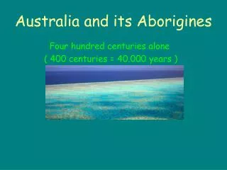
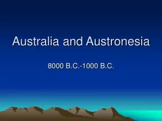
Australia and Austronesia. 8000 B.C.-1000 B.C. Australia Timeline. 8000 B.C.-colonization of most of Australia and New Guinea 6000-4000 B.C.-reorganization of coastal territories. 3000-2000 B.C.-Introduction of domestic dogs, more complex technology.

E N D
Australia and Austronesia 8000 B.C.-1000 B.C.
Australia Timeline • 8000 B.C.-colonization of most of Australia and New Guinea • 6000-4000 B.C.-reorganization of coastal territories. • 3000-2000 B.C.-Introduction of domestic dogs, more complex technology. • 1000 B.C.-Expansion of trade, invention of outrigger canoes.
Prehistoric culture • From 5000 -1000 B.C. there was a gradual increase in temperature and rainfall and the development of more sophisticated technologies. • The main items of trade were songs and dances, along with flint, precious stones, shells, seeds, spears, and food items. • Political power rested with community elders rather than hereditary chiefs and disputes were settled communally in accordance with an elaborate system of tribal law. http://www.answers.com/topic/prehistory-of-australia
Roonka Site • The Roonka site is located on the Murray River, approximately 5 km south of Blanchetown in South Australia. • Excavation of the prehistoric Aboriginal cemetery in the Roonka Flat dune began in November 1972, after flooding and erosion had exposed a number of burials. • Skeletal remains of more than 120 individuals have been recovered from Trench A, with radiocarbon dates indicating a sequence from at least 7000 years until the European contact period. http://www-personal.une.edu.au/~pbrown3/Roonka.html
Burial in situ http://www-personal.une.edu.au/~pbrown3/ausindex.html
Roonka Burial • One of the most interesting aspects of the Roonka cemetery is the variety of artifacts found in association with the burials. • Roonka 108 was buried with a kangaroo incisor tooth headband which later became cemented to the cranial vault through the action of secondary carbonates in the dune. http://www-personal.une.edu.au/~pbrown3/Roonka.html
Coobool Creek • The Coobool Creek skeletons were collected from a site near 'Doherty's Hut' at Coobool Crossing on the Wakool River between Swan Hill and Deniliquin in southern New South Whales. • Recent AMS date of 7200 ± 60 years BP • The combined effects of large size and a shared cultural practice (artificial cranial deformation) gives several of the crania from Coobool Creek, Nacurrie and Kow Swamp-Cohuna a visual and statistical appearance which is apparently unique to the central Murray Valley region http://www-personal.une.edu.au/~pbrown3/CC.html
Cranial Deformation at Coobool Creek http://www-personal.une.edu.au/~pbrown3/CC.html
Technology in Australia • Scrapers and other stone tools made from flint were common in the early Holocene. • Around 3000 B.C. standardized, finely made tools were made. • Southeast-Backed artifacts (flakes with steep retouch) • Northwest-leaf shaped points.
Backed Artifacts from Mussel Shelter from Loggers Shelter http://arts.anu.edu.au/arcworld/resources/paa/ba/photo.htm
Points A series of refitted knapping floors at increasing distances from quarries reveal the progressive modification of bifacial points and cores as material is transported through the landscape. An example of this modification is the progressive conversion of unifacial points into bifacial points as they are carried across the landscape. http://arts.anu.edu.au/arcworld/aboutus/hiscock.htm
Tasmania • The same environmental shifts were responsible for changes in settlement, foraging, and social patterns in Tasmania, notably the complete cessation of fishing around 1800 BC. • Hunters shifted to hunting terrestrial game and fat-rich seals and birds, minimizing lean fish. • Open forests and grassland replaced some closed forests c. 2000 BC, this may have been intensified by Aboriginal burning practices. • Rockshelters above 1000 m ASL were occupied more after 2000 BC as inland resources rose in use. • The isolated Bass Strait Islands were abandoned c. 2000 BC while use of less remote islands intensified.
Later Tasmania • The time between 2000 and 500 BC involved alterations to territory size and residential locations, reorganization of seasonal movements, and changing social and political organization. • This is consistent with the abandonment and relocation of artistic and ritual activities on Tasmania, where carved panels at Mount Cameron West were abandoned. • Ngarrabulgan mountain, previously used for camping, hunting, and social events was abandoned in the last 1000 years, as mythologies describing dangers were established. Early art panels show uniform images across broad areas; late panels display regional distinctiveness, marking the emergence of regional political and social entities. • Increasing cemeteries and large base camps may reflect increased territoriality.
Why did the Tasmanian’s stop eating fish? • Seems to have ceased around 1800 B.C. • Several Theories: • No ecological reason, cultural decision. • Change to “fat-rich” foods such as seal and sea birds. • Environmental change meant inlands easier to forage.
Tasmanian Tiger? • The last one died in Tasmania at the zoo in 1936. • It went extinct on Australia much earlier, due to the introduction of the dog.
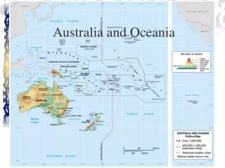
Austronesia • The islands of the Pacific Ocean, including Indonesia, Melanesia, Micronesia, and Polynesia. • The Austronesian dispersal is recent, particularly in Oceania, where they comprised the first settlers, arriving within the past 3500 to 800 years. • Languages indicate that the primary dispersal was not uniform or continuous, as they share a common ancestor and spread outwards from a homeland.
Early Agriculture in Austronesia • Southeast Asia and the Pacific islands witnessed two dispersals of agricultural populations: pre-Austronesian, and Austronesian. • Pre-Austronesian people arrived by at least 4000 BC in the New Guinea highlands, favorable for farming and free of malaria. • Taro, yams, bananas, and sugarcane were grown. • The absence of cereals and domesticated animals led to small, scattered populations. • Pigs were not introduced until c. 1000 BC by Austronesians, and the American sweet potato arrived as late as AD 1550. • Lowland New Guinea had a low population and endemic malaria, and no agricultural colonization of Australia occurred: it was the last completely hunter-gatherer continent to survive until European contact.
Taiwan • Between 3000 and 2000 BC, the Neolithic complex termed Dabenkeng developed on Taiwan, with incised and cord-marked pottery, stone adzes, rice, pigs, dogs, and possibly chickens. • Recent discoveries at sites such as Nanguanli indicate a style that developed out of the Dabenkeng, mainly after 2000 BC. • This post-Dabenkeng has linked Dabenkeng culture to the early Austronesians through materials such as Dabenkeng-type pottery with cord-marked, red-painted, and red-slipped decoration, stone barkcloth beaters, perforated slate projectile points, shouldered stone adzes, baked clay spindle whorls, tanged reaping knives of shell, and shell bracelets and earrings. • Many of these also occur at sites in the Philippines, Indonesia, and Melanesia.
Dispersals to Southeast Asia and Madagascar • In the Philippines, Sarawak, Sabah, the Talaud Islands, northern Sulawesi, and the northern Moluccas archaeological traces of the Austronesian expansion of the 2nd and early 1st millennia BC are found in rockshelters and shell midden sites with pottery, shell artifacts, and polished stone adzes, and rice husks. • Sites include Andarayan, Gua Sireh, Bukit Tengkorak, Magapit, and Nagsabaran • Pollen studies from Taiwan, Java, and Sumatra indicate clearance for agriculture from c. 2000 BC onwards. • The few sites known date the Neolithic colonization to the 2nd or 1st millennia BC. Madagascar and the Comoro Islands were probably only reached by Austronesians in the mid-1st millennium AD, or Iron Age.
Northern Phillipines Sites http://www.nmp.gov.tw/main/07/7-3/3-3-2/4.065-093.pdf
The Colonization of Oceania • In the western Pacific, between 1400 and 900 BC, Neolithic sites of the Lapita cultural complex were established from the Admiralty Islands to Samoa, correlating with a linguistic spread. • Settlers found rich resources and malaria-free areas not subject to high infant mortality rates. Site sizes and numbers indicate rapid population growth.
Lapita Economy • The Lapita had a mixed horticultural and maritime economy. Village settlements about 1 to 8 ha in size contain sherds, earth ovens, hearths, postholes, and other features. Inter-island exchange brought obsidian and other stone. • The Mariana Islands were settled before 1500 BC by users of pottery similar to Lapita. • Their Chamorro language can be traced to the northern Philippines, and the open-sea crossing of at least 2500 km represents a truly great voyage. • The Palau Islands were occupied around 1500 BC, while the Carolines, were not settled before c. AD 1.
Naitabale-Lapita in Fiji • The Naitabale settlement was probably established about 1000 BC by a group of Lapita people whose ancestors had come from the Solomon Islands. • The distinctive Lapita pottery that identifies the culture of these early settlers was found in abundance at the Naitabale settlement. • In the course of excavations at Naitabale in 2002, a complete human skeleton was discovered in beach sand more than 1.5 metres below the ground surface. • The skeleton was covered by undisturbed layers of sediment (sand and silt) in which Lapita pottery was found.
Facial Reconstruction of Lapita burial on Fiji, ca. 3000 http://www.frimlin.com/links/2005/08/reconstructed-face-of-lapita-culture.php
The Settlement of Polynesia • Lapita colonists reached Tonga and Samoa by about 1000 BC. • Pottery grew simpler over time and eventually went out of use in Samoa and southern Micronesia c. AD 300. • Pottery-making continued in New Guinea and Melanesia. Clay sources don't explain this -- some islands lacked clay but others had excellent sources. • Rice, millet, and spinning and weaving were also lost; Austronesians may have experienced "bottleneck" losses of cultural knowledge.
Polynesia • Polynesians invented the double sailing canoe allowing colonization with transported domesticates, and terraced and canal irrigated agricultural systems were impressive. • New Zealand's palisaded earthwork fortifications and Eastern Polynesia's massive stone platforms used by competing chiefs in the Hawaiian, Society, and Marquesas Islands.
Easter Island • Easter Island is over 2,000 miles from the nearest population center, (Tahiti and Chile), making it one of the most isolated places on Earth. • It is best known for the giant stone monoliths, known as Moai, that dot the coastline. • The early settlers called the island "Te Pito O Te Henua" (Navel of The World). • Admiral Roggeveen, who came upon the island on Easter Day in 1722, named it Easter Island. • Today, the land, people and language are all referred to locally as Rapa Nui. http://www.netaxs.com/~trance/rapanui.html
Location of Easter Island http://www.crystalinks.com/easterisland.html
Who were the Easter Islanders? • In 1722 when, on Easter Sunday, Dutch commander Jacob Roggeveen speculated reported a mixed race island with both dark skinned and light living together. Some were even described as having red hair and being sun-burnt looking. • According to Thor Heyerdahl, Easter Island was settled in stages over a period of years by at least two different cultures. One from Polynesia and the other from South America, possibly Peru, where mummies of red -headed individuals have been found along side those of black hair. • Contemporary archeologists think it's an open and shut case - the first and only people ever to live on Easter Island were from an individual group of Polynesians that, once finding Easter, then had no contact with any other races.
Statues on Eastern Island http://www.netaxs.com/~trance/rapanui.html
How were statues moved • American Geologist Charles Love, in a series of experiments, successfully moved a replica moai by placing it on two logs cut to fit into the bottom of the statue. • When raised onto a track of wooden rollers he found that his 10 ton moai could be moved 145 feet in just a few minutes using 25 men and two ropes. http://mysteriousplaces.com/Easter_Island/html/contro2.html
Reconstruction of moving Moai http://mysteriousplaces.com/Easter_Island/html/contro2.html
Exploring Easter Island • http://www.pbs.org/wgbh/nova/easter/explore/
Population Overload • The population of Easter Island reached its peak at perhaps more than 10,000, far exceeding the capabilities of the small island's ecosystem. • Resources became scarce, and the once lush palm forests were destroyed - cleared for agriculture and moving the massive stone Moai. • In this regard, Easter Island has become, for many, a metaphor for ecological disaster. • Thereafter, a thriving and advanced social order began to decline into bloody civil war and cannibalism. http://www.netaxs.com/~trance/rapanui.html