Download
1 / 53
530 likes | 877 Vues
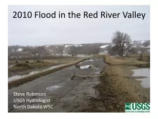
2010 Flood in the Red River Valley. Steve Robinson USGS Hydrologist North Dakota WSC. 2010 Flood - Details to Remember. Flooding on the Red River in the spring of 2010 while not as severe as the previous year was still significant

E N D
2010 Flood in the Red River Valley Steve Robinson USGS Hydrologist North Dakota WSC
2010 Flood - Details to Remember • Flooding on the Red River in the spring of 2010 while not as severe as the previous year was still significant • The early occurrence of the snow melt and associated runoff – 2010 one of the largest magnitude flood to occur this early on theRedRiver • An unusual warming trend resulted in a melt pattern from east to west • The east to west melt pattern resulted in • Minnesota tributaries melting first • North Dakota tributaries stayed frozen with snow cover intact • This melt pattern was favorable and most likely lessened the impact of the Spring flood
2010 Flood in North DakotaTopics • Flood preparations by the ND WSC staff • Field Issues • Weather conditions leading to the flood • 2010 Flood magnitude and characterization • Devils Lake
Preparations for Flooding • By Feb 2010 a larger than normal flood was expected • WSC Preparations for Flood Event • Extension of stage-discharge ratings • Based on need of NWS NCRFC • Review of gage elevations versus AHPS probabilities • Placement of back up stage sensors at key gages • Locating and recruiting additional field staff (AR,CO,KS,NE,MA,MT,IN -12 staff total) • Installation of Rapid Deployment and project gages
2010 Flood Field issuesRapid Deployment Gaging Stations 2010 Flood Information Additional Monitoring for Fargo Area 2 - Rapid Deployment Gages (COE) 4 - Project gages (COE) 5 - Project gages (WRD) 6 - Project gages (Fargo) Additional Monitoring for Sheyenne R 2 - Rapid Deployment Gages (COE) Additional Monitoring for North Dakota 8 - Rapid Deployment Gages (COE)
Flood Field issuesRiver Ice Conditions • Destroys or damages sensing equipment in the River • Creates conditions that are unmeasurable • Damages or destroys measuring equipment
Flood Field issuesGage Access • Road washouts • Flooded Roads • Submerged Equipment
Weather Factors Contributing to the 2010 FloodSummary • Above normal Autumn precipitation • Saturated soils • Above normal river flows • Above normal snow pack • Major early spring rain (Mar 9-12) • An unusual melt pattern and earlier than normal spring thaw in the southern Red River Valley From National Weather Service
Weather Factors Contributing to the 2010 FloodFall Precipitation Departure From Normal Steve Buan Dan Luna NWS - NCRFC Chanhassen, MN 2-3 X Normal
Weather Factors Contributing to the 2010 FloodSoil Moisture Saturation Ranking Wettest Soil Moisture State in 100 Years
Weather Factors Contributing to the 2010 Flood Above Normal Fall and Winter Flows in the Red River
Weather Factors Contributing to the 2010 Flood Winter Precipitation Departure 2-4 X Normal
Weather Factors Contributing to the 2010 Flood Snow Pack March 9, 2010 6” +
Snow Pack Evolution Early March Warm Air + Rain
Snow Pack Evolution Early March Warm Air + Rain
Snow Pack Evolution Early March Warm Air + Rain
Snow Pack Evolution Early March Warm Air + Rain
Snow Pack Evolution Early March Warm Air + Rain
Snow Pack Evolution Early March Warm Air + Rain
Snow Pack Evolution Early March Warm Air + Rain
Snow Pack Evolution Early March Warm Air + Rain
Snow Pack Evolution Early March Warm Air + Rain
Snow Pack Evolution Early March Warm Air + Rain
Snow Pack Evolution Early March Warm Air + Rain
Snow Pack Evolution Early March Warm Air + Rain
Weather Factors Contributing to the 2010 FloodEarly Spring Rain – March 9-12 • Fargo Weather • Rain - 1.27 inches • Temp range from 34 – 40 F • Grand Forks Weather • Rain - 1.22 inches • Temp range from 33 – 37 F
2010 Flood Magnitude and Characterization Flood Peaks at Selected Red River Locations 2009 Flood Information
Peak Stages for Selected Years on the Wild Rice River near Abercrombie, ND Mar 19 8,700 cfs 2009 1897 1997 2001 2006 2010 1969 2010 Peak ranks 6th in 78 Years of Record 2010 Exceedance Probability (.10 -.04)
Spring Flood Comparison for Wild Rice River near Abercrombie, ND Total Flows in Acre-ft (Mar 1 to May 31)
Peak Discharges for Selected Years on the Red River at Fargo, ND 2009 1997 1969 1897 2010 2001 2006 2010 ranks 5th in 109 years 2010 Exceedance Probability (.02) 109 years of record peaks – 1897, 1902 to current Daily record – 1902 to current
Spring Flood Comparison for Red River at Fargo, ND Total Flows in Acre-ft (Mar 1 to May 31) 2010 – 3/21/10 2009 – 7 days 2006 – 15 days 2001 – 24 days 1997 – 27 days
Peak Discharges for Selected Years on the Red River at Grand Forks, ND 1997 1897 1979 2009 1882 2006 2010 2001 (2010 ranks 7th in 128 years) 2010 Exceedance Probability (.10 - .02) 128 years of record peaks -1882 to current Daily record – 1904 to current
Spring Flood Comparison for Red River at Grand Forks, ND Total Flows in Acre-ft (Mar 1 to May 31) 2010 – 3/20/10 2009 – 12 days 2006 – 17 days 2001 – 25 days 1997 – 29 days 1 Day before Fargo
Spring Flood Comparison for Red River at Grand Forks, ND 2009 2008 2007 2006 2005 2004 2003 2002 2001 2000 1999 1998 1997
Century-Scale Trends in Peak Streamflow in the United StatesBased on ongoing work of Bob Hirsch, Karen Ryberg, and Gregg Wiche 1997 2009 1776-2009 Data Courtesy Manitoba Water Stewardship and Geological Survey of Canada Publication by Bill Rannie