Download
1 / 30
300 likes | 407 Vues
Explore the fundamentals of plate tectonics and its role in geology, geophysics, and Earth's system dynamics. Learn about boundaries, movements, and evidence supporting this crucial theory.

E N D
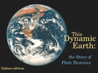
Lecture 1b: Plate Tectonics: the Earth as a System • Up to ~40 years ago, geology was a large collection of somewhat disconnected observations and local knowledge. The advent of plate tectonics organizes most of geology into a coherent, physically-based framework, and is therefore of paramount importance in surficial geology as well as in geophysics and the study of the deep interior. • The postulates of plate tectonics are as follows: • The silicate earth is divided into a lithosphere, which is cold and therefore brittle and rigid, and an asthenosphere, which is hot and therefore ductile. • Simple scaling arguments show that the asthenosphere is likely to convect. The lithosphere is the cold, upper boundary layer of this convecting system, but the extreme temperature dependence of rheology makes the system very different from simple convection models • The lithosphere organizes itself into a series of internally (almost) rigid plates. These plates are mobile with respect to the asthenosphere and with respect to each other. • By various mechanisms, the strain needed to allow convective heat to escape and cold material to return to the asthenosphere is concentrated into narrow zones at the boundaries of plates
Plate Tectonics: the Earth as a System • Plate tectonics is a kinematic theory • It specifies that the plates move and describes where deformation, seismicity, volcanism, etc. occur • The issue of dynamics, i.e., the driving forces for plate motion, is a separate question • Details aside, however, plate motions are the surface expression of the Earth’s heat engine: the interior is hot, space is cold, the second law of thermodynamics states that this gradient will drive spontaneous processes in pursuit of equilibrium • Only the Earth has plate tectonics at the present era. This implies that it requires a combination of: • the right heat budget (mostly a matter of size; compare Mars) • the right rheology • The surface must be rigid enough to make plates (compare Jupiter) • but weak enough to localize strain (compare Venus)
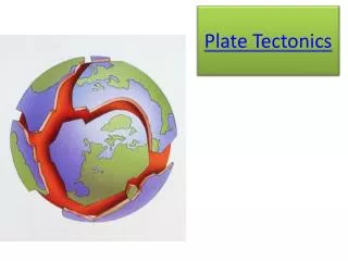
Plate Tectonics: the Earth as a System • The boundaries between lithospheric plates are of three kinds • Divergent, Convergent, Transform
Divergent Plate Boundaries • Where lithospheric plates are moving away from one another at their boundary, new lithosphere must be created. This is accomplished by mid-ocean ridges and continental rifts.
Convergent Plate Boundaries • Where lithospheric plates are moving towards one another at their boundary, lithospheric area must be consumed. This is accomplished by subduction or thickening and delamination.
Transform Plate Boundaries • Where the motion of two plates is parallel to their boundary, lithosphere is neither created nor deformed, but strain is concentrated and seismicity is common. In all three cases, the response of the lithosphere is dominated by faulting, the primary mechanism for strain concentration to narrow boundaries
Hotspots • To this simple scheme we must add at least one other important element of mantle convection that is not directly associated with the rheology of the lithosphere: • Plumes: some 10% of heat flow across the mantle is thought to be carried by rising plumes rather than subduction of cold lithosphere. This mode of convection is driven by basal heating rather than surface cooling. Plumes are presumed to lead to long-lived centers of intraplate volcanism as well as large episodes of volcanism often associated with the formation of new divergent boundaries.
The continents move? Humbug…can you prove it? Evidence for Plate Tectonics • The fit of the continents. This was noted almost as soon as good maps were available, namely after the solution of the problem of longitude in 1735 (maps before this are distorted since only latitude could be measured precisely). • Lithologic and Paleontological correlations across the Atlantic. In 1915 Alfred Wegener added observations of Paleozoic similarities between S. America and Africa as evidence for the former proximity of the continents. He proposed that all landmasses were formerly joined in the supercontinent Pangaea.
Evidence for Plate Tectonics • Mapping of the seafloor: discovery of mid-ocean ridges and deep-sea trenches, 1950-1960, by sonar bathymetry measurements.
Evidence for Plate Tectonics • Mapping of the seafloor: this is now done globally and precisely with satellite gravity data (calibrated by ship tracks)
Evidence for Plate Tectonics • Distribution of volcanism • Volcanoes are found along narrow belts; although volcanism has many causes, it is a sign of activity (vertical motions, large heat or mass transfers)
Evidence for Plate Tectonics • Seismicity: earthquake locations are mostly restricted to narrow zones along mid-ocean ridges, oceanic trenches, and continental margins. In cross-section, the Wadati-Benioff zone clearly suggests the mechanism of subduction. Seismicity is a side-effect of the deformation of rocks; hence the seismicity distribution is almost prima facie evidence of the internal rigidity of plates and the strain concentration at plate boundaries. Red: shallow Green: intermediate depth Blue: Deep
Evidence for Plate Tectonics • Age of the seafloor from sediment thickness and biostratigraphy. The age of the oldest sediment in a section (deposited on igneous basement) clearly gets systematically older with distance from the mid-ocean ridges. This data is gathered by deep-sea drilling.
Evidence for Plate Tectonics • Magnetic lineation of the seafloor. When new ocean crust forms it acquires a readily measurable remanent magnetism. The pattern of polarity reversals known from terrestrial magnetostratigraphy can be read as symmetric lineations around the mid-ocean ridges that demonstrate seafloor spreading and establish its rate.
Evidence for Plate Tectonics • Geodetic observation. To all the traditional lines of evidence, we must now add direct measurement of plate velocities by geodesy (VLBI and GPS).
Mantle Convection • Convection is the transport of heat across a gravitational potential by bulk motion driven by buoyancy forces due to thermal expansion • Whether a layer will convect rather than remain stationary and transport heat by conduction depends on the following variables: • Q: the magnitude of heat flow across the bottom of the layer • A: the magnitude of heat generated within the layer • d: the thickness of the layer • a: the thermal expansivity • g: the acceleration due to gravity • k: the thermal conductivity • k: the thermal diffusivity • n: the kinematic viscosity • In particular, a layer will be unstable to overturning if the dimensionless Rayleigh number Ra exceeds a critical value ~103
Mantle Convection • What is Ra for the Earth’s mantle? • We know g and d, obviously. a and k are measured in the laboratory on mantle minerals. n is measured by postglacial rebound or other geophysical methods as well as laboratory measurements. (Q+Ad)/k follows from heat flow measured at the surface. Layer thickness (km) Ra Upper mantle 700 106 Lower mantle 2000 3 x 10⁷ Whole mantle 2700 108 • Conclusion: even though the mantle is rigid enough to transmit shear waves, it is grossly unstable to convective overturn, and expected to convect vigorously.
Geodynamic setting of major rock suites • Most geology can be understood by situating the environment of rock formation in a plate tectonic context. • That is, the active regions where rocks are being formed today are situated either at particular kinds of plate margins or in continental or oceanic plate interiors, but most of the action is at plate boundaries • When we recognize characteristic sequences of ancient rock types and deformation patterns, we can connect them to processes that we see today. • The modern, active examples help us to interpret ancient formations. • Here are the major environments where rocks are made, with modern and ancient examples of each…
Geodynamic setting of major rock suites Oceanic crust • Plate spreading creates a very characteristic sequence of rocks. It is found anywhere one drills into oceanic basement. It was recognized as a characteristic assemblage on land and named ophiolite before the nature of the oceanic crust was known. Ophiolites are pieces of ocean crust obducted onto continents by the tectonics of convergent margins. • The characteristic assemblage, from the top down is: • Deep-sea marine sediments • Massive sulfide deposits • Pillow basalts • Sheeted basaltic dikes • Layered gabbro • Serpentinized peridotites
Geodynamic setting of major rock suites • Oceanic crust • Modern example: Hess Deep, Equatorial Pacific This sequence results from both the tectonic and petrogenetic processes at mid-ocean ridges. More on mid-ocean ridges in the next lecture
Geodynamic setting of major rock suites • Oceanic crust • Ancient example: Oman ophiolite
Geodynamic Setting of Major Rock Suites • Passive continental margin • When a continent is rifted and a new continental margin forms, it soon becomes a passive margin in the middle of a plate as the coast moves further from the ridge axis (example: east coast of North America). • A passive margin is the edge of a continent, but not a plate boundary • A characteristic and reproducible geological sequence results: • massive basaltic volcanism and normal faulting associated with initiation of rifting • shallow water sediments: evaporites, delta deposits, carbonate shelf • a thick wedge of terrigenous sediment, notably turbidites, as thermal subsidence and loading of the margin provide a sink for material eroded from the continent
Geodynamic Setting of Major Rock Suites Passive continental margin Modern example: US Atlantic Coast Ancient examples: Paleozoic Cordilleran miogeocline Proterozoic greenstone belts of Africa, Canada
Geodynamic Setting of Major Rock Suites • Ocean-ocean subduction • Subduction of one oceanic plate under another oceanic plate occurs frequently, without the involvement of continental material. Examples are the Aleutian arc, Marianas arc, Antilles arc. • Volcanic sequences mostly basaltic • Accretionary prisms small because subducted plate typically carries only thin coating of pelagic sediment • Overriding plate behind the arc under extension and a back-arc basin may develop, with a spreading center much like a mid-ocean ridge • Island arcs may be accreted onto continental margins, e.g. along west coast of North America. Much of central Asia is constructed from a series of Paleozoic island arcs and accretionary prisms.
Geodynamic Setting of Major Rock Suites Ocean-ocean subduction
Geodynamic Setting of Major Rock Suites • Ocean-continent subduction • Where an oceanic plate subducts readily under a continental margin, we generate an Andean type margin. High mountains, stratovolcanoes, and large plateaux are characteristic. • Thick igneous crust forms by intrusion and eruption of calc-alkaline magma (basalt-andesite-dacite-rhyolite). At depth there are major batholiths of intermediate to silicic intrusive rocks • Forearc basin accumulates volcaniclastic sediment • Accretionary prism is scraped off downgoing plate and piled up inboard of the trench: a melange of oceanic rocks metamorphosed at high pressure and low temperature • The association of a high-pressure, low-temperature metamorphic belt with a high-temperature belt of batholithic rocks parallel and ~200 km away is called a paired metamorphic belt. Many can be recognized in ancient terrains. • Modern example: Cascades • Ancient example: California (the paired metamorphic belt here is the Franciscan Complex and the Sierra Nevada)
Geodynamic Setting of Major Rock Suites • Ocean-continent subduction
Continental collision zone • At the closing of an ocean basin, two continents collide. Continental crust is too buoyant to subduct. Instead the crust is doubled-up, shortened, folded, and overthrust in a mountain building event or orogeny. • Many important ancient rock sequences (e.g. Appalachians) are recognized, by comparison to active (Himalaya) or recent (Alpine) mountain belts, to be derived from collisional orogenies. • Central part of range is built from uplifted and heavily deformed oceanic and continental shelf sediments and slices of ophiolite from the vanished ocean. • Collisional orogens begin as ocean-continent subduction zones; associated rocks are incorporated in the collision. Volcanism may continue during the collision. • Large mountain belts shed lots of sediment into surrounding basins. During mountain-building, deep-sea basins receive turbidite deposits called flysch which is folded and deformed as the orogeny continues. Later sediments called molasse are deposited in shallow-water or subaerial basins. • Extensive regional metamorphism exposed at the surface as rocks from depth are brought to the surface by thrust faulting and erosion of cover. Geodynamic Setting of Major Rock Suites
Geodynamic Setting of Major Rock Suites Contintental Collision Modern example: Himalayan orogeny
Geodynamic Setting of Major Rock Suites • Contintental Collision • Ancient example: • Appalachian orogeny