Download
1 / 33
630 likes | 1.45k Vues
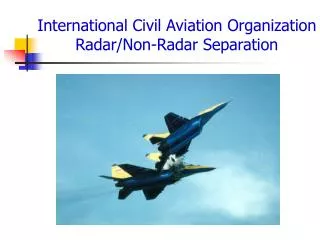
International Civil Aviation Organization Radar/Non-Radar Separation. Overview.

E N D
International Civil Aviation Organization Radar/Non-Radar Separation
Overview • As you work IFR traffic, it is essential that you know the basic IFR separation standards. You will use these standards separately and/or in combination to move IFR traffic in a safe, orderly, and expeditious manner. ICAO procedures are contained in ICAO Air Traffic Management Publication (PANS-ATM) Doc 4444. • In addition to the basic ICAO radar separations standards, there are two types of ICAO non-radar separation standards: • Vertical • Horizontal • Lateral • Longitudinal • This lesson covers the basic ICAO radar procedures and ICAO non-radar standards used to obtain the minimum required separation between IFR aircraft, however it is not all inclusive of the contents of ICAO publications.
Objective(s) • IAW ICAO Air Traffic Management (Doc 4444), you will be familiar with: • Separation definitions. • Concept of enroute radar separation and radar separation criteria. • The requirements for applying vertical separation. • The requirements for applying horizontal separation (lateral/longintudinal).
Separation Definitions • Separation: Spacing between aircraft, levels or tracks. (ICAO) • Non-Radar Separation: The separation used when aircraft position information is derived from sources other than radar. (ICAO) • Separation Minima: The minimum longitudinal, lateral, or vertical distances • by which aircraft are spaced through the application of air traffic control procedures. (FAAO Pilot/Controller Glossary) • Radar separation and non-radar separation are based on the concept that aircraft are surrounded by airspace that other aircraft CANNOT enter.
RADAR SEPARATION CONCEPTS Radar Separation By adding altitude/Mode C information, the aircraft's protected airspace can be measured both horizontally and vertically. - The horizontal radar separation minimum SHALL be 5NM (9.3km). - Below 29,000 feet (8,850 meters), vertical separation SHALL be 1,000 feet (300 meters). - Above 29,000 feet, vertical separation SHALL be 2,000 feet (600 meters), except where regional agreements allow for less than 2000 feet (600 meters). However, minimum vertical separation shall NEVER be less than 1,000 feet (300 meters) within designated portions of airspace
CONTROLLED AIRSPACE BOUNDARIES Radar Separation Provide navigational assistance to ensure that aircraft will NOT be less than 2.5NM (4.6km) from the limit of the controlled airspace unless local arrangements have been made. This provides separation minima between radar-controlled aircraft operating in adjoining areas. When control is to be transferred, local handover procedures apply. Note: Separation between aircraft and the boundaries of special use airspace (such as restricted areas, prohibited areas, MOAs, and alert areas) SHALL be determined by the appropriate ATS authority.
RADAR COVERAGE TRANSITION TO NONRADAR COVERAGE Radar Separation When aircraft are flying from an area of radar control to one of non-radar control, non-radar separation SHALL be established before: The aircraft under the radar control reach the limit of the area of responsibility, or The aircraft leaves the area of radar coverage
NON-DIGITIZED TARGETS Apply separation between centers of primary targets. - Apply radar separation (based upon primary radar) so that the distance between the centers of the radar targets, which represent the locations of the aircraft, is NEVER less than a prescribed minimum. - The edges of such targets shall NEVER be allowed to touch UNLESS vertical separation is provided between the aircraft. NON-DIGITIZED TARGETS Apply separation between ends of control slashes. - Radar separation based SSR responses SHALL be applied so that the distance between the closest edges of the positional element of the SSR responses is NEVER less than the prescribed minimum. Radar Separation
DIGITIZED TARGETS Apply separation between centers of digitized targets. - When using digitized targets, apply radar separation so that the distance between the center of the targets is NEVER less than prescribed minimum. Radar Separation
Non-Radar Separation • Where the type of separation or minimum used to separate two aircraft cannot be • maintained, another type of separation or another minimum shall be established • prior to the time when the current separation minimum would be infringed. • (Ref ICAO PANS-ATM Doc 4444) • Where the term “on track” is used in the provisions relating to the application of • longitudinal separation minima using DME, it means that the aircraft is flying either • directly inbound to or directly outbound from the station. (Ref ICAO PANS-ATM Doc 4444) • When applying DME standards, direct controller-pilot communication shall be • maintained while such separation is used. (Ref ICAO PANS-ATM Doc 4444)
Non-Radar Separation (Vertical) Ref ICAO PANS-ATM (Doc 4444) 5.3.1 Vertical separation application Vertical separation is obtained by requiring aircraft using prescribed altimeter setting procedures to operate at different levels expressed in terms of flight levels or altitudes in accordance with the provisions in Chapter 4, Section 4.10. 5.3.2 Vertical separation minimum The vertical separation minimum (VSM) shall be: a) a nominal 300 m (1,000 ft) below FL 290 and a nominal 600 m (2,000 ft) at or above this level, except as provided for in b) below; and b) within designated airspace, subject to a regional air navigation agreement: a nominal 300 m (1,000 ft) below FL 410 or a higher level where so prescribed for use under specified conditions, and a nominal 600 m (2,000 ft) at or above this level.
Non-Radar Separation (Lateral) Ref ICAO PANS-ATM (Doc 4444) 5.4.1.1.2 Lateral separation of aircraft is obtained by requiring operation on different routes or in different geographical locations as determined by visual observation, by the use of navigation aids or by the use of area navigation (RNAV) equipment. 5.4.1.2.1 Means by which lateral separation may be applied: 1) 5.4.1.2.1.1 By reference to the same or different geographic locations. By position reports which positively indicate the aircraft are over different geographic locations as determined visually or by reference to a navigation aid. (See Figure 5-1)
Non-Radar Separation (Lateral) 5.4.1.2.1 Means by which lateral separation may be applied: (continued) 2)5.4.1.2.1.1 By use of the same navigation aid or method. By requiring aircraft to fly on specified tracks which are separated by a minimum amount appropriate to the navigation aid or method employed. Lateral separation between two aircraft exists when: b) NDB: both aircraft are established on tracks to or from the NDB which are diverging by at least 30 degrees and at least one aircraft at a distance of 28 km (15 NM) or more from the facility. (See Figure 5-3) a) VOR: both aircraft are established on radials diverging by at least 15 degrees and at least one aircraft is at a distance of 28 km (15 NM) or more from the facility. (See Figure 5-2)
Non-Radar Separation (Lateral) 5.4.1.2.1 Means by which lateral separation may be applied: (continued) 2) 5.4.1.2.1.1 By use of the same navigation aid or method. (continued) d) RNAV operations: both aircraft are established on tracks which diverge by at least 15 degrees and the protected airspace associated with the track of one aircraft does not overlap with the protected airspace associated with the track of the other aircraft. This is determined by applying the angular difference between two tracks and the appropriate protected airspace value. The derived value is expressed as a distance from the intersection of the two tracks at which lateral separation exists. c) Dead Reckoning (DR): both aircraft are established on tracks diverging by at least 45 degrees and at least one aircraft is at a distance of 28 km (15 NM) or more from the point of intersection of the tracks, this point being determined either visually or by reference to a navigation aid and both aircraft are established outbound from the intersection. (See Figure 5.4)
Non-Radar Separation (Lateral) 5.4.1.2.1 Means by which lateral separation may be applied: (continued) 3) 5.4.1.2.1.3 By use of different navigation aids or methods. Lateral separation between aircraft using different navigation aids, or when one aircraft is using RNAV equipment, shall be established by ensuring that the derived protected airspaces for the navigation aid(s) or RNP do not overlap. 4) 5.4.1.2.1.4 RNAV operations where RNP is specified on parallel tracks or ATS routes. Within designated airspace or on designated routes, where RNP is specified, lateral separation between RNAV-equipped aircraft may be obtained by requiring aircraft to be established on the centre lines of parallel tracks or ATS routes spaced at a distance which ensures that the protected airspace of the tracks or ATS routes does not overlap. 5) 5.4.1.2.1.5 Transitioning into airspace where a greater lateral separation minimum applies. Lateral separation will exist when aircraft are established on specified tracks which: a) are separated by an appropriate minimum; and b) diverge by at least 15 degrees until the applicable lateral separation minimum is established; providing that it is possible to ensure, by means approved by the appropriate ATS authority, that aircraft have the Navigation capability necessary to ensure accurate track guidance.
Non-Radar Separation (Longitudinal) Ref ICAO PANS-ATM (Doc 4444) 5.4.2.1.1 Longitudinal separation shall be applied so that the spacing between the estimated positions of the aircraft being separated is never less than a prescribed minimum. Longitudinal separation between aircraft following the same or diverging tracks may be maintained by application of speed control, including the Mach number technique. When applicable, use of the Mach number technique shall be prescribed on the basis of a regional air navigation agreement. 5.4.2.1.2 In applying a time- or distance-based longitudinal separation minimum between aircraft following The same track, care shall be exercised to ensure that the separation minimum will not be infringed whenever the following aircraft is maintaining a higher air speed than the preceding aircraft. 5.4.2.1.3 Longitudinal separation may be established by requiring aircraft to: a) depart at a specified time, b) to arrive over a geographical location at a specified time, or c) to hold over a geographical location until a specified time.
Non-Radar Separation (Longitudinal) 5.4.2.1.5 For the purpose of application of longitudinal separation, the terms same track, reciprocal tracks and crossing tracksshall have the following meanings: a) Same track (see Figure 5-5): same direction tracks and intersecting tracks or portions thereof, the angular difference of which is less than 45 degreesor more than 315 degrees, and whose protected airspaces overlap b) Reciprocal tracks (see Figure 5-6): opposite tracks and intersecting tracks or portions thereof, the angular difference of which is more than 135 degreesbut less than 225 degrees, and whose protected airspaces overlap c) Crossing tracks (see Figure 5-7): intersecting tracks or portions thereof other than those specified in a) and b).
Non-Radar Separation (Longitudinal) SAME TRACK - SAME LEVEL Separation Minima: 15 minutes However, separation may be reduced to:
Non-Radar Separation (Longitudinal) SAME TRACK - SAME LEVEL Separation Minima: (Continued) 37 km (20 NM), provided: 1) each aircraft utilizes the same “on-track” DME stations; and 2) separation is checked by obtaining simultaneous DME readings from the aircraft at frequent intervals to ensure that the minimum will not be infringed (see Figure 5-20) 10 minutes, if navigation aids permit frequent determination of position and speed. (see Figure 5-9) or However, separation may be further reduced to:
Non-Radar Separation (Longitudinal) SAME TRACK - SAME LEVEL Separation Minima: (Continued) 5 minutes, in the following cases, provided that in each case the preceding aircraft is maintaining a TAS of 37 km/h (20 kt) or more faster than the succeeding aircraft (see Figure 5-10): 1) between aircraft that have departed from the same aerodrome; 2) between en-route aircraft that have reported over the same exact significant point; 3) between departing and en-route aircraft after the en-route aircraft has reported over a fix that is so located in relation to the departure point as to ensure that five-minute separation can be established at the point the departing aircraft will join the air route. 19 km (10 NM) provided: 1) the leading aircraft maintains a TAS of 37 km/h (20 kt) or more faster than the succeeding aircraft; 2) each aircraft utilizes the same “on-track” DME stations; and 3) separation is checked by obtaining simultaneous DME readings from the aircraft at such intervals as are necessary to ensure that the minimum is established and will not be. infringed. (See Figure 5-21). or And:
Non-Radar Separation (Longitudinal) SAME TRACK - SAME LEVEL Separation Minima: (Continued) 3 minutes, in the following cases, provided that in each case the preceding aircraft is maintaining a TAS of 74 km/h (40 kt) or more faster than the succeeding aircraft (see Figure 5-11): 1) between aircraft that have departed from the same aerodrome; 2) between en-route aircraft that have reported over the same exact significant point; 3) between departing and en-route aircraft after the en-route aircraft has reported over a fix that is so located in relation to the departure point as to ensure that five-minute separation can be established at the point the departing aircraft will join the air route.
Non-Radar Separation (Longitudinal) CROSSING TRACKS - SAME LEVEL Separation Minima: 15 minutes at the point of intersection of the tracks (see Figure 5-12) However, separation may be reduced to:
Non-Radar Separation (Longitudinal) CROSSING TRACKS - SAME LEVEL Separation Minima: (Continued) 10 minutes, if navigation aids permit frequent determination of position and speed. (see Figure 5-13) 37 km (20 NM), provided: 1) each aircraft utilizes the same “on-track” DME stations; and 2) separation is checked by obtaining simultaneous DME readings from the aircraft at frequent intervals to ensure that the minimum will not be infringed 3) each aircraft reports distance from the station located at the crossing point of the tracks and that the relative angle between the tracks is less than 90 degrees. (see Fig. 5-22A) or However, separation may be further reduced to:
Non-Radar Separation (Longitudinal) CROSSING TRACKS - SAME LEVEL Separation Minima: (Continued) 19 km (10 NM), provided: 1) The leading aircraft maintains a TAS of 37km/h (20 kts) or more faster than the succeeding aircraft; 2) each aircraft utilizes the same “on-track” DME stations; and 3) separation is checked by obtaining simultaneous DME readings from the aircraft at frequent intervals to ensure that the minimum will not be infringed 4) each aircraft reports distance from the station located at the crossing point of the tracks and that the relative angle between the tracks is less than 90 degrees (see Fig. 5-22B)
Non-Radar Separation (Longitudinal) CLIMBING or DECENDING - SAME TRACK Separation Minima: 15 minutes while vertical separation does not exist (See Figures 5-14A and 14B) However, separation may be reduced to:
Non-Radar Separation (Longitudinal) CLIMBING or DECENDING - SAME TRACK Separation Minima: (Continued) 10 minutes while vertical separation does not exist, provided that such separation is authorized only where navigation aids permit frequent determination of position and speed (See Figures 5-15A and 5-15B) 19 km (10 NM), provided: 1) each aircraft utilizes “on-track” DME stations; and 2) one aircraft maintain a level while vertical separation does not exist; and 3) Separation is established by obtaining simultaneous DME readings from the aircraft. (See Fig. 5-23A and 5-23B) or And:
Non-Radar Separation (Longitudinal) CLIMBING or DECENDING - SAME TRACK Separation Minima: (Continued) 5 minutes while minutes while vertical separation does not exist, provided that the level change is commenced within 10 minutes of the time the second aircraft has reported over an exact reporting point (see Figures 5-16A and 5-16B).
Non-Radar Separation (Longitudinal) CLIMBING or DECENDING – CROSSING TRACKSSeparation Minima: 10 minutes while vertical separation does not exist, provided that such separation is authorized only where navigation aids permit frequent determination of position and speed (See Figures 5-18A and 5-18B) 15 minutes while vertical separation does not exist (See Figures 5-17A and 17B) or
Non-Radar Separation (Longitudinal) CLIMBING or DECENDING – RECIPROCAL TRACKSSeparation Minima: 10 nm Aircraft utilizing on-track DME may be cleared to climb or descend to or through the levels occupied by other aircraft utilizing on-track DME, provided: 1) that it has been positively established that the aircraft have passed each other and are at least 10 NM apart, or 2) such other value as prescribed by the appropriate ATS authority. 10 minutes where lateral separation is not provided, vertical separation shall be provided for at least ten minutes prior to and after the time the aircraft are estimated to pass, or are estimated to have passed. Provided it has been determined that the aircraft have passed each other, this minimum need not apply. (See Figure 5-19). or
Non-Radar Separation (Longitudinal) MACH NUMBER TECHNIQUE: (MNT) : What is MACH Number Technique? Mach Number Technique is a control technique (based on speed) used by ATC whereby turbojet aircraft operating successively along suitable routes are cleared to maintain appropriate MACH numbers for a relevant portion of the enroute phase of flight. The principle objective is to achieve improved utilization of the airspace and to ensure that separation between successive aircraft does not decrease below established minima. (FAAO 7110.65, Pilot/Controller Glossary) How is MACH Number Technique applied? When the Mach number technique is applied and provided that: a) the aircraft concerned have reported over the same reporting point and follow the same track or continuously diverging tracks until some other form of separation is provided; or b) if the aircraft have not reported over the same reporting point and it is possible to ensure, by radar or other means, that the appropriate time interval will exist at the common point from which they either follow the same track or continuously diverging tracks; minimum longitudinal separation between turbojet aircraft on the same track, whether in level, climbing or descending flight shall be: 10 minutesorbetween9 and 5 minutes, provided: the preceding aircraft is maintaining a MACH number greater than the following aircraft.
Non-Radar Separation (Longitudinal) MACH NUMBER TECHNIQUE:(Continued) SAME TRACK – SAME LEVEL; CLIMBING or DECENDINGSeparation Minima: Using the “Rule of 11”, the MNT can be applied in simpler terms. Using 11 as a baseline, subtract the difference in aircraft MACH speeds to reach the required minimum separation in minutes. 11 - (MACH diff in speed) = separation standard Example: NW11, maintaining MACH .86 reports fix A at 0800 BA41, maintaining MACH .81 reports fix A at 0807 11 - 5 (diff in MACH speed) = 6 minutes required separation. In this example aircraft can be at the same altitude or climb/descend through the altitude of the other.
Radar/Non-Radar Separation Summary We’ve covered a lot of information in a short amount of time. It is imperative that you be familiar with these non-radar rules for future application. Theses charts are included in your reference materials to assist you with the application of non-radar separation standards.
Radar/Non-Radar Separation Summary Questions???


![CIVIL AVIATION BILL [B 73B - 2008]](https://cdn2.slideserve.com/4286844/civil-aviation-bill-b-73b-2008-dt.jpg)