Download
1 / 11
110 likes | 276 Vues
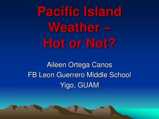
Pacific Island Weather – Hot or Not?. Aileen Ortega Canos FB Leon Guerrero Middle School Yigo, GUAM. PURPOSE. To use NASA satellite data to compare surface temperature and precipitation of different islands in the Pacific Ocean. LEARNING OUTCOMES. Students will be able to:

E N D
Pacific Island Weather – Hot or Not? Aileen Ortega Canos FB Leon Guerrero Middle School Yigo, GUAM
PURPOSE • To use NASA satellite data to compare surface temperature and precipitation of different islands in the Pacific Ocean
LEARNING OUTCOMES • Students will be able to: • Make inferences about an area’s climate based on interpreting data on a weather graph • Create graphs using Microsoft Excel • Explain the difference between weather and climate
Aleutian Islands 54 N, 164 W Guam 13 N, 144 E Fiji 18 S, 175 E
QUESTIONS: • How do you think location (latitude and longitude) affects the weather on each Pacific island? • How does temperature and precipitation differ in Guam and Fiji? How are they similar? • Why is the weather at the Aleutian Islands different from the weather found at Guam and Fiji? • What kind of climate region (tropical, dry, moderate, continental, polar) can you expect to see if you visit Guam? Fiji? the Aleutian Islands? • How is the weather graph you created similar to a climograph? • How does this weather graph differ from a climograph?
Climographs • Summarize the climate of a location on a single diagram. • Average monthly temperature and precipitation in a given location are plotted in a single graph. • Temperature is plotted using a line graph. • Precipitation is shown using a bar graph. • Both graphs are placed on a single graph to create a climograph.