Download
1 / 66
660 likes | 854 Vues
National Weather Service Central Pacific Hurricane Center/ Weather Forecast Office Honolulu, Hawaii Hurricane Preparedness - 2009. Jim Weyman Director/Meteorologist in Charge. Overview. Forecast Office Structure and Programs Hurricane Information Recipe for Tropical Cyclones

E N D
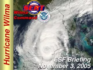
National Weather Service Central Pacific Hurricane Center/ Weather Forecast Office Honolulu, Hawaii Hurricane Preparedness - 2009 Jim Weyman Director/Meteorologist in Charge
Overview Forecast Office Structure and Programs Hurricane Information Recipe for Tropical Cyclones Summary – 2007 Central Pacific TC Season Forecast – 2008 Central Pacific TC Season Climate Change and Variability Triple Threat Hurricane Products Hurricane Preparedness Conclusion
Mission NOAA's National Weather Service Provides weather, hydrologic, and climate forecasts and warnings for the United States,its territories, adjacent waters and ocean areas, for the protection of life and property and the enhancement of the national economy. Data and products form a national information database and infrastructure which can be used by other governmental agencies, the private sector, the public, and the global community.
Regional Forecast Programs • Central Pacific Hurricane Center • Central Pacific 140W to 180 north of Equator • UN World Meteorological Organization Recognized Regional Specialized Meteorological Center for Central Pacific
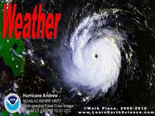
Tropical Cyclones - Hurricane Iniki, Sep 11, 1992 Direct hits rare…but devastating • 3 in last 50 years • Dot (1959), Iwa (1982), Iniki (1992)
Terminology • Tropical Cyclone: Generic term. Includes Tropical Depressions, Tropical Storms, and Hurricanes. • Tropical Depression: Winds of 38 mph or less. Assigned a number (e.g., TD-01C) • Tropical Storm: Winds of 39 to 73 mph. Assigned a name. • Hurricane: Winds of 74 mph or higher. Five Categories. Category 5 >155mph
Saffir/Simpson Scale Category Winds One 75-95 mph (65-82 kts) Two 96-110 mph (83-95 kts) Three 111-130 mph (96-113 kts) Four 131-155 mph (114-135 kts) Five 155+ mph (135+ kts)
Central Pacific Tropical Cyclone Season • Season: June 1 to November 30 • Tropical Cyclones can occur in any month • Central Pacific Average per Year • 4-5 Tropical Cyclones • 1971 to 2008: 163 Tropical Cyclones • 36% Hurricanes, 28% Tropical Storms, 36% Tropical Depressions
Recipe for Tropical Cyclones • Sea Surface Temperatures • 80°F (26.5°C) over a large area • Weak Vertical Wind Shear • Low Level Disturbance • Region of upper level divergence/outflow
Recipe for Tropical Cyclones • Sea Surface Temperatures • 80°F (26.5°C) over a large area • Weak Vertical Wind Shear • Low Level Disturbance • Region of upper level divergence/outflow
Effect of Vertical Wind Shear 40,000 ft/200 mb H H Typical cruising altitude of commercial airplane Heat Heat 5,000 ft/850 mb L L Surface
Recipe for Tropical Cyclones • Sea Surface Temperatures • 80°F (26.5°C) over a large area • Weak Vertical Wind Shear • Low Level Disturbance • Region of upper level divergence/outflow
Recipe for Tropical Cyclones • Sea Surface Temperatures • 80°F (26.5°C) over a large area • Weak Vertical Wind Shear • Low Level Disturbance • Region of upper level divergence/outflow
Surveillance and ForecastingAids • Satellites – Geostationary and Polar Orbit • Reconnaissance Aircraft • “Hurricane Hunters” • 4 Doppler Radars • Intensity, Winds, and Rainfall • Hurricane Models – Multiple Ones
Tropical Storm Kika 7-12 August 2008 • First and only tropical cyclone in Central Pacific Basin for 2008 • Peaked at minimal Tropical Storm strength • No impacts to Hawaiian Islands and no significant impacts to other Pacific Islands
Factors Affecting Tropical Cyclone Forecasts for Central Pacific • El Nino (Warmer) – Possible Impacts • More Active Hurricane Seasons • Greater Chance of Late Season Hurricanes • Drought Conditions During Winter Months • Numerous High Surf Events • La Nina (Cooler) and Neutral Conditions • No Strong Statistical Correlations • Tendencies of Normal to Less Active Hurricane Seasons and Near Normal to Above Rainfall
Central Pacific Tropical Cyclones 5 Most Active Seasons for Period 1971-2008 Year TC H TS TD • 1994 11 5 3 3 (El Nino Year) • 1992 11 3 3 5 (El Nino Year) • 1982 10 4 6 0 (El Nino Year) • 1997 9 0 5 4 (El Nino Year) • 1985 8 4 2 2 (La Nina Year)
Decadal Variations • 1971-1994 Average about 5 systems per year with much variation • 1995-2006 (not including 1997) Average about 3.5 systems per year with little variation • Possibly produced by Pacific Decadal Oscillation Change in 1995 and late 1960s
Central Pacific Tropical Cyclones 1957-2008 # of storms year
2009 Hurricane Season Outlook • 80% near to below normal season • Seasonal Forecast 3-5 Tropical Cyclones • 20% chance of above normal season • 6+ Tropical Cyclones if moderate-strong El Nino develops • Based Upon • The ongoing conditions of suppressed activity since 1995 • Near normal ocean temperatures and then development of El Niño or warmer than normal temperatures during the later part of the season. • Have to prepare same way regardless of outlook
Hurricanes and Global Warming • Healthy Scientific Debate • Some studies have shown same number of hurricanes but more intense • Some studies show lack of long term data to make conclusive statement • Some studies show increase in damage and impacts due to societal changes • Some studies have indicated a possibility of increased number of hurricane in central Pacific
Questions? National Weather Service 2525 Correa Road Suite 250 Honolulu, HI 96822-2219 973-5280 james.weyman@noaa.gov 271-6238 raymond.tanabe@noaa.gov 271-6267 www.weather.gov/hawaii www.weather.gov/cphc
Tropical Cyclone Impacts • Extreme wind conditions Iniki: wind gusts greater that 150 mph Iwa: wind gusts greater that 120 mph • Flash Flooding Iniki: 8 to 10 inches over short time frame TD 1-C: 14+ inches upslope of Hilo • Storm Surge, High surf Iniki: 30 to 35 ft surf on Kauai, high water marks up to 25 ft, 3 to 4 ft storm surge Estelle: 10 to 20 ft surf even though closest passage was 120 nm south of Big Island.
Wind Destruction on Kauai Sheets of roofing iron, a pallet, broken plants and other debris fly through the air at the height of Hurricane Iniki in Lihue, Kauai (Photo by Bruce Asato, courtesy of the Honolulu Advertiser).
Ocean Waves Extreme Winds MWL Wave Runup Wave Setup SWL Currents Storm Inundation Storm Surge High Tide MSL after Harper (2001)
Oblique aerial photograph showing overwash debris (the line of light colored material near middle of the picture) near Kukuiula, southern Kauai (view to west)
Central Pacific Hurricane Center Watches and Warnings Hurricane/Tropical Storm Watch • Hurricane/Tropical Storm conditions are possible in the watch area…usually within 48* hours. Hurricane/Tropical Storm Warning • Hurricane/Tropical Storm conditions are expected within the warning area…usually within 36* hours * Change starting with 2009 season in Central Pacific.
Central Pacific Hurricane CenterText Products • Tropical Weather Outlook • Tropical Cyclone Discussion • Tropical Cyclone Forecast/Advisory • Tropical Cyclone Public Advisory • Hurricane Local Statements
Central Pacific Hurricane CenterTropical Weather Outlook • Issued 4 times daily during hurricane season – June 1 through November 30 • 4 AM, 10 AM, 4 PM, 10 PM HST • The Tropical Weather Outlook provides a summary of possible or anticipated tropical cyclone development and other areas of interest • Can give you several days “heads up” before a tropical cyclone actually develops
Central Pacific Hurricane CenterTropical Weather Outlook TROPICAL WEATHER OUTLOOK NWS CENTRAL PACIFIC HURRICANE CENTER HONOLULU HI 400 AM HST TUE JUN 8 2004 FOR THE CENTRAL NORTH PACIFIC...BETWEEN 140W AND 180 NO TROPICAL CYCLONES ARE EXPECTED THROUGH THURSDAY MORNING. $$
Central Pacific Hurricane CenterTropical Weather Outlook TROPICAL WEATHER OUTLOOK NWS CENTRAL PACIFIC HURRICANE CENTER HONOLULU HI 1000 AM HST FRI MAY 11 2007 FOR THE CENTRAL NORTH PACIFIC...BETWEEN 140W AND 180 A LARGE AREA OF DISORGANIZED SHOWERS AND THUNDERSTORMS IS ABOUT 1000 MILES EAST SOUTHEAST OF HILO...HAWAII. DEVELOPMENT...IF ANY...WILL BE SLOW TO OCCUR. ELSEWHERE...NO TROPICAL CYCLONES ARE EXPECTED THROUGH SUNDAY MORNING.
Tropical Cyclone Products • Once a tropical cyclone develops or moves into the Central North Pacific, Tropical Discussions, Public Advisories, and Forecast/Advisories are issued at regularly scheduled times • 5 AM, 11 AM, 5 PM, 11 PM • For storms that are expected to remain over water and not affect any land areas, these three are the only products issued • For tropical cyclone that are expected to impact land areas, position estimates, intermediate advisories, and local statements are also issued.
Central Pacific Hurricane CenterTropical Cyclone Discussion • Explain the forecaster’s reasoning behind the analysis and forecast of the tropical cyclone • Assess confidence or uncertainty • Reason for change in track or intensity forecast • Plans for watches and warnings
Central Pacific Hurricane CenterTropical Cyclone Discussion OVER THE PAST SIX HOURS...TWO-C HAS STARTED TO SHOW SIGNS OF BETTER ORGANIZATION . WIND RADII WERE ALSO EXPANDED PRIMARILY THROUGH 36 HOURS IN RESPONSE TO THE INCREASED IN INTENSITY AND QUIKSCAT DATA. THE FORECAST TRACK OF TWO-C HAS BEEN ADJUSTED SOUTHWARD OR TO THE LEFT OF THE PREVIOUS TRACK... THE FORECAST INTENSITY WAS INCREASED THROUGH 36 HOURS IN RESPONSE TO THE INCREASE IN INITIAL INTENSITY. ITS PROJECTED PATH KEEPS TWO-C OVER WATER AND AWAY FROM ANY MAJOR PACIFIC ISLANDS. THE SOUTHWARD ADJUSTMENT OF THE FORECAST TRACK AFTER 36 HOURS ALSO PLACES TWO-C FURTHER AWAY FROM JOHNSTON ISLAND.
Central Pacific Hurricane CenterForecast /Advisory • Short Term Section (days 1-3) • Current position and movement • Forecast center positions • Maximum wind speed and gusts in knots • 34, 50, and 64 knot wind speed radii • Extended Outlook Section (days 4-5) • Forecast center positions • Maximum wind speed in knots
Central Pacific Hurricane CenterForecast / Advisory HURRICANE CENTER LOCATED NEAR 16.5N 160.9W AT 09/2100Z. POSITION ACCURATE WITHIN 30 NM. PRESENT MOVEMENT TOWARD THE NORTH OR 10 DEGREES AT 22 KT. ESTIMATED MINIMUM CENTRAL PRESSURE 935 MB. EYE DIAMETER 10 NM. MAX SUSTAINED WINDS 125 KT WITH GUSTS TO 150 KT. 64 KT....... 30NE 30SE 30SW 30NW 50 KT....... 75NE 75SE 75SW 75NW 34 KT........200NE 200SE 200SW 200NW 12 FT SEAS..200NE 200SE 200SW 200NW ALL QUADRANT RADII IN NAUTICAL MILES
Central Pacific Hurricane CenterPublic Advisory • Watches or warnings in effect • Highlights most significant conditions • Reference to local statements from Civil Defense and NWS • Location, movement, and intensity of tropical cyclone • Intermediate Advisories • Issued at 2 or 3 hour intervals when a tropical cyclone affects or is forecast to affect an island • Special advisories • Issued anytime significant changes occur • Cancellation of a Hurricane/Tropical storm Watch or Warning • Classification of tropical cyclone changes • A tornado threat develops
Central Pacific Hurricane CenterPublic Advisory AT 5 PM HST...0300Z...THE CENTER OF TROPICAL DEPRESSION GUILLERMO WAS LOCATED NEAR LATITUDE 16.0 NORTH...LONGITUDE 142.3 WEST OR ABOUT 875 MILES EAST SOUTHEAST OF HILO HAWAII. THE DEPRESSION IS MOVING TOWARD THE WEST NEAR 20 MPH AND THIS MOTION IS EXPECTED TO CONTINUE FOR THE NEXT 24 HOURS. MAXIMUM SUSTAINED WINDS ARE NEAR 30 MPH WITH HIGHER GUSTS...MAINLY THE NORTHERN SIDE OF THE DEPRESSION. THE DEPRESSION IS EXPECTED TO DISSIPATE DURING THE NEXT 24 HOURS.
Hurricane Local Statements • Specific details for county area • Watches and/or warnings in effect • Hurricane/Tropical Storm location, movement, and intensity • Significant details – wind, surf, rain and flood potential, tornado potential • Civil Defense evacuation orders • Precautions necessary to protect life and property • Frequent releases – every 2 or 3 hours, more often if necessary