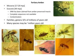
AMBER
AMBER. Areal Mean Basin Estimated Rainfall COMET Hydromet 00-3 Robert S. Davis, Pittsburgh WFO. AMBER Overview. All watersheds in county warning area are defined to a Minimum Basin Area (MBA) of 2 mi 2 to show spatial rainfall distribution.

AMBER
E N D
Presentation Transcript
AMBER Areal Mean Basin Estimated Rainfall COMET Hydromet 00-3 Robert S. Davis, Pittsburgh WFO
AMBER Overview • All watersheds in county warning area are defined to a Minimum Basin Area (MBA) of 2 mi2 to show spatial rainfall distribution. • The WSR-88D polar grid (1o by 1km) is mapped to the defined watersheds. • Average Basin Rainfall (ABR) is computed for each watershed every volume scan. • An hourly ABR rate is determined from the single volume scan (5-6 min.) of ABR.
National Basin Delineation • 30Sep1999 – NWS agrees to fund the AMBER National Basin Delineation project by NSSL for all of the United States. • ArcInfo used to define the watershed boundaries. • USGS 1 arc second (30 m) DEM data supplied by EROS Data Center. • www.nssl.noaa.gov/teams/western/basins
Pfastatter System Proposed and Applied on a Global Basis (GTOPO30) Kristine and John Verdin Senior Scientists EROS Data Center Journal of Hydrology 218 (1999) 1-12
Coding - Basins • First requires identification of the four largest tributaries, according to the criterion of area drained. • These are assigned the numbers 2, 4, 6, and 8, in the order in which they are encountered as one goes upstream along the main stem.
Basin Boundary 8 6 4 2 Basin Boundary Interbasin Boundary Streamline
Coding - Interbasins • The interbasins are numbered 1, 3, 5, 7, and 9, again working upstream from the mouth of the main stem. • Interbasin 1 is the area drained by the main stem between the mouth of basin 2 and the mouth of the main stem. • Closed basin is assigned the number 0 (zero)
Basin Boundary 8 9 7 6 5 4 3 2 Basin Boundary 1 Interbasin Boundary Streamline
AMBER Watershed Division • All watersheds in the county warning area are divided into hydrologic segments no larger than 10 mi2. • A Minimum Basin Area of 2 mi2 is used in the initial NSSL stream creation procedure. • Each forecast office may modify the NSSL stream database (subdivide or aggregate).
AMBER 10 mi2 Watersheds • Operational 01May1985 • Basins defined on “Fishing stream map of Pennsylvania. • Color Graphics display of WSR-57 rainfall estimates RADAP-II data (2o x 1 nm grid) • 36 county map backgrounds with overlay of defined streams watersheds. • No ABR computation.
Pine Creek Flash Flood May 30, 1986 Pine Creek #1061 2 Area 68mi 2" PBZ WSR-88D 4" Min/Max AZRAN 6" 044° at 11km Allison 101° at 27km Park Allegheny Etna River
Pine Creek Pine Creek #1061 Flash Flood 2 Area 68mi May 30, 1986 5172 5173 5171 2 5.5mi 2 10.1mi 2 4.3mi 5174 5170 2” 13.9mi 2 2 3.7mi 4” 5169 5167 Little Pine Creek 8” 2 4.1mi 5168 Little Pine Creek 5167 6” 5169 Gourdhead Run 5168 2 8.3mi 5170 Crouse Run 2 6.2mi 5171 Willow Run 5172 Montour Run 5173 North Fork Pine Creek 5174 Headwaters Pine Creek Allegheny 0 4km River
DHR WSR-88D Bin AssignmentPolar grid 1o by 1km • DHR grid is mapped to all defined watershed segments. This allows ABR computation in 5-6 minute time steps. • DHR grid is mapped to all defined Urban Areas to compute ABR urban rainfall. • Single 1km DHR bins are assigned to location of all rain gages, allowing gage comparison with radar estimated rainfall.
Little Pine Creek #5168 78o 80o 82o 6380 2.4mi 2 84o 6379 86o 1.6mi 2 88o 6378 90o 2.1mi 2 92o 94o 22.5km 96o 24.5km 26.5km RADAP-II 30May1986 ABR 1930 - 2100 UTC 6380: 7.09 in 6379: 6.35 in 6378: 3.55 in 5168: 5.70 in
watershed boundary 2 0.35mi 2 0.34mi 2 0.35mi * Average * 50dBZ * * 42dBZ 52dBZ Reflectivity 2 Scans 1.4 Z = 300R AVERAGE BASIN RAINFALL (ABR) .08 x + .35 ) x .35 ( .34 + .25 .35 x ABR = = 0.228" (.34 + .35 + .35) Rate = 0.228 X 10 = 2.28 in/hr 53km 52km 51km 50km 91° 0.93km 0.87km 90° 1km 1km 1km 6min RAIN: 0.08" 0.25" 0.35"
Pine Creek Aftermath • RADAP-II provided excellent rainfall estimates for bucket survey gages and for ABR in watersheds down to 3mi2 . • Disaster survey team recommended that a 1-hour flash flood guidance (FFG) be initiated. • Analysis of flash flood watersheds needed to be reduced from 10 mi2 to at least 3mi2.
AMBER 3 mi2 Watersheds • Operational 01May1990 (RADAP-II data) • MBR and ABR computations. • 01June1993 WSR-88D Installed. • Operational 01May1996 (WSR-88D data) • Watershed analysis accomplished on 7.5 minute topographic maps and MBA reduced to 3 mi2. • ABR computations only.
Flash Flood Threat and ABR • Severity of flash flooding is directly related to the observed ABR in a watershed. • The time period of the ABR determines the ABR rate. The higher the ABR rate, the greater the risk of serious flash flooding. • ABR varies as function of watershed area. As watershed area increases, ABR and ABR rate tend to decrease.
FF Scale for Flash FloodingABR in inches • FF0 ABR = FFG to < FFG + 0.5 • FF1 ABR = FFG + 0.5 to < FFG + 1.5 • FF2 ABR = FFG + 1.5 to < FFG + 2.5 • FF3 ABR = FFG + 2.5 to < FFG + 3.5 • FF4 ABR = FFG + 3.5 to < FFG + 4.5 • FF5 ABR = FFG + 4.5 to < FFG + 5.5 • FF6 ABR = FFG + 5.5 or higher.
ABR Rate • Based on 5-6 minute observed ABR. • Hourly ABR Rate = ABR x 3600/vsec, where vsec= the number of seconds in the volume scan. • ABR Rate is used to identify watersheds currently receiving the heaviest rainfall, before the flash flood producing accumulation occurs.
AMBER Z/R Gage Comparison • The single 1km DHR bin that contains the rain gage is used to compute the radar rainfall estimate. • Tropical vs. Standard Z/R usage can be estimated using 15 minute gage data. • Gage comparisons should be done to verify validity of the WSR-88D rainfall estimates.
Pitcairn, PA Flash Flood 01-02July1997
2 147mi ALLEGHENY COUNTY WESTMORELAND COUNTY WASHINGTON COUNTY 2 446mi BRADDOCK M.A.P. WATERSHED BOUNDARY 0.05 TURTLE CREEK 0.35 3.76 1.71 1.38 PITCAIRN 0.29 0.92 N 0.32 M.A.P. RAIN GAGES (in) 24-HOUR RAINFALL ENDING 1200 UTC 02JULY1997 CITY OF PITCAIRN 0.23 0.07 0 10km
2 147mi 2 24.0mi 2 26.9mi 2 28.2mi 2 10.2mi MONONGAHELA RIVER ALLEGHENY COUNTY 2 22.4mi 2 34.8mi WESTMORELAND COUNTY TURTLE CREEK WATERSHED AVERAGE BASIN RAINFALL (ABR) 0.76 01-02JUL1997 01/2200- N 02/0015 UTC 1108 2306 2303 1.21 0.74 1.73 2307 X.XX = ABR (in) 0.12 PITCAIRN 2304 2305 0.41 0.16 1108 = TURTLE CREEK(1) 2303 = TURTLE CREEK(2) 5km 0 2304 = BRUSH CREEK(1) 2305 = BRUSH CREEK(2) 2306 = TURTLE CREEK(3) 2307 = TURTLE CREEK(4)
WATERSHED BOUNDARY TURTLE CREEK 2 5323 = DIRTY CAMP RUN 3.3mi 2 5328 = ABER'S CREEK 10.4mi AVERAGE BASIN RAINFALL (ABR) 01-02JUL1997 01/2200 - 02/0015 UTC 4149 = GATEWAY MIDDLE SCHOOL 4229 = HOLIDAY PARK IFLOWS I-76 N 4229 ROADS 5328 (1.49) (x.xx) = ABR (in) MURRYSVILLE PA-22 5323 4149 PA-22 (2.64) PITCAIRN I-76 3km 0
10.4mi 2 6308 = HEADWATERS OF ABER'S CREEK 4.7mi 2 1.9mi 2 2.4mi 2 TURTLE CREEK 39-44km FROM KPBZ WSR-88D (ABR) AVERAGE BASIN RAINFALL 01-02JUL1997 01/2200 - 02/0000 UTC ABER'S CREEK #5328 (1.49) ABER'S CREEK SUBDIVISIONS 6306 = THOMPSON RUN N 6307 = PIERSON'S RUN (0.39) #6308 I-76 (1.68) HOLIDAY PARK IFLOWS #6307 #4229 1.26 in. (3.21) #6306 PA-22 MURRYSVILLE PA-22 GATEWAY MIDDLE SCHOOL #4149 3.30 in. I-76 (x.xx) = ABR (in) 0 3km
Thompson Run Flooding • Three feet of water was reported on Route 22 near the outflow of Thompson Run into Aber’s Creek at 2320UTC. • Route 22 is the main parkway through the eastern suburbs of Pittsburgh. • The road was closed for almost an hour due to the high water.
3.3 mi 2 1.5 mi 2 DIRTY CAMP RUN(1) 1.8 mi 2 01-02July1996 01/2200 - 02/0015 UTC ELEMENTARY SCHOOL 38-41km FROM PBZ WSR-88D TURTLE CREEK DIRTY CAMP RUN #5323 (2.64) DIRTY CAMP RUN(2) N #6305 (3.16) #6304 (1.97) (x.xx) = ABR (in) PITCAIRN 2km 0
Pitcairn Flash Flooding • About 10 million dollars of flood damage occurred in the city of Pitcairn. • Residents in Pitcairn reported that Dirty Camp Run was up near bankfull before the heavy rain began in town. • The peak of the flooding in Pitcairn occurred from 01July/2330 UTC to 02July/0030 UTC.
Tropical Z/R Cases • Standard Z/R: Z = 300R1.4 • Tropical Z/R: Z = 250R1.2 • Maximum Rate Cap 5.0 in/hr? • Tropical Storm not required!!!
Standard and Tropical Z/R 8 7 6 5 Z=300R1.4 4 Z=250R1.2 3 2 1 0 38 41 44 47 50 53 56 35
AMBER Case Study Fort Collins, CO 28-29July1997
SPRING CREEK FLASH FLOOD 28-29JUL1997 LARIMER COUNTY, CO 1022 4001 13.2 mi 2 CACH LA POUDRE RIVER 4000 5062 5063 2 2.0 mi 2 6.6 mi 1022 = SPRING CREEK 5064 5062 = SPRING CREEK(1) 2 4.6 mi 5063 = SPRING CREEK(2) BURLINGTON 5064 = SPRING CREEK(3) NORTHERN 4000 = FORT COLLINS (EAST) 4001 = FORT COLLINS(WEST)
SPRING CREEK RADAR RAINFALL DENVER WSR-88D 5 TROPICAL Z/R 28JUL97 2327Z TO 5 29JUL97 0500Z 4 (inches) 1022 3 5.96 Max Rain 7 in/hr 4001 7.63 6.03 RAIN 6 2 GAGES(in) 6.62 8.74 4000 RANGE IN 5.29 8.95 KILOMETERS 7 8.50 1.00 10.15 8.65 5063 3.89 5062 7.37 11.24 9.97 100 7.20 2.38 9 10.00 11.75 o 334 7.89 10 99 o 332 o 333 9.26 13.07 2 98 5064 1022 = SPRING CREEK o 331 11.15 5062 = SPRING CREEK(1) 10.74 97 5063 = SPRING CREEK(2) 8 o 330 96 5064 = SPRING CREEK(3) 10.62 4 5 3 4000 = FORT COLLINS (EAST) 5 o 329 6 6 4001 = FORT COLLINS(WEST)
SPRING CREEK RADAR RAINFALL DENVER WSR-88D 5 TROPICAL Z/R 28JUL97 2327Z TO 5 29JUL97 0500Z 4 (inches) 1022 3 4.67 Max Rain 4 in/hr 4001 6.05 4.70 RAIN 6 2 GAGES(in) 5.21 6.57 4000 RANGE IN 3.70 6.79 KILOMETERS 7 6.47 0.88 7.33 6.11 5063 2.78 5062 6.38 7.56 7.57 100 4.98 1.90 9 7.13 8.36 o 334 6.42 10 99 o 332 o 333 7.69 8.95 2 98 5064 1022 = SPRING CREEK o 331 8.26 5062 = SPRING CREEK(1) 7.82 97 5063 = SPRING CREEK(2) 8 o 330 96 7.88 5064 = SPRING CREEK(3) 4 5 3 4000 = FORT COLLINS (EAST) 5 o 329 6 6 4001 = FORT COLLINS(WEST)
AMBER Case Study Dallas, Tx Flash Flood 05May1995
Dallas, TX 1000 Turtle Creek (3.95in) 2 8.6mi Flash Flood I-635 06May1995 TOLLWAY 7775 1001 Knights Branch (3.66in) 2 5.3mi ABR 1002 0100- 1002 Bachman Br. 7755 NORTH 0300UTC (3.82in) 2 2.1mi LOOP 12 7735 1003 Cedar Branch 1001 1000 (3.55in) 2 2.1mi DALLAS 6895 16 17-18 1-6 1004 Local 7 1535 12 (3.26in) 2 1.3mi 6855 1003 155 1005 6775 1005 Urban SMU- 8? 1004 1955 Cotton Bowl 2 8.2mi (4.07in) 6715 1855 TRINITY RIVER I-30 10 Rain Gage 0 2km 13-15 9 Location of fatality 11