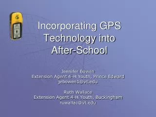
Incorporating GPS Technology into After-School
Incorporating GPS Technology into After-School. Jennifer Bowen Extension Agent 4-H Youth, Prince Edward jebowen1@vt.edu Ruth Wallace Extension Agent 4-H Youth, Buckingham ruwallac@vt.edu. What is GPS?. Global Positioning System Consists of Three Parts Space segment (satellites)

Incorporating GPS Technology into After-School
E N D
Presentation Transcript
Incorporating GPS Technology into After-School Jennifer Bowen Extension Agent 4-H Youth, Prince Edward jebowen1@vt.edu Ruth Wallace Extension Agent 4-H Youth, Buckingham ruwallac@vt.edu
What is GPS? • Global Positioning System • Consists of Three Parts • Space segment (satellites) • Control segment (send signals to satellites) • User segment (you and your GPS receiver)
What do you do with it? • Learn to set waypoints and navigate among waypoints • Leave a “bread crumb trail” • Navigate to given coordinates (geocaching!) • Much more!
Why GPS? • Technology appeals to youth! • Pulls in an older audience (great for middle school age) • Flexible format • Great for teambuilding/group activities • With childhood obesity on the rise, geocaching promotes an appreciation of the outdoors and encourages physical activity.
Settings • In-School Programs • After-School Programs • Camp Classes • Weekend Program • Day Camp • Clubs
Program Content • How the GPS systems works (3 parts) • Basic operations • Setting waypoints • “go-to” function • Entering coordinates • Map and Compass/Orienteering • Computer Software Applications
After-School Programs Three-day Format Day One: • What is GPS? (Powerpoint presentation) • Getting to Know Your GPS Receiver • Marking a Waypoint Day Two: • Navigating with GPS – Routes and TracBack Day Three: • High Tech Treasure Hunt
Techno-Treasure Hunt Day Camp • Why Have a GPS Day Camp? • Format • Content • Evaluation • Risk Management Considerations • Other Considerations • Continuing Activities • Resources • Group Activities
Why Have a GPS Day Camp? • Youth are more technologically savvy • It captures their interest • Youth need quality summer programming in a safe, supervised environment • Allows youth an in-depth look at GPS technology
Format • Three days • Six hours each day • Youth ages 9–13 • Everything done in groups – requires trained adult and teen leaders to work with each group
Format • Combination of classroom learning, hands-on learning, and field exercises • Teens and adult volunteers are assigned to each group and are able to offer individual assistance
Content Day 1 • Intro to GPS • Hands-on basics of using receivers • How to read and use topographic maps • Using GPS and Topo maps together • Introduction to Geocaching (website)
Content Days 2 and 3 • Assign caches to groups • Plug coordinates into GPS receivers • Plot coordinates on topo maps • Travel and Geocaching activites
Intro. to Geocaching Geocaching is an adventure game for GPS users. The basic idea is to have individuals and organizations set up caches all over the world and share the locations of these caches on the internet. GPS users can then use the location coordinates to find the caches. (from geocaching.com) There are various types of caches. All contain a log book and many contain items for trade.
Geocaching Geocaching Etiquette • Cache In, Trash Out (CITO) • Take something only if you leave something (never leave food or other smellables). • Sign log. • Put cache back exactly as you found it. • Never move a cache!
Geocaching Safely Use the buddy system. Beware of terrain/ Look out for wildlife Look out for poison ivy, briars, etc. Mark your starting point as a waypoint (in case you get lost). Drink water (but not from a stream). Geocaching
Evaluation • Daily wrap up and review • Observation • Daily Journal
Risk Management Issues • Scout locations!!!! • Insurance • Bus Use Agreement • Plans in place for • Heat • Injury • Communication • Prepare youth for • Poison Ivy • Wildlife Encounters • Terrain
Other Considerations • Obtain Materials • GPS receivers • Maps • Radios • Build in “Fun Times” • Sign-up, Promotion, Fees, Forms
Continuing Activities • GPS Club • Hiding Caches
Community Mapping • Integration of GPS and GIS technologies • Youth mark waypoints of community features • Plot coordinates on maps using ArcView software
State Park Partnerships • Partnered with staff at James River State Park, Holliday Lake State Park, and Twin Lakes State Park to set up geocaches. • Geocaches established to highlight areas of natural or historical significance and to promote recreational trail use.
Comments from Geocachers • December 30, 2005 by Grinch & Gremlin (39 found) We didn't know this state park existed, so it was nice to discover it and to take a pleasant walk at the end of the day. SL. T: pedometer L: a geode from Brazil. We also took the killer bee travel bug. TFTC! • July 21 by 5K-HILLS (3 found)Also, found this one while learning about geocaching from Ranger Dawn in the park. • October 14 by Troop249Nelson (1 found)This was the very first geocache found by Girl Scout Cadette Troop 249. Finding this cache (and learning how GPS works) helped us earn our Orienteering badge. WE HAD SO MUCH FUN!! We can't wait to go on our next hike or camping trip to find more!! T: Army Men L:Angel SL.
Addressing Park Concerns • Geocaches are never buried – no digging required • Park sets parameters for cache placement (ex: distance from trail) • Caches are reviewed to insure appropriate content • Parks/Rec staff consider risk vs. increased usage and recreational opportunities
Rewards • Can draw new youth and adults into your program (those with a specific interest in technology) • Program participants learn about the global positioning system and how to use a handheld GPS unit • Participants get outside and get moving while participating in a fun recreational activity
4-H GPS Websites http://www.ext.vt.edu/resources/4h/environment/gpsgis.html http://4h.unl.edu/kids/gpsgeocaching.htm http://www.umext.maine.edu/Waldo/4H/4HGPS.htm http://nys4h.cce.cornell.edu/research/GeospatialScienceand4-H.php Garmin.com Geocaching.com Groundspeak.com Earthcache.org Resources