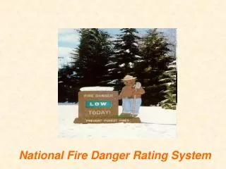
Fire Danger Rating System
This project focuses on the development of a Fire Danger Rating System by integrating multiple weather data outputs, such as wind speed, temperature, humidity, rainfall, and surface pressure, across 1567 locations. The data is stored in an MS Access database and analyzed with the Spatial Fire Management System (SFMS) to compute Fine Fuel Moisture Code (FFMC) and Fire Weather Index (FWI) values. Results will be overlaid on peat maps to identify areas with high forest fire occurrence risk, guiding further TAPM analysis for peat soil assessments.

Fire Danger Rating System
E N D
Presentation Transcript
Process • CCAM outputs extraction: • Wind speed and direction • Temperature • Humidity • Rainfall • Surface pressure • 1567 locations • Saving the data into MsAccess database format • Reading the database using SFMS (Spatial Fire Management System) to get the FFMC (Fine Fuel Moisture Code) and FWI (Fire Weather Index)
1567 points used 128 BMKG weather stations 1439 counties all around Sumatra and Kalimantan
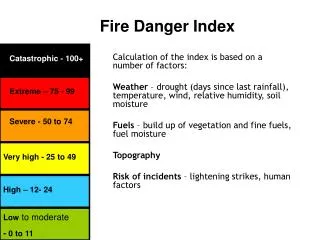
Next Process • Overlaying SFMS output onto peat map • The area covered with red color on the map has a big probability of forest fire occurrence • If so, TAPM runs using CCAM output converted to TAPM synoptic data
+ = RED -> extreme Peat soil Running TAPM