Download
1 / 35
350 likes | 522 Vues
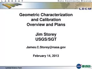
Geometric Characterization and Calibration Overview and Plans Jim Storey USGS/SGT James.C.Storey@nasa.gov February 14, 2013. Landsat Science Team. Overview. Prelaunch Calibration Geometric Calibration Goals OLI Prelaunch Testing TIRS Prelaunch Testing Commissioning Period

E N D
Geometric Characterizationand CalibrationOverview and PlansJim StoreyUSGS/SGTJames.C.Storey@nasa.govFebruary 14, 2013 Landsat Science Team
Overview • Prelaunch Calibration • Geometric Calibration Goals • OLI Prelaunch Testing • TIRS Prelaunch Testing • Commissioning Period • Launch to Underfly • Underfly to WRS-2 Orbit • Final Orbit to Commissioning • Operations Period • Routine Performance Characterization • Ongoing Calibration Activities • Key Performance Requirement Evaluation • Issues and Worries • Spacecraft • OLI • TIRS • Summary • Backup Charts • On-orbit Geometric Calibration Details
Prelaunch Calibration Landsat Science Team
Geometric Calibration Goals • The objective of OLI/TIRS geometric calibration is to construct a line-of-sight (LOS) vector for each active detector, that can be related to the spacecraft attitude and ephemeris data • Using the detector LOS vector in conjunction with the attitude and ephemeris data, we project the LOS to find its intersection with the Earth’s topographic surface • We use instrumentdesign information, adjusted based upon prelaunch measurements, to determine along- and across-track viewing angles for each detector, relative to the instrumentcoordinate system • These prelaunch OLI and TIRS LOS models will be refined on-orbit if necessary • When the instruments are integrated with the spacecraft, we measure the alignment of the OLI, TIRS, and spacecraft coordinate systems to relate the instrumentLOS models to the spacecraft navigation coordinate system used by the attitude control system (ACS) • The OLI-to-ACS and TIRS-to-OLI alignments will be measured on-orbit to account for launch shift, zero-G release, and any seasonal thermal effects Landsat Science Team
LOS Calibration Process Overview • Initial OLI and TIRS LOS maps were constructed from the instrument design information • View angles were constructed for each detector using models of the focal plane layout and optical system performance • The LOS map was used to derive a set of Legendre polynomial coefficients and corresponding detector offset table • Each band on each sensor chip assembly (SCA) has a set of Legendre coefficients • The OLI LOS model uses 2nd order Legendre polynomials • The TIRS LOS model uses 3rd order Legendre polynomials • The TIRS LOS model also includes a scene select mirror (SSM) pointing model • These modelswere used for image simulation and algorithm development • The design-based LOS map was refined based on prelaunch detector LOS measurements taken during prelaunchtesting • An “as-built” prelaunch LOS map was constructed by adjusting the optical and focal plane placement parameters to fit the prelaunch measurements • This LOS map was used to derive a new set of prelaunch Legendre polynomial coefficients and corresponding detector offset table • On-orbit LOS model calibration corrections will be computed and applied if necessary by adjusting the Legendre coefficients Landsat Science Team
OLI SPAtial Test Set (SPATS) Configuration • Spatial Testing Equipment • Horizontal Collimating Assembly (HCA) • Produces collimated beam for OLI • Integrating Sphere • Back-illuminates Target Assembly • Target Assembly • Contains Knife Edge and Slit targets at focus of HCA • SPATS projects selected target (e.g., slit, edge) onto OLI focal plane while measuring target position • Test fixture orients OLI relative to HCA • Target and test fixture telemetry are recorded and time tagged • All measurements performed in thermal vacuum chamber Source Assembly Contains Integrating Sphere & Target Assembly HCA Calibration Mirror OLI on Test Fixture HCA Collimator HCA Fold Mirror 2 HCA Fold Mirror 1 Landsat Science Team
OLI Prelaunch LOS Characterization • Effective focal length, optical distortion parameters, SCAlocations, and SPATS alignment parameters were adjusted to fit the slit scan and continuous edge scan measurements to the LOS map • The adjusted LOS map was used to derive an updated prelaunch LOS model (Legendre coefficients and detector offset table) • The LOS locations of selected detectors were measured by scanning slit and edge targets across the detectors • Slit target moved across detector in discrete steps – “step-stare” scan • OLI imagery was recorded continuously, with time codes • Target position telemetry was also recorded and time tagged • For subsequent correlation with imagery • Horizontal and vertical slits were used to measure both directions • Results were verified with continuous edge scans • Edge scans provide measurements for all detectors Landsat Science Team
OLI Prelaunch Spatial Characterization Even and Odd Detectors Align Adjacent Detectors Sample Vertical Edge Scan Sample Horizontal Edge Scan • Analyzed all of the prelaunch SPATS knife edge test data • Yields edge response slope, half edge extent, overshoot/undershoot, ripple, angular sample distance, and aliasing performance Landsat Science Team
TIRS Prelaunch Geometric Characterization LOS Target Disk Target • TIRS TVAC2 testing generated data used for prelaunch spatial and geometric (line-of-sight) characterization • Collected large disk targets for spatial characterization • Collected 2-pixel “point” targets for line-of-sight measurement • Collected an array of target points across each TIRS SCA • TIRS data collected in “frame” mode • 2D image window read off focal plane instead of just science rows • This is an alternate data collection mode for the TIRS focal plane • Allows for 2D analysis of targets • Centroiding LOS targets • 2D spatial response modeling
TIRS Prelaunch LOS Model Construction • The LOS targets were measured and used to update the TIRS focal plane layout and SSM alignment parameters • Targets were measured at three different SSM positions to allow for SSM pointing characterization • Used to update initial models developed from design and refined in TVAC1 testing • TVAC2 results were used to update the TIRS LOS model • New Legendre coefficients and detector offsets were generated and stored in the CPF
Geometric Commissioning Plan • Geometric Commissioning Plan has been drafted, containing 22 tasks and associated schedule • Launch to first light – 2 tasks • First light to WRS-2 orbit - 14 tasks • Operational orbit – 6 tasks • These tasks cover: • Performance characterization • Geometric • Spatial • Geometric calibration refinement • Analysis of special data sets • Off-nadir data • Initial lunar scan data • Stellar acquisitions • Jitter testing • On-orbit requirements verification • Reporting results • Commissioning activities will be coordinated with the OLI and TIRS instrument teams
Launch to First Light • Task 1: Process and analyze X-band test data • Examine OLI test pattern data from X-band test • X-band test will use OLI test pattern generation capability in which frame and line headers are real but imagery is replaced with test pattern. • Examine Spacecraft Ancillary Data for Earth-pointing imaging interval • Ensure that attitude and ephemeris data are as expected • Task 2: Monitor attitude control system (ACS) calibration • Monitor the ACS calibration activities performed by Orbital and the Flight Operations Team • To understand attitude determination performance • To capture updates to ACS flight software parameters relevant to ground processing, such as the body-to-SIRU alignment, and update CPF if necessary
First Light to WRS-2 Orbit (1 of 4) • Task 3: Process first TIRS Earth image acquisition • TIRS should be ready for imaging on or about DSL 23 • The first TIRS scene will be used to verify the TIRS LOS coordinate system • Task 4: Process first OLI Earth image acquisition • First OLI/TIRS coincident imaging operations planned for DSL 31 • Look for internal geometric consistency: detector misalignment (detector deselect errors), band misregistration, or SCA-to-SCA discontinuities • Task 5: Initial OLI alignment calibration • Perform initial OLI alignment calibration to bring systematic accuracy within range of automatic GCP processing • Task 6: OLI-TIRS Co-Alignment Check • Measure OLI-TIRS offset manually to perform initial coarse alignment update to get TIRS alignment calibration within range of automated tools • Compare OLI and TIRS cross-track fields of view to verify instrument co-alignment
First Light to WRS-2 Orbit (2 of 4) • Task 7: OLI Focus Check • OLI will acquire scenes of pre-identified focus check sites, some of which are also MTF characterization sites, to support a visual check on focus quality • Task 8: TIRS Focus Check • Examine TIRS scenes acquired with different focus settings • Task 9: Initial on-orbit geometric calibration • An initial calibration will make subsequent data processing work better • Perform an OLI sensor alignment calibration update • Run OLI band registration characterization/calibration and update test CPF • Run TIRS alignment calibration and update test CPF • Run TIRS band registration characterization/calibration and update CPF • Task 10: TIRS scene select mirror update • If the OLI-TIRS co-alignment is OK, this task will be cancelled • If OLI-TIRS co-alignment is poor (per task #6): • Coordinate with TIRS instrument team • Determine SSM roll correction desired to improve co-alignment
First Light to WRS-2 Orbit (3 of 4) • Task 11: Analyze off-nadir data • Characterize off-nadir performance • Run all geometric characterizations (geodetic accuracy, geometric accuracy, OLI and TIRS B2B, off-nadir to nadir I2I) on off-nadir data • Order and process a high latitude off-nadir scene that looks outside the WRS to demonstrate that all algorithms still work • Collect nadir then off-nadir then nadir data along path 174 • Analyze test data to demonstrate pre- and post-maneuver geometric accuracy • Task 12: Lunar data processing • Process first set of lunar images (days 44-45) • Process all 15 OLI SCA scans to demonstrate lunar processing algorithms • Run band registration characterization/calibration to check cirrus band alignment • Process TIRS lunar scans to demonstrate feasibility of TIRS lunar processing • Repeat for subsequent lunar acquisitions • Compare results to demonstrate stability of lunar measurements • Task 13: Pre-WRS on-orbit calibration update • Update OLI sensor alignment cal using data acquired through the underfly • Review all OLI focal plane calibration data • Repeat TIRS alignment calibration and band alignment cal • Create updated CPF containing best calibration parameters derived prior to ascent to final orbit
Simulated OLI Lunar Image L1G data processed by IAS Level 0R data (with 8X oversampling) produced by data simulator
First Light to WRS-2 Orbit (4 of 4) • Task 14: Jitter characterization • Phase 1: Baseline jitter characterization • Examine attitude data for disturbance harmonics and high frequency content • Run pan band image-to-image registration accuracy characterization using dense along-track tie point sampling • Correlate tie points positions with time and plot tie point residuals vs. time to look for uncompensated jitter effects • Examine accumulated OLI and TIRS band registration characterization data for requirements conformance and consistency • If results are problematic, present to project Engineering Review Board for approval to execute phase 2 jitter testing (e.g., SADA dithering test) • Phase 2: Alternate observatory configurations (if necessary) • Repeat jitter analyses for data acquired in new observatory configurations • SADA dithering mode • TIRS cryocooler frequency tuning • Reaction wheel speed bias change • Task 15: OLI MTF (spatial) analysis • Analyze all usable OLI MTF targets using the updated CPF from task 13 • Verify that the set of bridge targets are providing consistent results • Generate an estimate of OLI spatial performance • Task 16: OLI stellar calibration data analysis • Analyze stellar calibration acquisitions to check OLI-to-ACS alignment
WRS-2 Orbit (1 of 2) • Task 17: Run-for-record CPF update • Automated processing of all acquired cal scenes should be available once we are on the WRS-2 orbit • Apply any final updates to the CPF and coordinate values with BATC and TIRS to define consensus on-orbit CPF • Task 18: Run-for-record geometric characterization • Collect geodetic accuracy performance data from all scenes processed to L1T • Collect geometric accuracy performance from scenes with validation points • Collect OLI and TIRS band registration accuracy results at band registration calsites • Image-to-image registration accuracy will be characterized • Reprocess and analyze all available MTF target sites • Task 19: OLI requirements verification • The subset of OLI requirements deferred for verification on-orbit are documented in the OLI On-Orbit Acceptance Plan • Some are performance requirements that could not be verified prelaunch • Some are test requirements that were specified as on-orbit requirements • The On-Orbit Acceptance Plan also identifies requirements that were verified prelaunch that should be confirmed on-orbit • Task #18 provides the data needed to verify these requirements
WRS-2 Orbit (2 of 2) • Task 20: TIRS requirements verification • Only a few TIRS requirements were explicitly deferred to on-orbit verification, but we will verify or re-verify all of the TIRS-related geometric requirements • Results will be provided to the TIRS instrument team for concurrence • Task 21: KPR baseline • Initial evaluation of OLI key performance requirements to establish a performance baseline for subsequent monthly monitoring • KPR #4 – OLI spatial (edge slope) performance • KPR #5 – Swath width • KPR #6 – Coverage • KPR #7 – Band Registration • Task 22: Commissioning Report • Provide summary charts for the On-orbit Acceptance Review • Draft geometric commissioning report
On-Orbit Geometric Characterization • A suite of geometric characterization tools are used to measure performance and provide inputs to the calibration algorithms • LPGS/IAS Geodetic Accuracy Characterization • Measures product accuracy prior to application of ground control • Collected as a byproduct of standard L1T processing • LPGS/IAS Geometric Accuracy Characterization • Measures product accuracy after application of ground control • Collected for scenes containing independent validation GCPs • IAS Band Registration Accuracy Characterization • Measures OLI, TIRS, and TIRS-to-OLI band registration • Uses selected desert and high altitude sites • Also operates on lunar data • IAS Image Registration Accuracy Characterization • Measures OLI-to-OLI or OLI-to-reference image registration • Includes enhancements for measuring high frequency (up to 60 Hz) along-track registration errors to support on-orbit jitter assessment • Cal/Val Tool Kit OLI Spatial (MTF) Characterization • Uses terrestrial (bridge) targets
On-Orbit Geometric Calibration • Three aspects of OLI geometric calibration will be measured and, if necessary, updated post-launch • OLI-to-spacecraft attitude control system alignment calibration • Relates OLI LOS model to spacecraft attitude and ephemeris data • OLI focal plane SCA-to-SCA alignment calibration • Measure and correct for SCA-to-SCA misalignment in the panchromatic band • Corrected by adjusting panchromatic band Legendre coefficients • OLI band-to-band alignment calibration • Measure band registration errors and correct by adjusting multispectral band Legendre coefficients • TIRS geometric calibration will also be refined on-orbit • The orientation of the TIRS instrument relative to the OLI • To ensure good reflective/emissive band registration • Relative alignment of the TIRS SCAs • TIRS 10.8 mm to 12.0 mm band alignment • All of these calibrations will be performed during commissioning and as necessary throughout operations
OLI Key Performance Requirements (KPRs) • The OLI contract includes operations phase incentives and penalties for certain critical performance parameters • Four of these are geometric/spatial • These KPRs will be evaluated monthly for the first 5 years of L8 operations • KPR #4 – OLI spatial (edge slope) performance • Penalties are assessed (by band and along/across-track direction) if the spatial edge slope performance is below critical thresholds • The MTF characterization algorithm generates a KPR-4 assessment report • KPR #5 – Swath width • Any earned incentive fees are forfeit if swath is less than 183 km • Measure directly in scenes acquired at row 60 (equator) • Determine analytically from the LOS model in the CPF • KPR #6 – Coverage • Any earned incentive fees are forfeit if internal data gaps are present • Look for SCA-to-SCA data gaps in row 60 scene(s) • Determine SCA-to-SCA overlap analytically from the LOS model in the CPF • KPR #7 – Band Registration • Positive incentives are available if band registration accuracy exceeds requirements • Penalties are assessed for poor performance • OLI band-to-band registration trending data is usedto generate a report showing measured performance relative to the KPR-7 thresholds
Spacecraft • Star tracker alignment stability • During subsystem level assembly and test, the star trackers had problems maintaining pointing stability through vibration testing and had to be rebuilt • Could happen again through launch, but it might not be a big deal as these appeared to be one-time shifts, which would get calibrated out. • SIRU scale factor stability • The model of SIRU used for L8 has sometimes had problems meeting the scale factor stability specifications. • This worries the ACS team and if they’re worried, I’m worried. • That said, it seems like it would have to get pretty bad to be a serious problem since, unlike L7, we will be getting frequent, accurate star measurements that should allow us to maintain a good estimate of the current SIRU scale factor. • Would probably require some tuning of ACS filter parameters. • GPS reliability and associated clock stability • Observatory level EMI/EMC testing revealed a compatibility problem between the solid state recorder and one of the GPS units that degrades the GPS signal level (though it is still within specifications). • Even intermittent loss of the GPS signal could compromise the stability of the spacecraft clock, which is “disciplined” by the GPS time signal.
OLI • Sensitivity to jitter from the solar array drive assembly (SADA) • The SADA uses a stepper motor that generates disturbances at the stepper frequency and its harmonics. • The stepper frequency varies slowly over an orbit as the SADA maintains solar array sun pointing. • If one or more of the resulting disturbance harmonics excite an OLI resonant mode, it could induce problematic line-of-sight jitter. • This is one of the things we will be looking for in the on-orbit jitter test. • If there is a problem, SADA jitter mitigation is available • The SADA has an alternative operating mode in which the stepper frequency is “dithered” (ramped up and down continuously) so that it does not dwell on a problematic frequency long enough to cause a problem • Sensitivity to jitter from the TIRS cryocooler • Similar issues exist for the TIRS cryocooler • The cooler drive frequency is constant but tunable, so it should be possible to adjust it away from a problematic frequency if necessary • This is also covered by the on-orbit jitter test.
TIRS • Scene select mirror stability and repeatability • The TIRS SSM does not move during imaging, but it rotates to view the calibration sources every orbit • The SSM should return to the same angle prior to every nadir imaging interval, but this remains to be demonstrated on-orbit • TIRS alignment stability • The TIRS Structural, Thermal, OPtical (STOP) model predicted a repeating within-orbit thermal variation in the TIRS alignment • If this is stable and repeatable, it can be modeled and corrected, potentially improving TIRS-to-OLI registration accuracy • If it is larger than predicted and/or not consistent, it could degrade TIRS-to-OLI registration
Summary • The at-launch geometric calibration parameters (e.g., LOS model, alignments) are based upon measurements from prelaunch tests • Initial on-orbit calibration updates will be generated using data collected prior to achieving the final orbit • Some manual intervention may be required to accommodate off-WRS acquisitions that do not align with supporting data sets • Several special analyses are planned during commissioning: • Off-nadir data accuracy, jitter characterization, stellar data analysis • Once the WRS-2 orbit is achieved, a final on-orbit geometric calibration refinement will be applied including: • OLI-to-ACS alignment • TIRS-to-OLI alignment • OLI and TIRS focal plane/SCA alignment • OLI and TIRS band alignment • These “run-for-record” parameters will be used in the on-orbit characterization that will demonstrate requirements compliance • Geometric characterization and calibration will continue during routine operations to monitor system performance
On-orbit OLI-to-ACS Alignment Calibration • OLI scenes will be corrected using a global ground control point (GCP) library derived from the Global Land Survey (GLS) data set • This is done more to provide scene-to-scene geometric consistency than to enhance accuracy • GCP correction will be attempted on all scenes but will revert to systematic (terrain corrected) processing for scenes with excessive cloud cover • Each GCP-corrected scene generates attitude and ephemeris correction parameters that are stored in a database • GCP correction parameters for many scenes are extracted from the database and examined for systematic trends attributable to OLI alignment errors • Results can be evaluated vs. time or location • OLI-to-ACS alignment calibration is updated to remove any residual systematic biases in the GCP correction results • During commissioning, stellar scans will also be used to measure the OLI-to-ACS (star tracker) alignment • Requires special acquisitions with extended detector integration time to image star field
On-Orbit Focal Plane Calibration OLI SCA #7 Reference Image • Digital orthophotoquad (DOQ) reference images of calibration sites are used to measure SCA-specific offsets in the OLI data • The panchromatic band segments from each SCAare geometrically corrected as separate output images • Each separate SCAimage is correlated with the reference image • Tie point measurements are used to adjust the panchromatic band Legendre coefficients for each SCA
On-Orbit Band Alignment Calibration • Band alignment calibration uses band registration measurements of desert sites to align the multispectral bands to the pan band by adjusting Legendre coefficients • Lack of vegetation improves image correlation performance • Software was developed to use lunar images to measure cirrus band registration • Ball performed a special study using Hyperion data to show that the terrestrial method will also work for the cirrus band using sites at suitably high elevation • Hyperion “SWIR1” Band • GloVis Location Plot • Hyperion “Cirrus” Band
TIRS Alignment Calibration • Combines functions of two OLI calibration algorithms: • Focal plane calibration – refine relative locations of TIRS SCAs • Sensor alignment calibration – determine relationship between instrument and spacecraft attitude control system • Uses TIRS-to-OLI band-to-band measurements to determine TIRS-to-OLI alignment matrix and TIRS SCA-specific adjustments • OLI SWIR band image is used as reference • Desert sites in the winter are preferred (see next chart) • Images from each TIRS SCA are individually correlated with the OLI reference to measure both SCA-specific and TIRS global alignment offsets • TIRS-to-ACS alignment is determined indirectly as a composite of the TIRS-to-OLI and OLI-to-ACS alignment matrices • TIRS-to-OLI alignment knowledge and stability is more important than TIRS-to-ACS alignment since it determines thermal-to-reflective band registration accuracy
L7 ETM+ SWIR1 Band (5) Thermal to SWIR Band Registration L7 ETM+ Thermal Band (6) Summer • High temperatures => Contrast reversal • High sun angles Fewer shadows Winter • Lower temperatures • Lower sun angles More (cool) shadows • Measuring thermal to reflective band registration is challenging • Experience with Landsat 7 has shown that desert sites in the cold (winter) season provide good thermal band to SWIR band correlation performance