Download
1 / 17
170 likes | 202 Vues
Explore the quality of pre-advisory model guidance for better tropical cyclone forecasting. Understand forecast consistency, track diagnosis, skill impacts, and future steps for improvement.

E N D
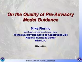
On the Quality of Pre-Advisory Model Guidance Mike Fiorino michael.fiorino@noaa.gov Techniques Development and Applications Unit National Hurricane Center Miami, FL 5 March 2008
We don’t know why… two cat5 TCs in the NIO -- 02A (Gonu) and 06B (Sidr) Global TC Activity 2007 - 34% below normal, lowest since…
“crash of 1999” “crash of 2007?”
Motivations • Forecasting as a data assimilation problem – update previous forecast with new information. The first forecast jump starts the process and because forecast-to-forecast consistency is a (strong) constraint, a good initialization is desirable. Guidance on the guidance in particular CON_ • Many models are first influenced by the first advisory. The transition from an INVEST (9?B) to a numbered system ([0-4]?B and from non-TC (LO, WV, DB, EX) to TC (TD,TS,HU,SD,SS). Diagnosis of the models • Focus on medium-range track (72-h FE): • Extend warning time 72 h (Jack Hayes), MRT still first-order foreast problem • 83% of major hurricanes have 1 or more Rapid Intensity events and 60% occur as the TC first reaches hurricane state (~ 3d), e.g., FELIX - 06L.2007 • Answer the mail – availability of 9X trackers from NCEP for JTWC
Error growth OFCL (analysis) v OFCI (background) WPAC/EPAC/LANT 2005-2007 ~8% / 6 h ; highest 36-48
120 h 90 kts 72 h 115 kts 25W.2004 MEARI – my first WPAC forecast, first JTWC 72-h
Mike’s Lessons Learned from 25W.2004 • first advisory jump starts the 6-h forecast cycle of OFCLcorrectingOFCI with new data and guidance • Know CONW is best aid...but wanted some guidance on what models were part of the consensus, should I do an SCON? (RYOC), favor one model? • Intensity forecast at 72-h was very bad (50 kt), based on synoptic reasoning. did not account for the “flavor” of the TC development in WESTPAC (generally look for reasons NOT to intensify T# / day) – character of TC activity on seasonal time scales a factor (weak constraint) • OFCL 72-h intensity forecasts in the LANT: -17% bias in 2005, +27% bias in 2006, -5% in 2007 – TC development on seasonal time scales a factor?
TC Operational State – Pre/Post Advisory 2007 LANT CARQ BT (best track) Advisories time axis (d): 0.0 = time of first advisory
Model Availability: -24 h – +24 h :: 2007 LANT GFSN06 NGPN06 GFDL06 CONU no 72-h forecast to verify
04L.2007 DEAN GFSN06 missing +0 h NGPS06 missing +6h GFSN06 NGPN06 GFDL06 CONU all models available -24 h
GFSN06 (~AVNI) 04L.2007 DEAN :: -24 h (pre-adv) MEAN FE ~ 50 nm
GFSN06 04L.2007 DEAN :: +24 h (POST-adv) MEAN FE ~ 290 nm
GFSN06 06L.2007 FELIX :: -24 h (pre-adv) model run at all times, but only one verifiable 72-h forecast
GFSN06 06L.2007 FELIX :: -24 h (pre-adv) model run at all times, three made verifiable 72-h forecasts 72-h FE MEAN ~ 75 nm
72-h mean FE Pre v Post (red); Pre v ALL (blue)EASTPAC/LANT 2005-2007 blue circles scaled by # of postitions PRE > post POST > Pre
Model (un)availability in WESTPAC 2007 GFSN06 JGFS06 EGRR06 JUKM06 CONW
Summary • Pre-advisory MRT guidance does have value… • dependence on initial vortex not strong • pre-adv GFS (before relocation) error much lower than post-adv for FELIX (after relocation) • HWRF/GFDL pre- and post- skill impacted similarly • more diagnostics of the model TC vortex analysis • diagnostics of CON • local trackers can fill gaps and should be run based on “bdecks” (working best track) in addition to the CARQ • Next steps… • comm of CARQ to NCEP, monitor running of the NCEP trackers • improve my local tracker – when all else fails • diagnostics of initial TC in the models