Download
1 / 21
210 likes | 239 Vues
Explore the integration of web-based GIS and mobile GIS technologies for efficient wildfire recovery and watershed management. Learn about real-time data updates, wireless networks, and mobile GIS architecture. Join us for a workshop led by Dr. Ming-Hsiang Tsou from San Diego State University.

E N D
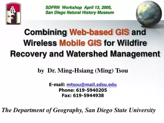
SDFRN Workshop April 13, 2005, San Diego Natural History Museum Combining Web-based GIS and Wireless Mobile GIS for Wildfire Recovery and Watershed Management by Dr. Ming-Hsiang (Ming) Tsou E-mail: mtsou@mail.sdsu.edu Phone: 619-5940205 Fax: 619-5944938 The Department of Geography, San Diego State University
Web-based GIS (Internet GIS) San Diego State University Client (Web browser) + Java applets Internet Map Server (ArcIMS) Web Server (map.sdsu.edu Internet Client (Web browser) + IMS Viewer Client (Web browser) Regional Database (GIS) Server Client The Network is the Computer The Internet is Your GIS.
Provide Easy and Interactive Access (Web browser) to Geospatial Information San Diego Wildfire 2003 Http://map.sdsu.edu
Spatial Query and DisplayFunctions (ESRI ArcIMS examples)combining census data and remote sensing images.
Mobile GIS • Mobile GIS refers to an integrated software/hardware framework for the access of geospatial data and services through mobile devices via wireline or wireless networks (Tsou, 2004). (Notebooks, PDA, Tablet PC, Pocket PC, etc.) WHY mobile GIS • Field works: data collection and validation process, coupled with GPS and wireless communications. • Real-time update / change • GPS integration.
Wireless Local Area Network (WLAN) Wi-Fi or WiMAX Technology • Different from cellular phone communication (CDMA, GPRS) • Fast Transmission Speed, Good for GIS applications (large size of data/images) • Wi-Fi (802.11b, 11Mbps, 2.4 Ghz), Wi-Fi5 (802.11a, 54Mbps, 5GHz). 802.11g, and 802.11n (up to 200Mbps) -- MIMO (multiple input multiple output). Short distance: 300 feet. • WiMAX (available in late 2006) 802.16d, 802.16e (Wireless Metropolitan Area Network (WMAN). 30 – 75 Mbps, 4 – 6 miles
Wireless Mobile GIS IntegrationPrototype Testing (2003 at MTRP) (Notebook Web Server (IIS) + ArcPAD + Blue tooth GPS + Wi-Fi )
User Scenario: Environmental Monitoring and Management Mission Trail Regional Park (short movie) Movies shot before the 2003 Wildfire. After the Wildfire, another testing was conducted by helping the park ranger to evaluate the damages of wildfire and landform changes. (Link to the movie MTRP.wmv)
REASoN Project Real Time GIS for Emergency Response(NASA REASon Project Example) Http://geoinfo.sdsu.edu/reason
Real-time Data Update from Pocket PC (ArcPAD) to Internet Map Server (ArcIMS) Wireless Communication Submit new polygons (Hot-zones) from Pocket PC to Internet Map Server (ArcIMS) via Wi-Fi channel.
Mobile GIS with Real-time Tracking ServerESRI ArcIMS Tracking Server (beta-version) Dynamic Display the location of in-field Agents (Park rangers, Fire fighters, etc.)
Watershed ManagementSan Diego Bay Common Ground Example Http://www.sdbay.sdsu.edu
Web Mapping for Water-quality Monitoring Interactive Mapping (Zoom-in, Zoom-out, Query) Static maps (print out): JPEG or PDF
Related Links and References Thank You Q & A • Http://map.sdsu.edu • Http://map.sdsu.edu/mobilegis • Http://www.sdbay.sdsu.edu • Http://geoinfo.sdsu.edu/reason Books & Papers (PDF available upon request) Internet GIS (book) – (Chapter 9. mobile GIS) http://map.sdsu.edu/gisbook Tsou, M.H. (2004). Integrated Mobile GIS and Wireless Internet Map Servers for Environmental Monitoring and Management, Cartography and Geographic Information Science. 31(3), pp. 153-165. Tsou, M.H. (2004). Integrating Web-based GIS and On-line Remote Sensing Facilities for Environmental Monitoring and Management. The Journal of Geographical Systems, No. 6: 1-20.
Real-time report submission and data upload (from Pocket PC to Server)
Evaluate Land Cover Change by ADAR Images via Internet Map Server (MTRP BMX site)
Education Tools and Outreach Activities San Diego Bay Marine Monitoring Earthquake Chasers
San Diego Emergency Response GIS Data Portal http://geoinfo.sdsu.edu/metadataexplorer Metadata Search Web Mapping Downloadable Data