Download
1 / 28
340 likes | 794 Vues
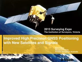
2013 Surveying Expo The Institution of Surveyors, Victoria. Improved High Precision GNSS Positioning with New Satellites and Signals. Nick Talbot Research Fellow, Trimble Navigation Australia. Overview. Introduction GNSS Constellation Status BeiDou System CMRx Format RTK Test Campaign

E N D
2013 Surveying ExpoThe Institution of Surveyors, Victoria Improved High Precision GNSS Positioning with New Satellites and Signals Nick TalbotResearch Fellow, Trimble Navigation Australia
Overview Introduction GNSS Constellation Status BeiDou System CMRx Format RTK Test Campaign Test Results Summary
Introduction Currently 75 GNSS satellites in space Expect to have 90 GNSS satellites in space by 2015; 120 satellites by 2020 45+ GNSS satellites in view over Asia / Pacific simultaneously by 2020 All GNSS satellites are capable of supporting metre-level and high-precision positioning at centimetre-level Following presentation describes some of the challenges presented by new satellites and signals Test results provided to illustrate the benefit of new satellites and signals with latest RTK hardware / firmware
GNSS Spectrum GNSS antennas and receiver RF components expanded to capture usable signals from E5 to G1 spectrum Good compatibility between GPS, QZSS and SBAS signal structure Long term compatibility on L1C and E1 signals with frequency and coding Galileo-E6; BeiDou-B3; and QZSS-LEX bands are to be regulated (limited access), even though B3 can be tracked and used today for RTK E5 E6 E1 L5 L2 G2 G3 L1 L5 G1 B2 B3 B1 L5 L2 L1 LEX RTX / OmniSTAR L5 L1 1614 1525 1237 1565 1551 1571 1214 1164 1189 1585 1590 1257 1579 1260 1300 1599 1559 1217 Frequency [MHz] GPS (US) Galileo (Europe) GLONASS (Russia) InmarSAT SBAS (US) IRNSS (India) QZSS (Japan) BeiDou (China)
BeiDou System Three satellite systems • BeiDou-1 (active ranging system) no Trimble support • BeiDou-2 (current system) used to be called Compass – subject of this talk • BeiDou-3 (proposal to move B1 to L1) first MEO satellites may launch in 2014 Current constellation • 5 GEOs / 5 Inclined GEOs / 4 MEOs / More MEOs in 2014 • GEOs are harder to acquire & track due to high data rate (2ms versus 20ms pre detection interval) • Multipath errors are constant for static users of GEOs
BeiDou System Signals • B1, B2 – supported by Maxwell VI ASIC What’s public • B1 Open Service is “fully” public • B2 is an Open Service – not in the current ICD • B2 is the same signal as B1 so it is supported • B3 is officially a restricted signal – even though current codes appear to follow a defined polynomial
BeiDouBroadcast Orbit Daily Performance –Based on RTX tracking network BeiDou dual-frequency code residuals, 7 May, 2013 RMS [m] RTX Station
CMRx Data Format Additional satellite observations naturally increases the size of the GNSS correction stream GNSS corrections need to be transmitted to rover from a reference station or VRS network Many radio solutions have limited bandwidth CMRx format provides a high level of data compression, with strong resistance to transmission errors
CMRx Data Format vs RTCM 3.x RTCM 3.1GPS (L1, L2) + GLONASS (L1, L2)9600 baud with 1 repeater (426 bytes/s)
CMRx Data Format vs RTCM 3.x CMRxGPS (L1, L2, L5) + GLONASS (L1, L2) + BeiDou (B1, B2)9600 baud with 1 repeater (426 bytes/s) 12 / 12 GLONASS + BeiDou 8 / 8 4 / 4
RTK Test Campaign A test campaign was run in several regions around the world where GPS, GLONASS, BeiDou, QZSS and Galileo satellites are currently visible, including China, Australia and New Zealand Data collected on baselines from 2km – 22km in a variety of environments: • Most in high multipath, trees, significantly masked environments • Some in relatively benign environments • 15 different baselines • Most data collected in China • 22km line from Perth Australia • 6km line from Christchurch New Zealand
RTK Test Campaign Tests conducted with Trimble R10; NetR9 receiver + Zephyr Geodetic 2 antenna, hardware Real-time system testing performed in the field PC version of RTK processor used to process logged GNSS data and analyze performance with various satellite systems enabled / disabled Truth computed using post-processed RTX
Collective Results –Vertical 95% Christchurch, New Zealand
RTK Example – Moderate Environment (Xi’an) Data collected using R10 GNSS receiver in China • Supports GPS/GLONASS/Galileo/QZSS/BeiDou Processed using a PC build of the real-time RTK engine • Operates in the same mode as real-time, no backward processing • Radio latency modeled • Operating mode set to kinematic • Data reprocessed with/without BeiDou Environment was moderately difficult Baseline length approximately 5km • Data collected in Xi’an
Moderate Environment (Xi’an) – Base Station (not a recommended setup) R10 GNSSBase Receiver
Moderate Environment (Xi’an) – Rover R10 GNSSRover Receiver
Galileo RTK • Galileo satellites are currently unhealthy • Trimble firmware is Galileo capable/ready. • Modify firmware to force the satellites to report they are healthy and hence are used in the RTK solution • Evaluate the RTK performance • 2-hour period with 3 Galileo satellites. • 2 identical rovers on an 8.9km line – real time test • Common antenna • Located in Melbourne Australia • RX1 = GPS+GLN+QZSS+BDS+Galileo • RX2 = GPS+GLN+QZSS+BDS
Summary Current BeiDou constellation nearly doubles the number of visible satellites over Asia Additional satellites improve accuracy of position estimates Tests show addition of BeiDou improved 95% position errors by: • 5-75% horizontal • 8-68% vertical Additional satellites help to reduce the overall impact of measurement noise and multipath errors
Summary Similar incremental improvements in position accuracy noted with Galileo satellites in RTK solution Additional satellites lead to increases in RTK correction bandwidth CMRx format designed for increased satellite counts CMRx roughly 55% smaller than RTCM v3.x Expect to see significant improvements in position availability and accuracy when BeiDou, QZSS, Galileo constellations fully populated
Questions?Acknowledgements:Stuart Riley and Sunnyvale TeamEric Leroy (QA)App Firmware TeamHCC/Survey/Infra/InTech H/W TeamTimo Allison, Markus Glocker (Terrasat)TNZ & Westminster field testingXi’an China teamDave Vanden Berg & InTech Beijing