Download
1 / 19
200 likes | 392 Vues
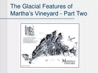
The Glacial Features of Martha’s Vineyard - Part Two. Questions to answer:. How did the ice and water from the glacier form the Vineyard? Why is the Vineyard shaped like it is? Why are some areas hilly and other areas so flat?

E N D
Questions to answer: How did the ice and water from the glacier form the Vineyard? Why is the Vineyard shaped like it is? Why are some areas hilly and other areas so flat? Why are some parts sandy and other areas full of rocks and boulders? How did the freshwater ponds and the saltwater ponds form? When did the Vineyard first form, and how has it changed since then?
Remember how much of North America was covered by ice! • Notice the direction of the ice flow. • Notice where Cape Cod is.
If we could have seen the Cape Cod area, this is what it would have looked like.
Also remember that the edge of the ice was lobed, and was especially loaded with till. (This shot is from Greenland today.)
There were three main lobes of ice that contributed to forming Cape Cod and the Islands. Can you name them?
Notice how these lobes of ice that were in this area are responsible for the shape of the Cape and Islands. Now let’s learn about…
Moraine and Outwash • The two main glacial features of the landscape of Martha’s Vineyard, as well as Cape Cod, Nantucket, the Elizabeth Islands, and Long Island. • They form very differently, but both are glacially formed.
Moraine • Deposited directly by the ice, after the ice melts away. • Sand, silt, gravel, rocks and boulders of all sizes. • Greatest amount of till is along the edges. (Why?) Called terminal moraine or end moraine. • Creates a hilly landscape. • Creates higher elevations. • The northeastern and northwestern sides of the Island.
A typical view of newly formed moraine (from Greenland). Notice all the rocks and boulders.
Outwash (outwash plain) • Deposited by glacial MELTWATER in front of the edge. • Meltwater streams often criss-cross in a “braided” manner. • Mostly just sand and silt. (Why?) • Creates a flat landscape. • Creates lower elevations. • The central (interior) and southern parts of the Island.
A typical view of an outwash plain. Notice the “braided” streams.
On Martha’s Vineyard, there are several of these old meltwater streams (of course they are dry now). • They are like long, shallow valleys. • They are often called the “bottoms”. • You can notice them as you cross over them, driving from Edgartown to West Tisbury.
The bottoms are sometimes called “frost” bottoms, because they can have frost in the morning on ANY DAY of the year. • This makes for very harsh conditions - few trees can tolerate it. • Some very unusual plants live there (tundra plants). • Some very rare insects and birds exist there too.
In one of the bottoms, a clever person built two dams and let rainwater fill the bottom in between them, making a man-made pond. It is called Long Pond.
If you follow the bottoms, they lead to the many coves of the island’s “Great Ponds”.
So the Great Ponds are really just the deepest parts of the bottoms, and have filled with sea water.
Go to “The Glacial Features of Martha’s Vineyard - Part Three, to view the remainder of this PowerPoint.