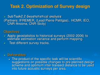
Task 2. Optimization of Survey design
120 likes | 251 Vues
This project, conducted in collaboration with IFREMER and other partners, focuses on applying geostatistics to historical surveys (2002-2006) to improve future acoustic survey designs in the Northern Aegean Sea. The objectives include estimating variance, testing survey tracks, and providing scientific recommendations for optimal inter-transect distances. Techniques such as kriging and mapping software (EVA2, Variowin, Splus, Surfer) will be employed to analyze distribution patterns of anchovy and sardine populations across various years, addressing the specific challenges of complex topography and stratification needs.

Task 2. Optimization of Survey design
E N D
Presentation Transcript
Task 2. Optimization of Survey design • SubTask2.2 Geostatistical analysis (Partners: IFREMER, (Lead Pierre Petitgas), HCMR, IEO, CNR-Ancona, CNR-Sicily) Objectives: • Apply geostatistics to historical surveys (2002-2006) to estimate estimation variance and perform mapping. • Test different survey tracks. • Deliverables • The product of the specific task will be scientific suggestions on possible changes to pre-planned design scheme and optimum inter-transect distance to be used into future acoustic surveys per area.
Northern Aegean Sea survey • Split Beam Biosonics DTX echosounder at 38 kHz • Parallel transects perpendicular to bathymetry, zig zag in gulfs • 10 nm inter-transect distance • Daytime echo collection • 25-30 days required to cover the entire area • 9 000 NM2/ 31.000 Km2 • EDSU was 1 nm
Due to area complex topography and the patchy distribution of the target species: • Need for area stratification • Increase sampling effort in areas of high abundance? • Division based on physical or biological reasons (e.g. topography, bathymetry, differences in the population characteristics) • Parallel transects perpendicular to bathymetry with 10 nm inter-transect distance • zig zag in gulfs
HCMR work on geostatistical analysis • Software used: EVA2, Variowin, Splus, Surfer for krigging and mapping • Total NASC values (2003-2006) • NASC values of anchovy and sardine (2003-2006) • Intrinsic variograms calculated per year and subarea • range, sill and nugget estimations are available • geometric anisotropy examined
2004 2005 2006 2008 Anchovy Distribution maps
2004 2005 2008 2006 Sardine Distribution maps
2008 2005 2006 Nasc Histograms: anchovy
Nasc Histograms: sardine 2008 2006 2005
Geostatistical analysis results • Practically what we have done is stratifying the area into homogeneously sampled areas and applied different structures to each stratum • Anchovy, ln(NASC+1) range: indicates the maximum size of fish patches sill/nugget: percentage of variance explained by the spatial pattern Thracian Sea West Thracian Thermaikos North Evoikos Gulf
Geostatistical analysis results • Sardine, ln(NASC+1) Thracian Sea North Evoikos Gulf West Thracian Thermaikos
Questions concerning the analysis and the peculiarities of Aegean Sea • Is there any alternative to analysis by stratum? • Existing topography does not allow much changes in the zig zag survey design, what are the alternatives? • In some cases strong geometric anisotropy is present. How can this be taken into consideration within the survey design? Generally: • Shall we apply intrinsic and • transitive geostatistics
Work organised with 3 workshops: • at kick-off meeting (23-24 March 2010) • by month 12 ( November 2010, Palma) • by month 21