Download
1 / 25
260 likes | 644 Vues
Lesson 1: Geography of the United States. Geography The study of our natural surroundings and how we interact with them. . REVIEW MAP. Label all of the Continents Label all of the Oceans Label all major Rivers Label the Equator Label the Prime Meridian Label the Northern Hemisphere

E N D
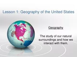
Lesson 1: Geography of the United States Geography The study of our natural surroundings and how we interact with them.
REVIEW MAP • Label all of the Continents • Label all of the Oceans • Label all major Rivers • Label the Equator • Label the Prime Meridian • Label the Northern Hemisphere • Label the Southern Hemisphere • Label the Eastern Hemisphere • Label the Western Hemisphere • *In what hemispheres is North America located?
World Map • SMART MAP • http://www.sheppardsoftware.com/
Globe • The most accurate map of Earth.
Lines of latitude and longitude LATITUDE LONGITUDE Lines on the map that run from the NORTH POLE to the SOUTH POLE. • Lines on the map that circle Earth from EAST to WEST.
CHALLENGE • Find 0 degrees latitude. • What is this line called? ____________________ • List all of the countries that this line intersects:
CHALLENGE • Find 0 degrees longitude. • What is this line called? ____________________ • List all of the countries that this line intersects:
Journaling • Why do you think the GLOBE is divided into lines of latitude and longitude?
Gulf • a large inlet of an ocean similar to a bay but often longer and more enclosed by land. • Example: Gulf of Mexico Find another “Gulf.”
Bay • Curved inlet of sea. • Example: San Francisco Bay Find another “Bay.”
Lake • a large body of water surrounded by land • Example: Lake Michigan Find another “Lake.”
Mouth • the place where a stream or river enters a sea or lake. • Find: A MOUTH
Source • the spring or fountain from which a river or stream begins. • Find the SOURCE of the Mississippi River. • Where is it located? __________________
Tributary • a stream, river, or glacier that joins a larger stream, river, or glacier, or a lake.
Mountain Range • A series of connected mountains. • Mountain Ranges in North America: Appalachian Mountains And ______________
Plains • Vast, open land. • Name the region of the US that is mainly plains.
Peninsula • a narrow piece of land that juts out from the mainland into an area of water • Example: Yucatan Peninsula Where is this located?
Cape • a point of land that juts out into water • Example: Cape Cod Where is this located?
Valley • a very low area of land that is surrounded by higher ground (mountains). • Example: Sacred Valley Where is this located?
Delta • a triangular area of sand and soil at the mouth of a river. • Example:
Island • A piece of land surrounded by water. • Name other Islands!
Sea • A great (___________) body of saltwater that covers a large portion of the Earth. • Example: Black Sea Where is this located?
Map Challenge • Make your land! • Directions • Rubric