Download
1 / 9
120 likes | 324 Vues
Selected GIS Applications in Civil Engineering CE 525 April 3, 2012. http://www.stantec.com/. Geographic Information Systems (GIS) Capabilities

E N D
Selected GIS Applications in Civil EngineeringCE 525April 3, 2012
http://www.stantec.com/ Geographic Information Systems (GIS) Capabilities Stantec, founded in 1954, provides professional consulting services in planning, engineering, architecture, interior design, landscape architecture, surveying, environmental sciences, project management, and project economics for infrastructure and facilities projects. Continually striving to balance economic, environmental, and social responsibilities, we are recognized as a world-class leader and innovator in the delivery of sustainable solutions.Stantec utilizes GIS to capture, update, manipulate, analyze and display spatial data to assist our engineers, planners, scientists and other technical professionals in communicating the results of real-world analyses to others through the use of cartographic representations such as maps and pictures.Stantec's GIS and Information Management Skills include:* Application Development* Data Collection & Conversion* Database Management* Mobile Solutions* Needs Analysis & Implementation Planning* Systems Integration* Technical Analysis* Training* Web Portal Services
http://www.byers.com/gis_consulting.html GIS Consulting Byers Engineering Company offers expert consulting services in Geographic Information Systems (GIS) to the communications, electric, and government industries. We have experience working on various GIS platforms such as ESRI® and Intergraph® as well as our own SpatialAge Suite of GIS Tools. We provide solutions for our clients’ business problems by implementing cost-effective and efficient GIS services that support their business processes.
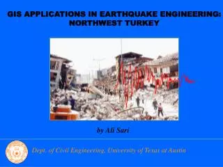
esri case studies … GeoDesign • Cape Cod GeoDesign • The Future of Urban Design • Building Smart from the Ground Up • CityEngine Adds a New Dimension to Your GIS Workflow • CDM Gains Significant Time Savings from Automated Data Management • Michels Corporation Improves Collaboration and Communication Data Integration and Visualization • California Postearthquake Information Clearinghouse Rocks • A Unique Approach to Bathymetry Mapping in a Large River System • Landslides Studied by Japan Researchers Infrastructure Management • EastlinkTollway Project [PDF] • From Deficient to Efficient • Engineers Use GIS to Improve Transportation Infrastructure Throughout Louisiana Critical Infrastructure Protection • USGS Soil Liquefaction Models Reveal Buildings and Roads at Risk • National Bridge Inventory Shows Structures at Risk
http://www.rickengineering.com/div_gis.htm • GIS Programming can automatically calculate: • Hydrologic Basin Areas • Flowline Lengths • Flowline Slope • Runoff Coefficient • Soils Types within Basins • Land Use within Basins • Many, many others ....
Interesting article about using GIS in small firm • http://www.cenews.com/magazine-article-cenews.com-6-2011-how_can_a_small_firm_use_gis_to_its_advantage_-8345.html
http://www.cuonline.edu/GIS/ • This CU Denver MEng-GIS degree is multidisciplinary, involving: • Civil Engineering (environmental, geodesy and remote sensing, water resources, geotechnical and transportation) • Geography and Environmental Sciences (ecology, environmental impact assessment) • Urban and Regional Planning (spatial analysis, community development) • Information Systems (database systems, software engineering) • Applied Mathematics (probability and statistics, simulation and optimization) • Engineering Management (strategic planning, project management)
What is a GISP? • A GISP is a certified geographic information systems (GIS) professional • A GISP has met the minimum standards for educational achievement, professional experience, and manner in which he or she contributes back to the profession • A GISP must abide by higher guidelines for ethical behavior • A GISP continues to educate and reeducate him or herself while preparing for recertification • A GISP has had their professional background scrutinized and reviewed by an independent third party organization. An Institute comprised of leading non-profit associations (AAG, NSGIC, UCGIS, GITA and URISA) focused on the application of GIS and geospatial technology • A GISP lives in all 50 States and 25 foreign countries • A GISP is more than a practitioner of GIS technology • A GISP is a professional • Similar to PE
GISP • http://www.gisci.org/