Download
1 / 26
280 likes | 595 Vues
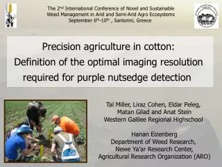
The 2 nd International Conference of Novel and Sustainable Weed Management in Arid and Semi-Arid Agro Ecosystems September 6 th -10 th , Santorini , Greece . Precision agriculture in cotton: Definition of the optimal imaging resolution required for purple nutsedge detection .

E N D
The 2nd International Conference of Novel and Sustainable Weed Management in Arid and Semi-Arid Agro Ecosystems September 6th-10th , Santorini, Greece Precision agriculture in cotton: Definition of the optimal imaging resolution required for purple nutsedge detection Tal Miller, Liraz Cohen, EldarPeleg, MatanGilad and Anat Stein Western Galilee Regional Highschool Hanan Eizenberg Department of Weed Research, NeweYa’ar Research Center, Agricultural Research Organization (ARO)
Introduction • Purple nutsedge is a troublesome weed, causing severe damage in cotton • Weeds may compete on resources such as water, light, space, nutrients etc.
The effect of purple nutsedge infestation on cotton biomass Cotton biomass (g m-2) Purple nutsedge biomass (g m-2)
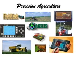
Precision agriculture approach • Precision agriculture, specifically, site specific weed management is a modern approach for reducing herbicide rates • This could be achieved by spraying herbicides only on weed patches based on the detection of the spatial distribution of weeds (and not on the entire field)
How can we detect weeds grown in the field? • Weeds are easily detected visually because they are green plants on brown soil • Several indexes were developed for this purpose
Normalized Difference Vegetation index (NDVI) • NIR = Reflection in Near Infra Red (770hm) • Red = Reflection in Red (660hm) • It was reported in the literature that NDVI is highly correlated to vegetative growth, nitrogen and chlorophyll levels
NDVI of wheat field pre planting savings50%
Research objectives • The main goal of this study was to determine the optimal resolution required for the detection of purple nutsedge in cotton
Research objectives (cont.) • Specific objectives were: • Detecting purple nutsedgeon bare soil (inter rows) using NGRDI index • Defining the threshold resolution for purple nutsedge detection High resolution RGB image (0.05 x 0.05 m per pixel)
Hypothesis We hypothesize that NGRDI values, greater than bare soil NGRDI (~0.01) represent vegetative growth, in our case purple nutsedge infestation
Materials & Methods • Experiments were performed in a commercial cotton field in the Jesreel Valley, Northern Israel • Aerial images were captured at the same day of data collection • Image resolution was 0.05 x 0.05 m per pixel • Twenty-five plots were randomly selected for data collection
Materials & Methods (cont.) • Weed coverage (%) was visually estimated • Purple nutsedge shoots were counted • Plot locations were marked using a differential GPS (dGPS – sub-meter) • Data were imported into a Geographical Information Software (GIS) software for advance analysis
Results 10m
Data processing 0.45 m 1.70 m • Originally pixel size was 0.05 x 0.05 m • Computing values of RGB channels • Reducing the resolution by increasing the size of the pixels • Re-computing values for the merged pixels by using the average value
Imaging Observations Marking location by dGPS Fixing image GIS Creating multi-layer map Choosing plots Color channels analysis Computing NGRDI index Is index value higher than ground value? No Yes Validation Increasing pixel size Determining threshold value
0.035 0.030 0.025 0.020 NGRDI 0.015 0.010 0.005 0.000 0 1000 2000 3000 4000 Relations between pixel size and NGRDI index Pixel size (cm2)
Conclusions • The threshold resolution for purple nutsedge detection from an aerial RGB image is 0.5 X 0.5 m per pixel (using NGRDI index) • Although NIR imaging is separating better weed from soil, using RGB channels (NGRDI index) is much cheaper and available for weed detection • Weed coverage that causes damage to cotton could be detected with a resolution of 0.5 x 0.5 m per pixel
Acknowledgment • EWRS for supporting my trip • Anat Stein for her assistance and motivation • Research team in the NeweYa’ar Research Center, Department of Weed Research • Dr. Yafit Cohen, Sensing, Information and Mechanization Engineering, ARO • Jimmie Ipen, field crops action, Alonim • Shay Mey-tal, Agam LTD • The school, for support and resources