Download
1 / 48
480 likes | 582 Vues
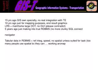
15 yrs ago GIS own specialty, no real integration with TE 10 yrs ago just for mapping purposes, end result graphics LRS = mainframe large DOT, no GUI (please contradict) 5 years ago just making into true RDBMS (no more clunky SQL connect navigator

E N D
15 yrs ago GIS own specialty, no real integration with TE 10 yrs ago just for mapping purposes, end result graphics LRS = mainframe large DOT, no GUI (please contradict) 5 years ago just making into true RDBMS (no more clunky SQL connect navigator Tabular data in RDBMS = ref integ, speed, no spatial unless suited for task (too many people use spatial bc they can … working arcmap
Presentation to the ESRI Transportation Special Interest Group February 19th, 2008 Linear Referencing Systems: Focus on County-level Usage
Presented by Gerry Kelly – Morning session • GIS-T overview: • The evolution of GIS-T at the county level • The Chester County GIS-T • GIS-T Geodatabase • Linear referencing • GIS-T applications Presentation to the ESRI Transportation Special Interest Group February 19th, 2008 Linear Referencing Systems: Focus on County-level Usage
The evolution of GIS-T: 15 years ago … Transportation Planning/ Engineering Traditional Database Computer Applications GIS GIS own specialty, no real integration with TE
The evolution of GIS-T: 10 years ago … Transportation Planning/ Engineering Traditional Database Computer Applications GIS
The evolution of GIS-T: 5 years ago … Transportation Planning/ Engineering Traditional Database GIS Computer Applications Internet GIS(-T)
The evolution of GIS-T: Now … Traditional Database Transportation Planning/ Engineering GIS Computer Applications Internet GIS(-T) Many related applications and datasets Web applications = GIS-T that people don’t know is GIS-T
The Chester County GIS-T Presented by Gerry Kelly Feb. 19, 2008
Overview the Chester County GIS-T Geodatabase The data: What went in the GDB, Where’d it come from? • Significant & consistent transportation-related data • Largely limited to State Rd system(about one-third County’s approx. 4500 road-miles) • Based on PennDOT’s linear referencing system (LRS) PennDOT Data PennDOT Street Centerline • Only centerline for State roads has meaningful data, usable LRS and is reasonably current and accurate. ChesCo GIS Street Centerline Multi-modal GIS-T TRANSPORTATION_NETWORK + a lot of work = Other ChesCo GIS Data ChesCo Other Data (non-GIS, or GIS from other depts) Municipal and other-agency data
Overview the Chester County GIS-T Geodatabase The final product … • Thirty+ feature classes • More than 225 related attribute and/or feature class tables • More than 200 coded-value domains/”look-up” tables • Meta data for spatial datasets within ArcCatalog • Other metadata in Oracle (same database as GDB)
GIS-T Surface Transportation Reference Network: The platform for the GIS-T • Initially based on the ESRI/UNETRANS GIS-T model • Consists of: • Two feature classes (derived from a geometric network) • TRANSPORTATION_CENTERLINE (was SURFACE_TRAN_EDGE) • TRANSPORTATION_JUNCTIONS (was SURFACE_TRAN_JUNCTION) • Oracle Tables directly related to one of the above feature classes • Oracle Tables that constrain values for IDs, segment names, route assignment etc.
GIS-T Surface Transportation Reference Network: General Characteristics • Serves as platform for almost all other GIS-T data • Either as the 1) spatial reference for events linearly referenced to the transportation network or 2) the network-related tables that tie together the bulk of the GIS-T GDB attribute data. • Unlike in the UNETRANS/ESRI GIS-T model, the network includes only a single feature class of all lines that represent the centerline of segments upon which travel can or does occur – regardless of transportation mode (TRANSPORTATION_CENTERLINE feature class). • This approach provides sufficient flexibility to model a truly multi-modal system. (While the vast majority of transportation elements occur along and are referenced to the street network, it is just as important have the ability to seamlessly reference such items to a segment of any travel mode)
GIS-T Surface Transportation Reference Network: The GIS-T Centerline What’s different from the base ChesCo centerline? • Accommodates all linear features that serve, have served or could serve surface transportation, regardless of travel mode. • Segments are assigned to routes • Segment and route IDs in accordance with regional standard for unique ID of by data-owner, area, travel mode, etc. • Secondary IDs relate back to County CL data and PennDOT segment data. • Supports the PennDOT linear-referencing system (LRS) • Ramps added as necessary • M values applied for non-PennDOT segments to maintain Local LRS • Feature dataset topological rules applied.
GIS-T Surface Transportation Reference Network: The GIS-T Centerline Segment Types The LU_TRANSPORT_EDGE_TYPE table presently permits five subtypes of segments: • Street • Rail (including inactive and/or abandoned if track still exists) • Non-motorized path (bicycle/multi-use paths, trails, off-street sidewalks) • Inactive corridor (utility rights-of-way, abandoned, greenways without formal paths …) • Waterway routes (only recreational in Chester County)
GIS-T Surface Transportation Reference Network: Topology of the GIS-T Network Example of Topology applied (by subtype for streets) • Essentially means that segments can only touch exactly at endpoints • Additional topological rules guarantee that every segment endpoint is covered by a network junction point (and junction points cannot be coincident or exist elsewhere than the endpoints) to ensure: • Network connectivity • Topologically accurate base for LRS
GIS-T Surface Transportation Reference Network: The GIS-T Centerline Rail Navigable waterway(miles from confluence of Brandywine Creek branches) “PennDOT” street (NHS) Non NHS local street Inactive corridor Trail
GIS-T Surface Transportation Reference Network: The GIS-T Centerline Example of network connectivity for various travel modes: Note: No connection
GIS-T Surface Transportation Reference Network: The GIS-T Centerline Examples of centerline accuracy for the non-street segments: Non-motorized travel, schools – missing connections Consistency with land parcel layer High-resolution ortho-photos for spatial accuracy, topology,
GIS-T Surface Transportation Reference Network: The GIS-T Centerline Relating the centerline to other data: Format for Unique Identification of Segments “15” for Chester County (from DOT) From Route-naming Agency If applicable, otherwise “X” “42” for PA [State FIPs Code]_[County Code]_[Municipality Code]_[Route ID]_[Segment ID]_[Mode Code]_[Data Agency Code] From Segment-naming Agency For Example: Segment 0030 of PennDOT Route 3063 in the PennDOT centerline file is uniquely identified as 42_15_3063_X_0030_ST_PD Whereas a corresponding segment from the Chester County centerline may have a unique ID of “2615” within the file, that translates into a “global” unique ID of 42_15_3063_X_2615_ST_CC
Transportation Geodatabase Datasets: • Activities • Administration • Air Travel/Transport • Analysis and Planning • Assets • Auxiliary Transportation Infrastructure • Bridge and Tunnel • Drainage • Incidents • Intersection • Lighting • Maintenance • Metadata • Parking • PennDOT Supplemental • Projects • Rail • Safety • School Transportation • Toll Road • Traffic Operation • Traffic Regulation • Traffic Signal • Transit • Transportation ancillary • Transportation Communication • Transportation Electrical • Transportation Infrastructure • Transportation Network Geometry • Transportation Reference Network • Utilities • Waterway
Relationships Among Features and Tables Streetlights, Traffic Signals and Related !
Chester County LRS (Linear Referencing System(s))
Multiple LRS options Supported by single underlying geometry Single “Transportation Centerline” Feature Class PennDOT LRS Applied Local LRS Applied Other LRS Applied • Rail station, mile marker, other agency measures, etc: • All Linearly-referenced data transformable among LRS’s via common underlying geometry/ArcToolbox • Fully-segmented, all inclusive FC (allows segment-specific event reference) OR • FC “dissolved” by applicable route ID’s after definition query is applied to extract only relevant segments (provides better performance) Hybrid LRS Applied?
Multiple LRS options Supported by single underlying geometry Single “Transportation Centerline” Feature Class PennDOT LRS Applied Local LRS Applied Local measures by local Route ID PennDOT measures by NLF
Example of application of M-Values to Route • West Bradford’s Vermont Lane Route: • Two segments – approx. 505’ • Route runs EB, but Westernmost segment runs WB
LRS vs. xy features … who’s to know? • Activities • Administration • Air Travel/Transport • Analysis and Planning • Assets • Auxiliary Transportation Infrastructure • Bridge and Tunnel • Drainage • Incidents • Intersection • Lighting • Maintenance • Metadata • Parking • PennDOT Supplemental • Projects • Rail • Safety • School Transportation • Toll Road • Traffic Operation • Traffic Regulation • Traffic Signal • Transit • Transportation ancillary • Transportation Communication • Transportation Electrical • Transportation Infrastructure • Transportation Network Geometry • Transportation Reference Network • Utilities • Waterway
GIS-T Surface Transportation Reference Network: GIS-T Applications Example: General approach to GIS-T application development ESRI’s ArcObjects supports VB form development that allows customized spatial functionality. ArcObjects and VBA link spatial and non-spatial functionality GIS-T Application forms allow access to the ArcSDE portion and/or the native–Oracle portion of the hybrid database, as well as special-purpose personal GDB’s.
Integration of Bridge Data into the GIS-T Same bridge by PennDOT data: LAT/LONG point 300’ away from accurate line event. • Translate PennDOT locations into accurate bridge centerpoints on GIS-T reference network. • Incorporate State and County data into the GIS-T database LAT/LONG point only … location accurate
GIS-T Bridge Application: Integration with Other GIS-T tools GIS-T custom toolbar provides tools for • General-purpose access to, and editing of all GIS-T data • Navigation of and info for transportation reference network • Bridge-specific tasks • Signal-specific tasks • Management of GIS-T pictures • Generalized functionality based on work done for the Bridges and Signals • ArcMap, ArcSDE enhancement
GIS-T Bridge Application: Example of quick display of basic bridge info
Integration of Signal Data into the GIS-T 1) cleanup and attribution of signal shapefile Before • Redundant signal point locations • Inaccurate Placement • No Attribute Data After • Unique signal point locations • Accurate Placement • Basic Attribute Data 2) Signal data consistent with GIS-T network, LRS and data structure
GIS EPZ (Emergency Planning Zone) Analysis application • EPZ population, demographics • Employment and school/daycare • Employment by place of work • Special facilities – such as schools and hospitals • Other places of interest • Resident’s locations • Streets and intersections
ChesCo Routable Network & Network Dataset … • Network connectivity: 100% network connectivity in the County and logical routes for travel just outside the county. • Grade separated intersections: Elevation data for the beginning and end of each segment are used to reflect connectivity, or lack there of • Oneway streets: (attributed by travel direction versus digitized direction) • Impedance (based on Travel Speeds): These speeds may reflect free-flow conditions, or travel speeds that reflect congestion by time-of-day, location, direction, etc. • Turning costs and restrictions: A Turn feature class defines prohibited turning movements and, potentially, turns that take a lot of time. • Route Hierarchy: Classifying roads to favor major roads to produce simpler more intuitive real-world routes Future enhancements could include attribution for specific motor vehicle type and purpose (i.e. emergency vehicles, hazardous materials, school busses, bicycle, pedestrian routing, multi-modal trips, etc)
Using the Network Dataset … • With ArcGIS Network Analyst or TransCAD, you can conduct • Drive-time analysis • Point-to-point routing • Route directions • Service area definition (incl. walk-to-school zones, etc.) • Shortest path • Optimum route • Closest facility • Origin-destination analysis
Routable Network Examples: Spatial & Attributes Grade separated intersections One-way segments Prohibited Turn The Turns Feature Class
Sample of edits required for routable network Replace with one node Edit for connectivity at single node Replace with one node 3 Split Bondsville Segment, relocate node 3 (not needed for routable network, but also evaluate whether the short segments are valid/required) 1 2 3 1 US 30 1 2 Note: The one-way data for the segments should ensure proper routing in this case. However, turning restrictions (regulatory or geometric) will often have to be explicitly defined for a given intersection. 1 2 3 Flag as Grade- Separated 1 2 3 Bondsville Rd 1 Record Segment as one-way in the digitized direction (“F”) Record Segment as one-way in reverse of digitized direction (“R”) Record Segment as two-way (“T”) 1 1 1 Edit for connectivity at single node 2 US 30/Bondsville Rd Interchange: Arrows depict digitized direction 3