Download
1 / 35
350 likes | 487 Vues
2009 USDA NAIP Statewide Imagery for Ohio. Ohio GIS Conference 2009 September 17, 2009. Jay Arnold, Northrop Grumman. Hayes Hubbs, USDA. Overview of USDA NAIP Program. National Agriculture Imagery Program (NAIP).

E N D
2009 USDA NAIP Statewide Imagery for Ohio Ohio GIS Conference 2009September 17, 2009 Jay Arnold, Northrop Grumman Hayes Hubbs, USDA
Overview of USDA NAIP Program National Agriculture Imagery Program (NAIP) • Administered by the Aerial Photography Field Office (APFO) of USDA’s Farm Service Agency (FSA) in Salt Lake City, Utah • Imagery acquired during agricultural growing season in CONUS • “Leaf-on” imagery collected to make digital orthophotography • Available to government agencies and public for a wide variety of projects
USDA NAIP 2009 Imagery Acquired at one-meter GSD Spectral resolution is natural color (Red, Green, Blue, or RGB) Available as digital ortho quarter quad tiles (DOQQs) or compressed county mosaics (CCM) DOQQS are geotiffs, CCMs generated by compressing DOQQs into single mosaic Beginning in 2009, most NAIP imagery will be collected digitally rather than with film cameras
3001, a Northrop Grumman companySelected by USDA NAIP ─7 States for 2009 1. OHIO 2. SOUTH CAROLINA 3. LOUISIANA 4. GEORGIA 5. ARKANSAS 6. NEBRASKA 7. NEW YORK
3001, a Northrop Grumman company Acquisition and Processing • Ohio CCMs complete as of 1-Sept 09
Flight Planning • 17,500 ft AGL collection throughout Ohio • N-S flight directions • ADS40 digital sensors • First acquisition on 5-June 2009Last acquisition on 1-Sept 2009
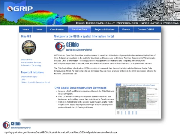
Products and Services • Color-infrared Imagery • Impervious Surface Maps • Land-use/Land-cover Maps • Web-hosted Imagery • Other products
Notable - OHIO - Mission complete • 3,049 Digital Ortho Quarter Quads (DOQQs) covering all 43,416 square miles of Ohio • 1-meter natural-color digital orthophotography with absolute horizontal accuracy of 6-m in MrSID and GeoTIFF formats • Leica Geosystems ADS platform onboard twin-engine aircraft operating at approximately 17,500 feet above the ground
Farm Service Agency • What is the Farm Service Agency? • The Farm Service Agency (FSA) is an agency within the USDA. • FSA provides federal program benefits to farmers and producers in terms of loans for operating and land purchase, commodity price supports, disaster relief, emergency assistance, conservation, and other needed agriculture support efforts.
Farm Service Agency • How is GIS related to FSA? • FSA has established the Common Land Unit (CLU) as a standardized GIS data layer. • The CLU data layer consists of boundaries related to all farm fields, rangeland, and pastureland in the United States. • FSA utilizes ArcSDE Enterprise Geodatabases. • USDA has created GIS tools to streamline many GIS processes. • Overall, GIS provides a spatial solution for administering FSA programs.
Farm Service Agency • The Farm Service Agency uses NAIP Imagery • As a guide to create field boundaries called Common Land Units related to farms enrolled in an FSA program.
Farm Service Agency • The Farm Service Agency uses NAIP Imagery • To determine changes in land use.
Farm Service Agency • The Farm Service Agency uses NAIP Imagery • As a key component of maps issued to customers.
Farm Service Agency • NAIP Imagery is also useful to the Farm Service Agency for other tasks such as: • Acreage & Crop Reporting • GPS Measurement Services • Appeal Hearings • Historical Assessments • Disaster Preparation