Download
1 / 1
10 likes | 81 Vues
This research aims to model station motions in Fennoscandia due to Glacial Isostatic Adjustment using GPS data analysis over 3000 days from 53 stations. Resulting 3D velocities show consistency with global ITFR2000 field with uncertainties at 0.2 mm/yr horizontally and 0.5 mm/yr vertically. Emphasizes larger velocity values in comparison to current GIA model, suggesting room for model parameter enhancement.

E N D
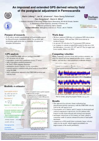
n e u An improved and extended GPS derived velocity field of the postglacial adjustment in Fennoscandia Martin Lidberg1,3, Jan M. Johansson1, Hans-Georg Scherneck1, Sten Bergstrand1, Glenn A. Milne2 1. Chalmers University of Technology, Onsala Space Observatory, SE-439 92 Onsala,Sweden. 2. Department of Earth Sciences, University of Durham, UK 3. National Land Survey, Gävle, Sweden Contact information: lidberg@oso.chalmers.se / Phone: +46 31 7725578 • Purpose of research • To be able to model station motions in Fennoscandia caused by Glacial Isostatic Adjustment (GIA). For geodetic and positioning applications this is commonly recognized as intraplate deformation. Work done • We have analyzed 3000 days of continuous GPS observations between January 1996 and June 2004 from stations in northern Europe • we present 3D velocities for 53 permanent GPS stations • we compare to current accepted GIA model for the area (120 km lithosphere, viscosity of 8·1020 and 1022 Pas for upper and lower mantle, Milne et al 2001) • GPS analysis • The GAMIT/GLOBK software package from MIT • 10° elevation cut off angle • troposphere zenith delay parameters (every 2nd hour) • daily troposphere gradient parameters • the Niell (1996) mapping functions • ambiguities fixed to integers (as far as possible) • regional analysis combined with global analysis from SOPAC using GLOBK • daily combinations adjusted to the ITRF2000 position and velocity field Computing velocities While computing velocities from daily position estimates, we solve for annual and semi-annual periodic cycles, remove outliers, and introduce shift parameters at antenna changes. Realistic σ estimates Least square solution • Chi2 of weighted means against segment length for the averages • computed chi2 of weighted means • chi2 modeled for 1st order GM process Plot for Umeå, using the program Tsview. (Herring 2003) Estimated 02 • Results • Our approach for reference frame realization has demonstrated global consistency with the ITRF2000 velocity field at the sub-mm/yr level. • Uncertainties at 0.2 mm/yr and 0.5 mm/yr for horizontal and vertical components respectively (1σ) for stations with longest records (from internal and external assessments) • maximum vertical rate of 10.6 mm/yr at Umeå, which is somewhat south of current estimated location of land uplift maximum • comparison to GIA model show systematic larger velocity values for the model, which suggest possibilities for improvement of the model parameters. n Assume 1st order GM process v(i) = a*v(i-1) +w(i); 0 < a < 1 Compute weighted means of the residuals, including weights for the means; - then compute weighted scatter of the weighted means e chi2/dof of mean ~ (1-exp(-m/)) u Averaging time correlation time parameter Averaging time (days) References: Johansson J M, Davis JL, Scherneck H-G, Milne GA, Vermeer M, Mitrovica JX, Bennett RA, Jonsson B, Elgered G, Elósegui P, Koivula H, Poutanen M, Rönnäng BO, Shapiro II (2002) Continous GPS measurements of postglacial adjustment in Fennoscandia 1. Geodetic result. Journal of geophysical research, vol. 107, no. B8, 10.1029/2001B000400. Milne GA, Davis JL, Mitrovica JX, Scherneck H-G, Johansson JM, Vermeer M, Koivula H (2001) Space-Geodetic Constraints on Blacial Isostatic Adjustments in Fennoscandia. Science 291, 2381-2385. Scherneck H-G, Vermeer M, Mitrovica JX, Milne GA (2002) BIFROST: Observing the Three-Dimensional Deformation of Fennoscandia. In Ice Sheets, Sea Level and the Dynamic Earth; Geodynamic series 29; American Geophysical Union. King RW, (2002) Documentation for the GAMIT GPS analysis software, MIT Internal Report, 206 pp (http://www-gpsg.mit.edu/~simon/gtgk/GAMIT.pdf) King RW, Herring TA, (2002) Global Kalman filter VLBI and GPS analysis program, MIT Internal Report, 98 pp (http:///www-gpsg.mit.edu/ ~simon/ gtgk/GLOBK.pdf) Herring T (2003) MATLAB Tools for viewing GPS velocities and time series. GPS solutions 7:194-199. Lidberg M, Johansson J M, Scherneck H-G, Davis J L (2005) An improved and extended GPS derived velocity field of the postglacial adjustment in Fennoscandia. Journal of Geodesy (submitted).