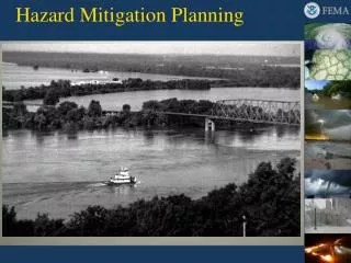
Hazard Mitigation Planning
Hazard Mitigation Planning. Workshop Objectives. Clarify process for identifying hazards and estimating potential losses, which form the basis for appropriate hazard mitigation actions Review the basics of preparing multi-jurisdiction plans

Hazard Mitigation Planning
E N D
Presentation Transcript
Workshop Objectives • Clarify process for identifying hazards and estimating potential losses, which form the basis for appropriate hazard mitigation actions • Review the basics of preparing multi-jurisdiction plans • Integrate plan update requirements into the mitigation plan
Workshop Structure Overview: Hazard Mitigation Planning Section 1: Risk Assessment Section 2: Multi-jurisdiction Plans Section 3: Plan Updates • Each section of the Risk Assessment section will include citation to the corresponding CFR requirement
Hazard Mitigation Planning • What is Hazard Mitigation Planning? • The effort to reduce loss of life and property by lessening the impact of disasters • How? • Through risk-based analysis providing a foundation for mitigation activities to reduce damages to lives, property, and economy • Creates a framework for risk-based decision making to reduce damages
Hazard Mitigation Planning • Break the cycle of disaster damage, reconstruction, and reoccurring damage Reoccurring Damages Reconstruction
Why is Hazard Mitigation Important? • Reduces: • Loss of life • Damage to property, essential services, and critical facilities • Economic disruption • Short-term and long-term recovery and reconstruction costs
Why is Hazard Mitigation Planning Important? • Building more disaster resistant communities • Raising awareness of risk and the need for risk reduction • Creating a roadmap for coordinating hazard mitigation efforts • Partnerships in the jurisdiction • Increased communication and cross-education between jurisdiction agencies • Eligibility for pre- and post-disaster grant funds
Hazard Mitigation Plan Development Process Step 1: Organizing Resources Step 2: Assessing Risks Step 3: Developing the Plan Step 4: Reviewing the Plan Step 5: Implementing the Plan
Step 1: Organizing Resources • Build the Planning Team • Organize the Planning Team • Hold Project Planning Meeting • Consider Hiring a Consultant • Engage the Public • Benefits of Public Participation • Document Public Involvement
Step 2: Assessing Risks Identify allhazards that could occur and impact any portion of the planning area. • First resource is the State Hazard Mitigation Plan • Remember that just because a hazard has not occurred in the planning area in the recent past does not mean that it will not occur in the future (Dam or levee failure)
Step 3: Developing the Plan Use risk assessment results to create a blueprint for reducing potential losses. • Describe mitigation goals • Identify all possible actions and projects that would prevent or reduce damage and/or protect citizens • Analyze possible actions and projects • Determine what is feasible • Prioritize actions • Document process and criteria for prioritization • Identify who initiates, administers, and implements mitigation actions
Step 4: Reviewing the Plan Plans should be monitored and evaluatedaccording to the process outlined in the plan • The hazard mitigation plan should be reviewed after major events and response to changes within the community. • Plans mustbe updated every 5 years or the jurisdiction becomes ineligible for a number of FEMA grants (i.e., HMGP, PDM, FMA, and SRL) • Include steps for incorporating the plan into capital improvement plans, land use plans, development codes, etc. • Invite the public and other agencies invited to participate in the plan maintenance process
Step 5: Implementing the Plan • Implementation of specific mitigation actions • Conduct periodic evaluations • Adopt the Plan • Plan must be relevant
Section 1: Risk Assessment Risk assessment provides the foundation for the rest of the mitigation planning process. • The purpose of the risk assessment is for jurisdictions to gather existing risk information that enables them to identify and assign value to risk in order to prioritize mitigation actions and appropriate resources to reduce losses from all natural hazards.
Risk Assessment Terminology • Hazard:source of potential danger or adverse condition • Hazard Identification: process of determining those hazards that threaten a given area • Impact: damage or consequences resulting from a hazard • Exposure:the number/value of all structures and other land, assets, etc that could potentially be impacted by a given hazard, typically based on geographic location
Risk Assessment Terminology • Extent: severity, intensity or magnitude of a hazard itself • Probability: measure of how often an event is likely to occur • Risk: potential for an unwanted outcome resulting from an event or occurrence, as determined by its likelihood and the associated consequences • Vulnerability: the number/value of structures/built environment and other assets, etc. that are identified as most likely to sustain damage or loss of use from a given hazard.
Risk Assessment Three basic components of risk assessment: • Identify Hazards • Profile Hazard Events • Estimate Losses
Identifying Hazards - CFR CFR §201.6(c)(2)(i): [The risk assessment shall include a] description of the type … of all natural hazards that can affect the jurisdiction. Does the plan include a description of all natural hazards that affect any of the participating jurisdictions? Suggestions • Think about hazards that may have significant impacts but that occur infrequently • Consult the State Mitigation Plan and/or with the State Hazard Mitigation Officer to identify hazards that may occur in the planning area.
Identifying Hazards Take Note!! • Some hazards like tornadoes, the flooding caused by dam or levee failure, and wildfires are not frequent but the effects can be devastating.
**State Hazard Mitigation Plan** U.S. Geological Survey Natural Hazards Center National Weather Service Flood Insurance Studies, FIRMs Watershed Studies Association of State Dam Safety Officials National Oceanographic and Atmospheric Administration National Severe Storms Laboratory Newspapers, Books, & Internet National, State, & Local Maps Experts (State Emergency Management, Weather Service, etc.) Determine Hazards That May Occur Locally Possible Resources:*
Severe Storms Tornadoes Flooding Severe Winter Storms Drought Extreme Heat Earthquakes Dam or Levee Failure Mine Subsidence Lake Michigan Storm Surge Hazards to Consider
Identifying Hazards - Tips • Indicate in plan narrative that state plan was consulted • Don’t eliminate hazards simply because you don’t have information about them • Think about those hazards that have significant impacts even if they occur infrequently. • Think about hazards relative to community vulnerabilities.
Identifying Hazards - Tips • Where possible map hazards. Illustrate locations subject to flooding, landslide or subsidence and areas subject to wildfire risks. • Cite sources, address data limitations • Think about low probability risks
Identifying Hazards – Human-Caused Hazards Human-Caused Hazards (sometimes referred to as man-made hazards) are terrorism and technological hazards • Hard to predict and change over time • Natural hazards may lead to human-caused hazards • Consideration of human-caused hazards is not required by DMA 2000 • While FEMA recommends including all hazards, only natural hazards are required • Jurisdiction can decide whether to address human-caused hazards in the plan • If human-caused hazards are included in the plan, they must be fully profiled
Identifying Hazards – Exercise • Group Discussion: • How many dams in your community? Where would you find this information? • Name one Illinois city or county that has completed more than 100 acquisitions of flood prone properties? Where would you find this information for your county? • What are the easiest references for the history of natural hazard events in your community? • http://www.ncdc.noaa.gov/stormevents/ • http://webra.cas.sc.edu/hvriapps/sheldus_setup/sheldus_login.aspx
Profiling Hazards - CFR CFR §201.6(c)(2)(i): [The risk assessment shall include a] description of the … location and extent of all natural hazards that can affect the jurisdiction. The plan shall include information on previous occurrences of hazard events and on the probability of future hazard events. First step after hazard identification is to determine how each hazard affects the planning area by describing: • Location affected by the hazard • Extent of the hazard • History ofhazard events • Probability of future hazard events *Only hazards that are chosen as affecting the jurisdiction should be profiled
Profiling Hazards - Location Identify the location (i.e., geographic area affected) of each natural hazard addressed in the new or updated plan. Specifically identify those areas of the jurisdiction that each hazard might affect How? • Narratives: description of a hazard or hazardous events and their effect on the jurisdiction • Maps: common frame of reference when describing where and how hazards can affect a jurisdiction
Profiling Hazards - Location Narratives Describing the areas at-risk for hazards is the easiest way to communicate risks to community residents. • The most significant hazards in Region V have boundaries. Special flood hazards are typically mapped. • When people attend meetings on hazard mitigation planning they want to know the boundaries of hazards relative to their own homes. • Where the boundaries of hazard risks cannot be described—snow storms, tornadoes, hail storms—there is no requirement for describing areas affected because all areas are equally affected.
Profiling Hazards - Location Maps • Show locations affected by each hazard—maps should include clear and accurate reference points. • Don’t try to show too much on one map! • Dam and levee location maps should help clarify the areas downstream that may be affected by a failure or breach. • Where modern flood hazard maps are available, there should be an effort to incorporate these maps in the local plan. • If flash flooding is identified as a hazard, its location should be shown on a map or with narrative
Use a Map to Show Locations • Maps are typically the easiest way to convey information • Begin with a base map • Transfer data for each hazard to the base map • Create a map showing Special Flood Hazard Areas and Base Flood Elevations • Create a map showing dam and levee locations • Create a map showing areas at risk of wildfire • Create other hazard maps—landslides, earthquakes, shoreline erosion if data exists
Boundaries vs. Planning-area wide Hazards Remember that not all hazards have a defined hazard boundary within the planning area • Boundaries: Hazard has definable limits • Planning-area wide: Could impact any jurisdiction 32
Floodplain Maps Flood Hazard Maps can be overlaid on aerial photographs or structure base maps to highlight those structures, roads and public buildings at risk . The map at right illustrates the areas in Alexandria County within the boundaries of the 1% flood hazard. 33
Map Areas Post-Disaster Campbell’s Island, 2001
Map the Properties At-Risk Flooding in Illinois April, 2011 Ottawa, Ohio, August 27, 2007 – Flooding in North Central Ohio damaged several towns during the summer of 2007. Mike Moore/FEMA
Areas of Land Subsidence Risks in Saline County Saline County Hazard Mitigation Plan
Profiling Hazards - Extent Identify the extent (i.e., magnitude or severity) of each hazard addressed in the new or updated plan. • Extent, as used in the Mitigation Plan, describes the expected magnitude of the hazard and should not be confused with impact • Extent can be described in both quantitative and qualitative measures of the strength of a particular hazard event including a range of the hazard’s potential severity.
Profiling Hazards – Extent • Severity is typically related to the size and scale of the hazard event. Plans should include consideration of the probability of certain size events. There may be a low probability for the most catastrophic tornadoes but a much higher probability of smaller events. Suggestions • Use scientific scales to describe extent • For floods, say “1-percent-annual-chance flood” or “100-year flood event” • For tornadoes, say “five EF3 events” • Do this for each jurisdiction if multi-jurisdictional plan • If it is the same for all jurisdictions, say so
Profiling Hazards – Historical Events Provide information on previous occurrences of each hazard addressed in the new or updated plan. • List previous occurrences of each hazard for each jurisdiction • Do this separately for each hazard • Must have enough history to do an accurate assessment • Cite information sources
Profiling Hazards – Historical Events Suggestions • Communities should keep records of their own histories of hazard events. Documenting high water marks, documenting property damages and losses, and identifying unique vulnerabilities will help future planning. • Keep a record. Document the impacts of significant events. • Include sufficient historical information to create probability estimates
Think Outside the Box! • Additional Resources for Historical Events • Electrical Outages due to Inclement Weather • School Closings due to Snow/Severe Winter Weather • Weather Related Highway Closures • Fire Department Data • Local Emergency Management Data • Assessor’s Data • National Funding Applications & Grants • Historical Society records • Explore your jurisdiction’s resources • Historical Records • Anecdotal Evidence 43
Profiling Hazards - Probability Include the probability of future events (i.e., chance of occurrence) for each hazard addressed in the new or updated plan. • Estimate the probability of future occurrences of each hazard for each jurisdiction • If history shows that one hazard typically occurs every 4 years, say the probability in any year is 25% (1/4=0.25) • If probability is the same for all jurisdictions, say this!
Profiling Hazards - Probability • Structural improvements—dams, levees, flood walls may reduce risks but they do not completely eliminate risks. Many dams, levees and other structural safeguards were constructed years ago and some have not been adequately maintained.
Profiling Hazards – Probability Suggestions • If probability cannot be calculated statistically, quantify the probability as , , or • Describe how probabilities were determined • Quantify the categories • Define terms • If history shows no occurrences of a hazard but it is still possible, say the probability is low high medium low
Profiling a Tornado – Probability Use FEMA & NOAA Maps and Data Who has a higher tornado probability: Illinois or Wisconsin? 47
Profiling Hazards – Ranking What is ‘ranking? • Assignment of values or numeric scores to chosen elements of each hazard, such as severity, probability of future events, and warning time. • Rankings are totaled, allowing prioritization • Be sure that the descriptions and data match the score! (e.g., don’t score high if the data says it’s low) How is this ranking helpful? • Ranking prioritizes hazards which helps direct the prioritization of hazard mitigation actions • Ranking is a commonly used approach to profiling hazards.
Profiling Hazards – Ranking Suggestions • Use criteria used in the current Illinois Hazard Mitigation Plan • Conduct jurisdiction-specific rankings for those hazards that have defined boundaries, such as flooding • Conduct planning area-wide ranking or hazards that can impact the entire planning area