Download
1 / 1
10 likes | 139 Vues
Science Support for NASA-NOAA Research to Operations (R2O) and GPM. Ralph Ferraro 1 (Government Principal Investigator), Bob Kuligowski 2 , Nai-Yu Wang 3 , Kaushik Gopalan 3 1 NOAA/NESDIS/STAR/CoRP, 2 NOAA/NESDIS/STAR/SMCD, 3 Cooperative Institute for Climate and Satellites (CICS).

E N D
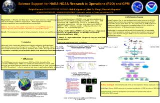
Science Support for NASA-NOAA Research to Operations (R2O) and GPM Ralph Ferraro1 (Government PrincipalInvestigator), Bob Kuligowski2, Nai-Yu Wang3, Kaushik Gopalan3 1 NOAA/NESDIS/STAR/CoRP, 2 NOAA/NESDIS/STAR/SMCD, 3 Cooperative Institute for Climate and Satellites (CICS) Requirement:1) Weather and Water Goal –Improve water resources forecasting capabilities. 2) Climate Goal - Develop an integrated global observation & data management system for routine delivery of information, including attribution of the state of the climate. 3) Mission Support Goal – Advancing space-based data collection capabilities and associated platforms and systems. Science:How do we utilize satellite measurements from the GPM-era sensors to improve regional & global precipitation estimates for all precipitation types? Benefit:The development of state-of-the are precipitation retrievals from satellites complements NOAA’s surface measurements and offer improved accuracy for use in weather forecasts, NWP assimilation, hydrology, etc. 3. Science Progress During the past several years, STAR PI’s have been active participants on NASA’s Precipitation Measurement Missions (PMM) science Team – PMM comprises of both TRMM and GPM. Through an innovative funding arrangement between NOAA (75%) and NASA (25%), four NOAA PI’s (2 NESDIS; 1 NWS; 1 OAR) have provided significant contributions to the PMM team. The NESDIS lead projects are: R. Kuligowski, PI: “Utilizing TRMM Precipitation Products in Operational Hydrology through Multi-Satellite and Multi-Sensor Quantitative Precipitation Estimation (QPE)” R. Ferraro, PI: “Improved Microwave Precipitation Over Land from TRMM through GPM Era” Some results are presented in the figures below. 4. GPM Transition Progress A draft Transition Plan for was developed and is under review by the NESDIS Transition Team, which is also focusing on continuity missions such as GPS, Ocean Wind Vectors, Solar Wind, etc. The primary R2O for GPM would be the hand over of NASA’s Precipitation Processing System (PPS) to NESDIS for operational delivery of GPM based products (figure below). Additionally, it’s envisioned that through NOAA funded R&D, a consolidated suite of NOAA precipitation products, using combined satellite, radar and rain gauges would blossom during the GPM-era and would benefit all of NOAA (second figure below). 1. Introduction Historically, STAR interacts with NASA through NASA’s competitive proposal process; these activities are carried out through instrument “Science Teams”. Examples include: AIRS, MODIS, AMSR-E and TRMM – several algorithms being used today have STAR roots. In order to prepare for upcoming “Decadal Survey” missions, NOAA & NASA have recently developed joint Research to Operations (R2O) teams – the degree of involvement of these teams is a function of the missions’ maturity. It is the purpose of this poster to highlight the R2O activities related to the Global Precipitation Measurement (GPM) Mission. 2. GPM Overview The GPM Mission is a joint venture between NASA and JAXA that builds off the successful TRMM program. GPM’s core satellite will contain advanced sensors (GMI and DPR) that will be capable of measuring light precipitation such as snow. The core satellite is used as the calibrator for the passive microwave sensors that will be part of the GPM “Constellation” – a fleet of operational and research satellites that will allow for global, 3-hourly or less precipitation estimates. Science Challenges: Advancing the state-of-the-art in precipitation retrieval, especially in cold seasons. Integrating all available measurements into seamless product for users. Next Steps: Secure NOAA resources for increased participation in GPM to continue R&D that integrates into NOAA applications soon after GPM core launch in 2013. Transition Path: Continued development and evolution of Transition Plan and the NASA-NOAA R2O concept.